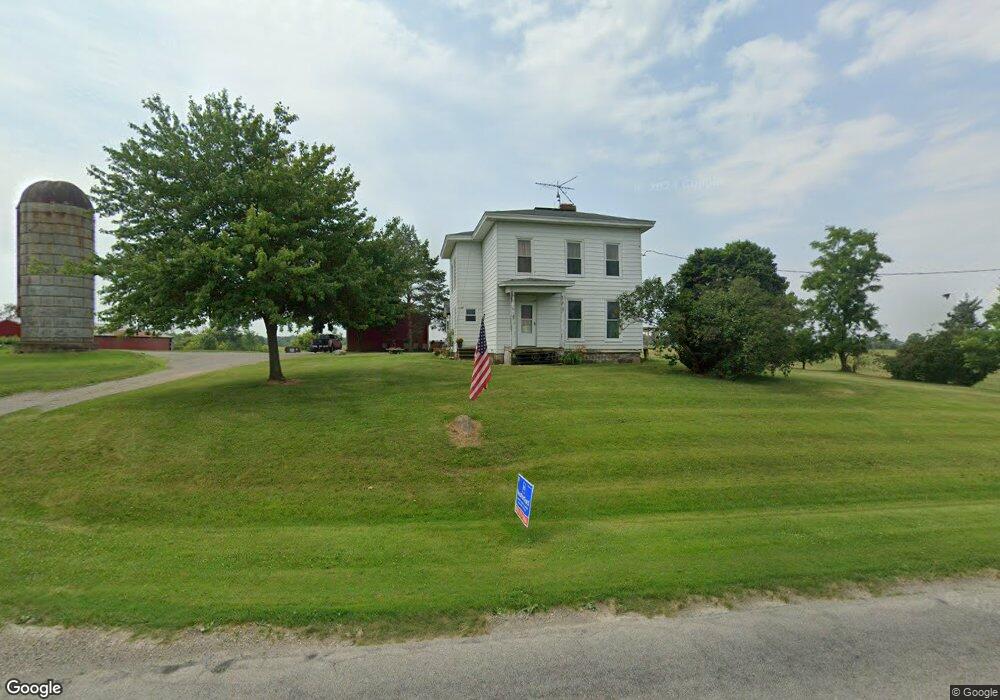
3717 Clinton MacOn Rd Clinton, MI 49236
Estimated Value: $272,000 - $403,542
5
Beds
2
Baths
2,316
Sq Ft
$141/Sq Ft
Est. Value
About This Home
This home is located at 3717 Clinton MacOn Rd, Clinton, MI 49236 and is currently estimated at $326,847, approximately $141 per square foot. 3717 Clinton MacOn Rd is a home located in Lenawee County with nearby schools including Clinton Elementary School, Clinton Middle School, and Clinton High School.
Ownership History
Date
Name
Owned For
Owner Type
Purchase Details
Closed on
Feb 10, 2005
Sold by
Lawrence Terry L and Lawrence Ruthann
Bought by
Sanborn Larry T and Sanborn Tia M
Current Estimated Value
Home Financials for this Owner
Home Financials are based on the most recent Mortgage that was taken out on this home.
Original Mortgage
$125,000
Outstanding Balance
$63,368
Interest Rate
5.71%
Mortgage Type
New Conventional
Estimated Equity
$263,479
Create a Home Valuation Report for This Property
The Home Valuation Report is an in-depth analysis detailing your home's value as well as a comparison with similar homes in the area
Home Values in the Area
Average Home Value in this Area
Purchase History
| Date | Buyer | Sale Price | Title Company |
|---|---|---|---|
| Sanborn Larry T | $195,000 | None Available | |
| Sanborn Larry T | -- | None Available |
Source: Public Records
Mortgage History
| Date | Status | Borrower | Loan Amount |
|---|---|---|---|
| Open | Sanborn Larry T | $125,000 |
Source: Public Records
Tax History Compared to Growth
Tax History
| Year | Tax Paid | Tax Assessment Tax Assessment Total Assessment is a certain percentage of the fair market value that is determined by local assessors to be the total taxable value of land and additions on the property. | Land | Improvement |
|---|---|---|---|---|
| 2025 | $2,808 | $167,700 | $0 | $0 |
| 2024 | $1,065 | $156,900 | $0 | $0 |
| 2023 | $2,430 | $141,600 | $0 | $0 |
| 2022 | $2,353 | $124,000 | $0 | $0 |
| 2021 | $2,322 | $119,800 | $0 | $0 |
| 2020 | $2,356 | $115,600 | $0 | $0 |
| 2019 | $223,921 | $87,800 | $0 | $0 |
| 2018 | $2,195 | $94,861 | $0 | $0 |
| 2017 | $2,032 | $79,014 | $0 | $0 |
| 2016 | $2,029 | $78,034 | $0 | $0 |
| 2014 | -- | $95,865 | $0 | $0 |
Source: Public Records
Map
Nearby Homes
- 112 Cass Ave
- 310 Colebrook Dr
- 112 Gibson St
- 116 Currier St
- 103 W Michigan Ave
- 317 Clark St
- 111 Washington St
- 118 Litchfield St
- 304 Edward J St
- 0 Mcneil Hwy Unit Parcel C
- 10000 Meads Hwy
- 13293 E Michigan Ave
- 6070 Clinton MacOn Rd
- 9410 Newburg Ct
- 9295 Newburg Hwy
- 9402 Pleasant Dr
- 11800 N Adrian Hwy
- 9103 N Union St Unit Lot 93
- 9103 N Union St Unit LOT 46
- 0 BLK Pleasant Dr
- 3577 Clinton MacOn Rd
- 3800 Clinton MacOn Rd
- 3535 Clinton MacOn Rd
- 3873 Clinton MacOn Rd
- 3872 Clinton MacOn Rd
- 3872 Clinton MacOn Rd Unit CLINTON MACON
- 3450 Clinton MacOn Rd
- 3890 Clinton MacOn Rd
- 3968 Clinton MacOn Rd
- 3979 Clinton MacOn Rd
- 4000 Clinton MacOn Rd
- 4000 Clinton MacOn Rd
- 4000 Clinton MacOn Rd
- 4130 Clinton-MacOn
- 212 Calhoun Ave
- 3871 Clinton MacOn Rd
- 3353 Clinton MacOn Rd
- 205 Calhoun Ave
- 203 Calhoun Ave
- 202 Calhoun Ave