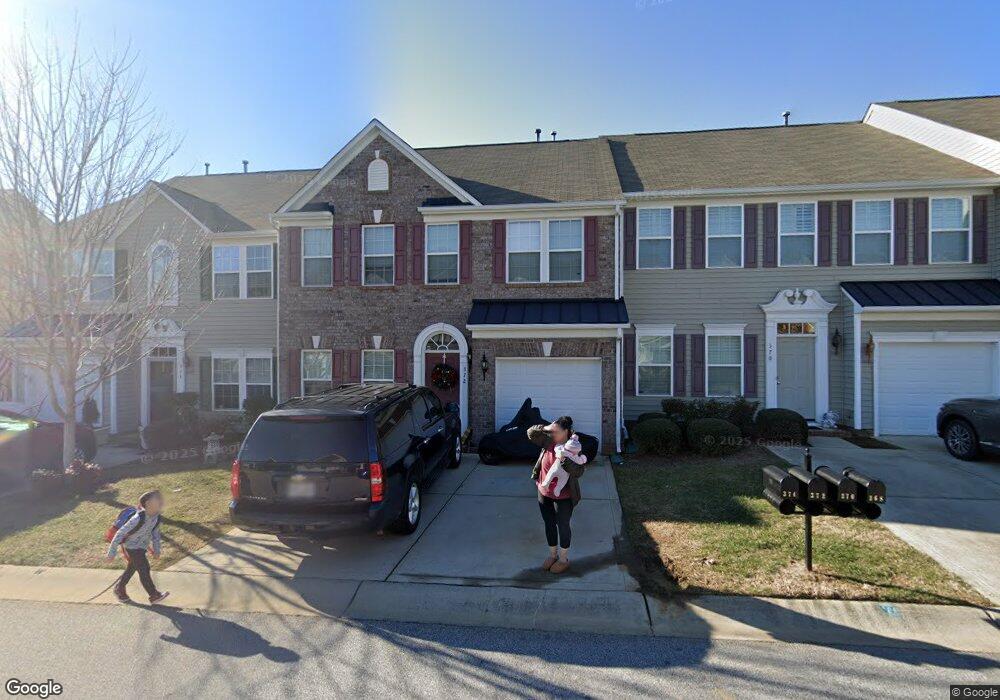
372 Battery Cir Unit 6 Clover, SC 29710
Estimated Value: $306,000 - $337,000
--
Bed
1
Bath
1,818
Sq Ft
$178/Sq Ft
Est. Value
About This Home
This home is located at 372 Battery Cir Unit 6, Clover, SC 29710 and is currently estimated at $323,654, approximately $178 per square foot. 372 Battery Cir Unit 6 is a home located in York County with nearby schools including Crowders Creek Elementary School, Oakridge Middle School, and Clover High School.
Ownership History
Date
Name
Owned For
Owner Type
Purchase Details
Closed on
Jan 18, 2015
Sold by
Smith V Karl Frederick
Bought by
Cepeda Alvin P and Cepeda Kimberly F
Current Estimated Value
Home Financials for this Owner
Home Financials are based on the most recent Mortgage that was taken out on this home.
Original Mortgage
$130,000
Interest Rate
3.98%
Mortgage Type
New Conventional
Purchase Details
Closed on
Apr 22, 2010
Sold by
Nvr Inc
Bought by
Smith V Karl Frederick
Home Financials for this Owner
Home Financials are based on the most recent Mortgage that was taken out on this home.
Original Mortgage
$164,240
Interest Rate
5.03%
Mortgage Type
VA
Purchase Details
Closed on
Mar 3, 2010
Sold by
Olson Development Llc
Bought by
Nvr Inc
Home Financials for this Owner
Home Financials are based on the most recent Mortgage that was taken out on this home.
Original Mortgage
$164,240
Interest Rate
5.03%
Mortgage Type
VA
Create a Home Valuation Report for This Property
The Home Valuation Report is an in-depth analysis detailing your home's value as well as a comparison with similar homes in the area
Home Values in the Area
Average Home Value in this Area
Purchase History
| Date | Buyer | Sale Price | Title Company |
|---|---|---|---|
| Cepeda Alvin P | $168,000 | -- | |
| Smith V Karl Frederick | $160,784 | -- | |
| Nvr Inc | $136,000 | -- |
Source: Public Records
Mortgage History
| Date | Status | Borrower | Loan Amount |
|---|---|---|---|
| Previous Owner | Cepeda Alvin P | $130,000 | |
| Previous Owner | Smith V Karl Frederick | $164,240 |
Source: Public Records
Tax History Compared to Growth
Tax History
| Year | Tax Paid | Tax Assessment Tax Assessment Total Assessment is a certain percentage of the fair market value that is determined by local assessors to be the total taxable value of land and additions on the property. | Land | Improvement |
|---|---|---|---|---|
| 2025 | $1,144 | $8,358 | $1,538 | $6,820 |
| 2024 | $1,027 | $7,268 | $1,533 | $5,735 |
| 2023 | $1,053 | $7,268 | $1,533 | $5,735 |
| 2022 | $868 | $7,268 | $1,533 | $5,735 |
| 2021 | -- | $7,268 | $1,533 | $5,735 |
| 2020 | $823 | $7,268 | $0 | $0 |
| 2019 | $781 | $6,320 | $0 | $0 |
| 2018 | $784 | $6,320 | $0 | $0 |
| 2017 | $731 | $6,320 | $0 | $0 |
| 2016 | $2,845 | $8,790 | $0 | $0 |
| 2014 | $2,700 | $5,440 | $1,360 | $4,080 |
| 2013 | $2,700 | $5,980 | $1,480 | $4,500 |
Source: Public Records
Map
Nearby Homes
- 370 Battery Cir Unit 20
- 431 Battery Cir
- 433 Battery Cir
- 450 Battery Cir
- 00 Hwy
- 335 Carroll Cove
- 1715 Curtis Dr
- 1911 Marlin Dr
- 304 Inland Cove Ct
- 319 Inland Cove Ct
- 447 Leaf Arbor Ct
- 5141 Sapp Cir
- 126 Misty Woods Dr
- 121 Misty Woods Dr
- 5165 Sapp Cir
- 2129 Salem Dr Unit 5
- 2678 Landing Pointe Dr
- 341 Windy Pine Dr
- 241 Boxelder Rd
- 2180 Shady Pond Dr
- 372 Battery Cir Unit 6
- 372 Battery Cir
- 372 Battery Cir
- 370 Battery Cir
- 370 Battery Cir Unit 1006C
- 374 Battery Cir
- 368 Battery Cir
- 368 Battery Cir Unit 368
- 368 Battery Cir Unit 1006D
- 378 Battery Cir Unit 7
- 378 Battery Cir Unit 378
- 378 Battery Cir Unit 1007D
- 364 Battery Cir
- 380 Battery Cir
- 380 Battery Cir
- 380 Battery Cir Unit 24
- 373 Battery Cir Unit 373
- 373 Battery Cir Unit 33
- 371 Battery Cir
- 369 Battery Cir