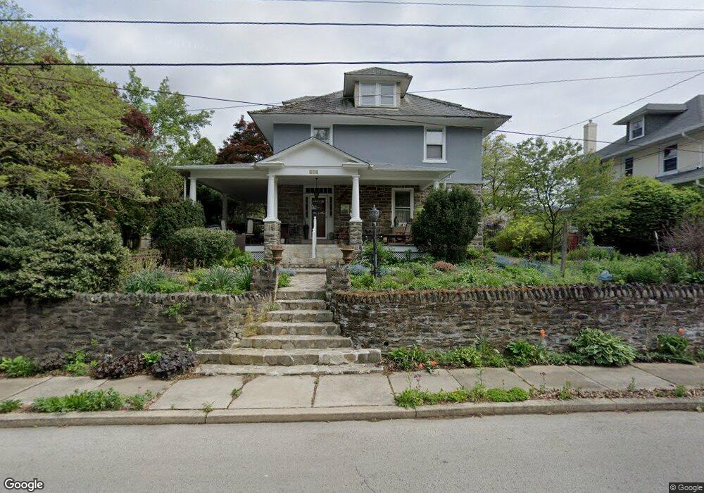
372 Forest Ave Ambler, PA 19002
Estimated Value: $632,601 - $843,000
4
Beds
3
Baths
2,439
Sq Ft
$293/Sq Ft
Est. Value
About This Home
This home is located at 372 Forest Ave, Ambler, PA 19002 and is currently estimated at $714,400, approximately $292 per square foot. 372 Forest Ave is a home located in Montgomery County with nearby schools including Lower Gwynedd El School, Wissahickon Middle School, and Wissahickon Senior High School.
Ownership History
Date
Name
Owned For
Owner Type
Purchase Details
Closed on
Sep 20, 2005
Sold by
Harris Dene and Taylor Susanne M
Bought by
Bruni Nick and Monser Mary Margaret
Current Estimated Value
Home Financials for this Owner
Home Financials are based on the most recent Mortgage that was taken out on this home.
Original Mortgage
$256,000
Interest Rate
5.81%
Create a Home Valuation Report for This Property
The Home Valuation Report is an in-depth analysis detailing your home's value as well as a comparison with similar homes in the area
Home Values in the Area
Average Home Value in this Area
Purchase History
| Date | Buyer | Sale Price | Title Company |
|---|---|---|---|
| Bruni Nick | $320,000 | -- |
Source: Public Records
Mortgage History
| Date | Status | Borrower | Loan Amount |
|---|---|---|---|
| Previous Owner | Bruni Nick | $256,000 |
Source: Public Records
Tax History Compared to Growth
Tax History
| Year | Tax Paid | Tax Assessment Tax Assessment Total Assessment is a certain percentage of the fair market value that is determined by local assessors to be the total taxable value of land and additions on the property. | Land | Improvement |
|---|---|---|---|---|
| 2025 | $6,012 | $161,690 | $49,960 | $111,730 |
| 2024 | $6,012 | $161,690 | $49,960 | $111,730 |
| 2023 | $5,649 | $161,690 | $49,960 | $111,730 |
| 2022 | $5,480 | $161,690 | $49,960 | $111,730 |
| 2021 | $5,336 | $161,690 | $49,960 | $111,730 |
| 2020 | $5,142 | $161,690 | $49,960 | $111,730 |
| 2019 | $5,049 | $161,690 | $49,960 | $111,730 |
| 2018 | $1,812 | $161,690 | $49,960 | $111,730 |
| 2017 | $4,851 | $161,690 | $49,960 | $111,730 |
| 2016 | $4,787 | $161,690 | $49,960 | $111,730 |
| 2015 | $4,505 | $161,690 | $49,960 | $111,730 |
| 2014 | $4,505 | $161,690 | $49,960 | $111,730 |
Source: Public Records
Map
Nearby Homes
- 42 Cavendish Dr
- 51 Cavendish Dr
- 64 Cavendish Dr
- 459 Edgewood Dr
- 127 Hampstead Dr Unit 127
- 700 Willowmere Ln
- 1000 Quinard Ct
- 25 N Ridge Ave Unit A
- 25 N Ridge Ave Unit B
- 43 N Spring Garden St
- 0 Johns Ln Unit BROOKSIDE ELITE
- 0 Johns Ln Unit EMERSON ELITE
- 138 Rosemary Ave
- 774 Johns Ln
- 226 N Spring Garden St
- 770 Johns Ln
- 201 Cherokee Cir
- 1502 Seneca Run
- 3404 Iroquois Way
- 1602 Seneca Run
- 366 Forest Ave
- 1417 N Bethlehem Pike
- 360 Forest Ave
- 369 Fairview Ave
- 356 Forest Ave
- 64 N Bethlehem Pike
- 355 Forest Ave
- 361 Fairview Ave
- 352 Forest Ave
- 1421 N Bethlehem Pike
- 357 Fairview Ave
- 1423 N Bethlehem Pike
- 347 Forest Ave
- 1411 N Bethlehem Pike
- 54 N Bethlehem Pike
- 353 Fairview Ave
- 346 Forest Ave
- 345 Forest Ave
- 368 Fairview Ave
- 360 Fairview Ave