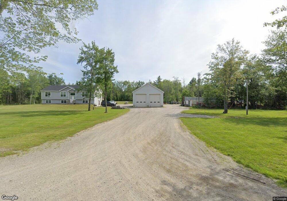
372 Gilpin Rd Orland, ME 04472
Estimated Value: $436,333 - $463,000
3
Beds
2
Baths
1,456
Sq Ft
$310/Sq Ft
Est. Value
About This Home
This home is located at 372 Gilpin Rd, Orland, ME 04472 and is currently estimated at $451,583, approximately $310 per square foot. 372 Gilpin Rd is a home with nearby schools including G. Herbert Jewett School, Miles Lane School, and Bucksport Middle School.
Ownership History
Date
Name
Owned For
Owner Type
Purchase Details
Closed on
Nov 22, 2019
Sold by
Lanpher Ryan J
Bought by
Lanpher Ryan J and Lanpher Sarah R
Current Estimated Value
Home Financials for this Owner
Home Financials are based on the most recent Mortgage that was taken out on this home.
Original Mortgage
$134,940
Outstanding Balance
$118,558
Interest Rate
3.75%
Mortgage Type
New Conventional
Estimated Equity
$333,025
Purchase Details
Closed on
Jan 30, 2006
Sold by
Roderick Elizabeth N and Mercer Brenda
Bought by
Lanpher Ryan J
Create a Home Valuation Report for This Property
The Home Valuation Report is an in-depth analysis detailing your home's value as well as a comparison with similar homes in the area
Home Values in the Area
Average Home Value in this Area
Purchase History
| Date | Buyer | Sale Price | Title Company |
|---|---|---|---|
| Lanpher Ryan J | -- | None Available | |
| Lanpher Ryan J | -- | None Available | |
| Lanpher Ryan J | -- | -- | |
| Lanpher Ryan J | -- | -- |
Source: Public Records
Mortgage History
| Date | Status | Borrower | Loan Amount |
|---|---|---|---|
| Open | Lanpher Ryan J | $134,940 | |
| Closed | Lanpher Ryan J | $134,940 |
Source: Public Records
Tax History Compared to Growth
Tax History
| Year | Tax Paid | Tax Assessment Tax Assessment Total Assessment is a certain percentage of the fair market value that is determined by local assessors to be the total taxable value of land and additions on the property. | Land | Improvement |
|---|---|---|---|---|
| 2024 | $3,850 | $316,060 | $91,480 | $224,580 |
| 2023 | $3,723 | $316,060 | $91,480 | $224,580 |
| 2022 | $3,114 | $318,440 | $91,480 | $226,960 |
| 2021 | $2,926 | $191,270 | $55,650 | $135,620 |
| 2020 | $2,944 | $192,420 | $55,650 | $136,770 |
| 2019 | $2,983 | $192,420 | $55,650 | $136,770 |
| 2018 | $2,827 | $192,420 | $55,650 | $136,770 |
| 2017 | $2,700 | $193,580 | $55,650 | $137,930 |
| 2016 | $2,652 | $193,580 | $55,650 | $137,930 |
| 2015 | $2,668 | $194,730 | $55,650 | $139,080 |
| 2014 | $1,034 | $72,800 | $55,650 | $17,150 |
| 2013 | $1,034 | $72,800 | $55,650 | $17,150 |
Source: Public Records
Map
Nearby Homes
- 160 Front Ridge Rd
- 0 Meadow Brook Ln
- 41 Wildwood Ln
- 348 Back Ridge Rd
- 54 Gross Point Rd
- M4L15&16 Acadia Hwy
- MAP4LOT17 Acadia Hwy
- 123 Front Ridge Rd
- 52 State Route 46
- #17 W Side Dr
- 269 E Side Dr
- 63 Main St
- 130 Hartview Cir
- M13, L36 Harland Cunningham Rd
- Lot 96 Pond Street Extension St
- 63 Pond St
- 155 Long Point Way
- 43 Verona Park
- 20 Verona Park Unit DR
- 23 Pond St
- 27 Brier Brook Rd
- 5 Briar Brook Rd
- 323 Gilpin Rd
- 14 Briar Brook Rd
- 6 Brier Brook Rd
- 19 Briar Brook Rd
- 53 Briar Brook Rd
- 435 Gilpin Rd
- 449 Gilpin Rd
- 293 Gilpin Rd
- 23 Powell Dr
- 22 Powell Dr
- 292 Gilpin Rd
- 312 Gilpin Rd
- 453 Gilpin Rd
- 72 Alder Rd
- 475 Gilpin Rd
- 70 Brier Brook Rd
- 487 Gilpin Rd
- 488 Gilpin Rd