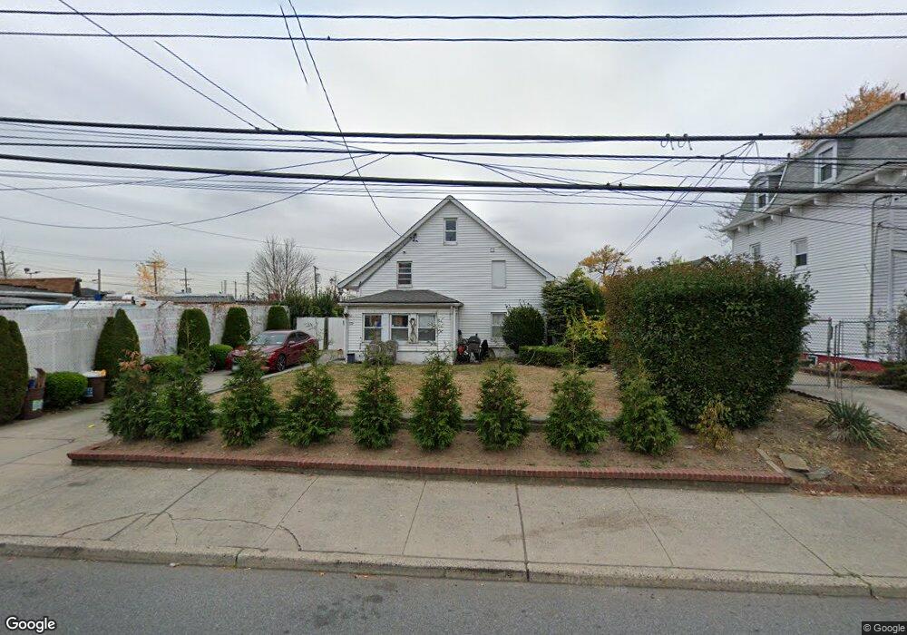
372 Harbor Rd Staten Island, NY 10303
Mariners Harbor NeighborhoodEstimated Value: $519,000 - $593,000
3
Beds
1
Bath
720
Sq Ft
$791/Sq Ft
Est. Value
About This Home
This home is located at 372 Harbor Rd, Staten Island, NY 10303 and is currently estimated at $569,598, approximately $791 per square foot. 372 Harbor Rd is a home located in Richmond County with nearby schools including P.S. 44 Thomas C Brown, I.S. 51 Edwin Markham, and Port Richmond High School.
Ownership History
Date
Name
Owned For
Owner Type
Purchase Details
Closed on
Aug 29, 2012
Sold by
Burgo Scott and Burgo Erin
Bought by
Zambrano Alexander J
Current Estimated Value
Home Financials for this Owner
Home Financials are based on the most recent Mortgage that was taken out on this home.
Original Mortgage
$228,000
Outstanding Balance
$157,915
Interest Rate
3.59%
Mortgage Type
New Conventional
Estimated Equity
$411,683
Purchase Details
Closed on
Jul 27, 2011
Sold by
Burgo Gerard and Burgo Joan
Bought by
Burgo Scott and Burgo Erin
Purchase Details
Closed on
Feb 12, 2002
Sold by
Ascolesi Carolann J
Bought by
Burgo James M
Home Financials for this Owner
Home Financials are based on the most recent Mortgage that was taken out on this home.
Original Mortgage
$108,000
Interest Rate
6.64%
Mortgage Type
Purchase Money Mortgage
Purchase Details
Closed on
Oct 28, 1996
Sold by
Murphy James J and Murphy Barbara
Bought by
Ascolesi Salvatore J and Ascolesi Carolann J
Create a Home Valuation Report for This Property
The Home Valuation Report is an in-depth analysis detailing your home's value as well as a comparison with similar homes in the area
Home Values in the Area
Average Home Value in this Area
Purchase History
| Date | Buyer | Sale Price | Title Company |
|---|---|---|---|
| Zambrano Alexander J | $285,000 | Stewart Title Insurance Co | |
| Burgo Scott | -- | Stewart Title Insurance Co | |
| Burgo Scott | -- | Old Republic Natl Title Ins | |
| Burgo James M | $135,000 | Old Republic Natl Title Ins | |
| Ascolesi Salvatore J | $100,000 | -- |
Source: Public Records
Mortgage History
| Date | Status | Borrower | Loan Amount |
|---|---|---|---|
| Open | Zambrano Alexander J | $228,000 | |
| Previous Owner | Burgo James M | $108,000 |
Source: Public Records
Tax History Compared to Growth
Tax History
| Year | Tax Paid | Tax Assessment Tax Assessment Total Assessment is a certain percentage of the fair market value that is determined by local assessors to be the total taxable value of land and additions on the property. | Land | Improvement |
|---|---|---|---|---|
| 2025 | $4,685 | $38,760 | $7,222 | $31,538 |
| 2024 | $4,697 | $35,580 | $7,422 | $28,158 |
| 2023 | $4,453 | $23,328 | $7,522 | $15,806 |
| 2022 | $4,370 | $30,900 | $10,680 | $20,220 |
| 2021 | $4,482 | $30,660 | $10,680 | $19,980 |
| 2020 | $4,327 | $26,460 | $10,680 | $15,780 |
| 2019 | $4,018 | $26,340 | $10,680 | $15,660 |
| 2018 | $4,076 | $19,440 | $10,680 | $8,760 |
| 2017 | $3,776 | $19,994 | $9,593 | $10,401 |
| 2016 | $3,478 | $18,948 | $9,692 | $9,256 |
| 2015 | $2,055 | $18,948 | $8,763 | $10,185 |
Source: Public Records
Map
Nearby Homes
- 268 Bruckner Ave Unit 268
- 414 Wilcox St
- 21 Carol Place
- 331 Union Ave
- 22 Spirit Ln Unit 37
- 56 Confederation Place
- 12 Doreen Dr
- 123 Amity Place
- 300 Andros Ave Unit A
- 49 Doreen Dr
- 300A Andros Ave
- 257 Maple Pkwy
- 22 Confederation Place
- 151 Amity Place
- 38 Eleanor Place
- 51 Adrianne Ln
- 48 Adrianne Ln
- 32 Amador St
- 37 Ludwig Ln
- 33 Ludwig Ln
- 366 Harbor Rd
- 368 Harbor Rd
- 360 Harbor Rd
- 2151 Forest Ave
- 358 Harbor Rd
- 2141 Forest Ave
- 12 Samuel Place
- 14 Samuel Place
- 356 Harbor Rd
- 367 Harbor Rd
- 369 Harbor Rd
- 16 Samuel Place
- 365 Harbor Rd
- 354 Harbor Rd
- 361 Harbor Rd
- 18 Samuel Place
- 357 Harbor Rd
- 352 Harbor Rd
- 349 Harbor Rd Unit 353
- 349-353 Harbor Rd