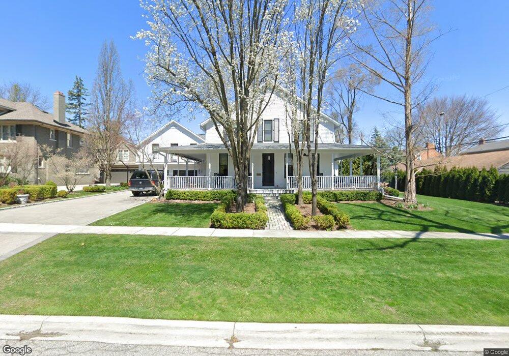
372 Harmon St Unit Bldg-Unit Birmingham, MI 48009
Estimated Value: $1,807,651 - $2,098,000
5
Beds
5
Baths
4,197
Sq Ft
$472/Sq Ft
Est. Value
About This Home
This home is located at 372 Harmon St Unit Bldg-Unit, Birmingham, MI 48009 and is currently estimated at $1,979,913, approximately $471 per square foot. 372 Harmon St Unit Bldg-Unit is a home located in Oakland County with nearby schools including Pierce Elementary School, Derby Middle School, and Ernest W. Seaholm High School.
Ownership History
Date
Name
Owned For
Owner Type
Purchase Details
Closed on
Nov 3, 2025
Sold by
Lotz Kristen Elizabeth and Black Gordon C
Bought by
Black Gordon C and Black Kristen Elizabeth
Current Estimated Value
Purchase Details
Closed on
May 3, 2021
Sold by
Whitehead George W and Whitehead Phyllis J
Bought by
Black Gordon C and Lotz Kristen Elizabeth
Create a Home Valuation Report for This Property
The Home Valuation Report is an in-depth analysis detailing your home's value as well as a comparison with similar homes in the area
Home Values in the Area
Average Home Value in this Area
Purchase History
| Date | Buyer | Sale Price | Title Company |
|---|---|---|---|
| Black Gordon C | -- | Title Wrx Title Agency | |
| Black Gordon C | $1,314,000 | Devon Title Agency |
Source: Public Records
Tax History
| Year | Tax Paid | Tax Assessment Tax Assessment Total Assessment is a certain percentage of the fair market value that is determined by local assessors to be the total taxable value of land and additions on the property. | Land | Improvement |
|---|---|---|---|---|
| 2025 | $26,122 | $762,320 | $0 | $0 |
| 2024 | $23,060 | $715,690 | $0 | $0 |
| 2023 | $22,097 | $644,790 | $0 | $0 |
| 2022 | $23,956 | $620,270 | $0 | $0 |
| 2021 | $15,333 | $581,450 | $0 | $0 |
| 2020 | $15,913 | $586,910 | $0 | $0 |
| 2019 | $17,568 | $585,330 | $0 | $0 |
| 2018 | $17,886 | $535,050 | $0 | $0 |
| 2017 | $17,712 | $541,040 | $0 | $0 |
| 2016 | $17,006 | $535,940 | $0 | $0 |
| 2015 | -- | $515,480 | $0 | $0 |
| 2014 | -- | $448,340 | $0 | $0 |
| 2011 | -- | $354,320 | $0 | $0 |
Source: Public Records
Map
Nearby Homes
- 551 N Old Woodward Ave Unit 551
- 488 Vinewood Ave
- 532 Brookside Ave
- 405 Bonnie Brier St
- 369 N Old Woodward Ave Unit 301
- 369 N Old Woodward Ave Unit 307
- 369 N Old Woodward Ave Unit 206
- 369 N Old Woodward Ave Unit 207
- 601 Dewey St
- 667 Oak Ave
- 670 Oak Ave
- 468 Willits St
- 395 Greenwood St
- 750 Hazelwood St
- 592 Lakeside Dr
- 1111 N Old Woodward Ave Unit 4
- 1111 N Old Woodward Ave Unit 23
- 1115 N Old Woodward Ave
- 255 Southfield Rd Unit 1
- 1115 N Old Woodward Ave Unit 52
- 372 Harmon St
- 420 Harmon St
- 560 Aten Ct
- 535 N Old Woodward Ave
- 570 Aten Ct
- 543 N Old Woodward Ave Unit Bldg-Unit
- 585 N Old Woodward Ave
- 577 N Old Woodward Ave Unit J577
- 575 N Old Woodward Ave
- 573 N Old Woodward Ave Unit J573
- 571 N Old Woodward Ave Unit J571
- 547 N Old Woodward Ave Unit 547
- 537 N Old Woodward Ave Unit N537
- 577 N Old Woodward Ave Unit 3 End U
- 577 N Old Woodward Ave Unit End U
- 571 N Old Woodward Ave Unit 57
- 595 N Old Woodward Ave Unit L595
- 557 N Old Woodward Ave
- 553 N Old Woodward Ave
- 549 N Old Woodward Ave
Your Personal Tour Guide
Ask me questions while you tour the home.