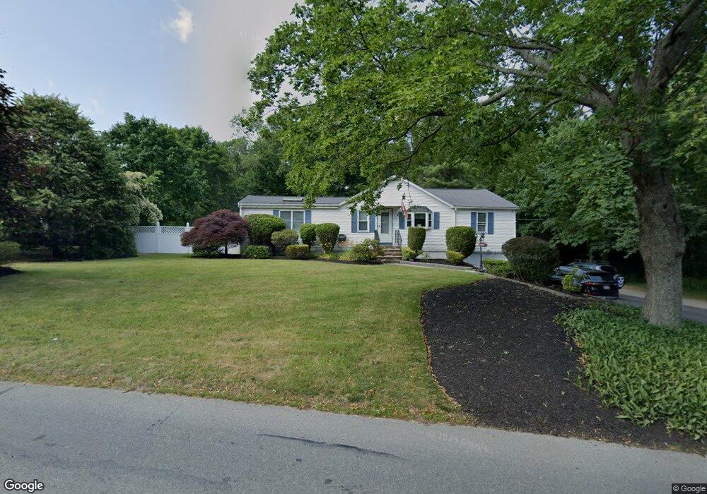
372 King Philip St Raynham, MA 02767
Estimated Value: $564,186 - $619,000
3
Beds
3
Baths
2,147
Sq Ft
$272/Sq Ft
Est. Value
About This Home
This home is located at 372 King Philip St, Raynham, MA 02767 and is currently estimated at $584,797, approximately $272 per square foot. 372 King Philip St is a home located in Bristol County with nearby schools including Merrill Elementary School, Williams Intermediate School, and Raynham Middle School.
Ownership History
Date
Name
Owned For
Owner Type
Purchase Details
Closed on
Sep 12, 1997
Sold by
Sinclair Alan and Sinclair Francis B
Bought by
Delcolle Jonathan R and Delcolle Ann Marie
Current Estimated Value
Home Financials for this Owner
Home Financials are based on the most recent Mortgage that was taken out on this home.
Original Mortgage
$115,000
Outstanding Balance
$16,203
Interest Rate
7.31%
Mortgage Type
Purchase Money Mortgage
Estimated Equity
$568,594
Purchase Details
Closed on
Jan 16, 1987
Sold by
Cottrell Rlty 1
Bought by
Tangaro John J
Home Financials for this Owner
Home Financials are based on the most recent Mortgage that was taken out on this home.
Original Mortgage
$114,950
Interest Rate
9.26%
Mortgage Type
Purchase Money Mortgage
Create a Home Valuation Report for This Property
The Home Valuation Report is an in-depth analysis detailing your home's value as well as a comparison with similar homes in the area
Home Values in the Area
Average Home Value in this Area
Purchase History
| Date | Buyer | Sale Price | Title Company |
|---|---|---|---|
| Delcolle Jonathan R | $119,000 | -- | |
| Tangaro John J | $121,000 | -- |
Source: Public Records
Mortgage History
| Date | Status | Borrower | Loan Amount |
|---|---|---|---|
| Open | Tangaro John J | $115,000 | |
| Previous Owner | Tangaro John J | $15,000 | |
| Previous Owner | Tangaro John J | $114,950 |
Source: Public Records
Tax History Compared to Growth
Tax History
| Year | Tax Paid | Tax Assessment Tax Assessment Total Assessment is a certain percentage of the fair market value that is determined by local assessors to be the total taxable value of land and additions on the property. | Land | Improvement |
|---|---|---|---|---|
| 2025 | $5,795 | $478,900 | $187,700 | $291,200 |
| 2024 | $5,764 | $464,100 | $187,700 | $276,400 |
| 2023 | $5,396 | $396,800 | $168,900 | $227,900 |
| 2022 | $5,294 | $357,000 | $159,500 | $197,500 |
| 2021 | $3,851 | $340,700 | $150,100 | $190,600 |
| 2020 | $4,761 | $330,400 | $142,600 | $187,800 |
| 2019 | $4,435 | $311,700 | $123,900 | $187,800 |
| 2018 | $3,420 | $281,400 | $118,200 | $163,200 |
| 2017 | $3,917 | $260,600 | $112,600 | $148,000 |
| 2016 | $3,848 | $256,900 | $108,900 | $148,000 |
| 2015 | $3,670 | $240,800 | $109,100 | $131,700 |
Source: Public Records
Map
Nearby Homes
- 123 Center St
- 65 Lothrop St
- 2 Maplewood Ln Unit 21-1
- 0 Maplewood Unit 21.3 73426136
- 0 Maplewood Unit 33-1 73420094
- 17 Lisa Dr
- 63 Vaillancourt St
- 9 Abbey Ln
- 13 Daisy Ave
- 5 New Carver St
- 18 Garfield St
- 47 Fairbanks Rd
- 84 Diniz Dr
- 138 Carver St
- 12 Oxford St
- 43 Avon St
- 658 Broadway
- 8 Spinnaker Ln Unit B
- 68 Sabbatia Ln
- 3 4th Ave
- 360 King Philip St
- 382 King Philip St
- 382 King Philip St Unit H
- 350 King Philip St
- 367 King Philip St
- 375 King Philip St
- 357 King Philip St
- 349 King Philip St
- 349 King Philip St Unit 1
- 340 King Philip St
- 412 King Philip St
- 393 King Philip St
- 339 King Philip St
- 337 King Philip St Unit 3
- 0 King Philip St (Rear) Unit 71557597
- 334 King Philip St
- 331 King Philip St
- 329 King Philip St
- 361 Broadway
- 373 Broadway