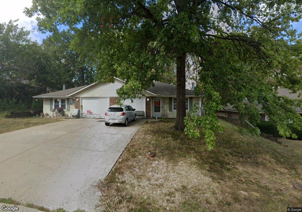
3721 SW McDanial Ave Blue Springs, MO 64015
Estimated Value: $179,898 - $257,000
2
Beds
2
Baths
2,116
Sq Ft
$98/Sq Ft
Est. Value
About This Home
This home is located at 3721 SW McDanial Ave, Blue Springs, MO 64015 and is currently estimated at $207,975, approximately $98 per square foot. 3721 SW McDanial Ave is a home located in Jackson County with nearby schools including Franklin Smith Elementary School, Paul Kinder Middle School, and Blue Springs High School.
Ownership History
Date
Name
Owned For
Owner Type
Purchase Details
Closed on
Sep 17, 2009
Sold by
Wheeler Steven Kyle and Wheeler Krystalle L
Bought by
Long Danny
Current Estimated Value
Home Financials for this Owner
Home Financials are based on the most recent Mortgage that was taken out on this home.
Original Mortgage
$126,400
Outstanding Balance
$83,376
Interest Rate
5.36%
Mortgage Type
New Conventional
Estimated Equity
$124,599
Purchase Details
Closed on
May 9, 2000
Sold by
Freeman Melissa A
Bought by
Cleary David M
Home Financials for this Owner
Home Financials are based on the most recent Mortgage that was taken out on this home.
Original Mortgage
$51,200
Interest Rate
8.13%
Mortgage Type
Purchase Money Mortgage
Create a Home Valuation Report for This Property
The Home Valuation Report is an in-depth analysis detailing your home's value as well as a comparison with similar homes in the area
Home Values in the Area
Average Home Value in this Area
Purchase History
| Date | Buyer | Sale Price | Title Company |
|---|---|---|---|
| Long Danny | -- | Chicago | |
| Cleary David M | -- | Heart Of America Title Inc |
Source: Public Records
Mortgage History
| Date | Status | Borrower | Loan Amount |
|---|---|---|---|
| Open | Long Danny | $126,400 | |
| Previous Owner | Cleary David M | $51,200 |
Source: Public Records
Tax History Compared to Growth
Tax History
| Year | Tax Paid | Tax Assessment Tax Assessment Total Assessment is a certain percentage of the fair market value that is determined by local assessors to be the total taxable value of land and additions on the property. | Land | Improvement |
|---|---|---|---|---|
| 2025 | $1,776 | $25,030 | $6,528 | $18,502 |
| 2024 | $1,742 | $21,766 | $4,636 | $17,130 |
| 2023 | $1,742 | $21,766 | $6,118 | $15,648 |
| 2022 | $1,737 | $19,190 | $1,648 | $17,542 |
| 2021 | $1,736 | $19,190 | $1,648 | $17,542 |
| 2020 | $1,503 | $16,906 | $1,648 | $15,258 |
| 2019 | $1,453 | $16,906 | $1,648 | $15,258 |
| 2018 | $1,314 | $14,714 | $1,435 | $13,279 |
| 2017 | $1,278 | $14,714 | $1,435 | $13,279 |
| 2016 | $1,278 | $14,345 | $1,406 | $12,939 |
| 2014 | $1,120 | $12,534 | $1,704 | $10,830 |
Source: Public Records
Map
Nearby Homes
- 125 Beach Dr
- 3812 SW McDanial Ave
- 601 SW Shadow Glen Dr
- 603 SW Shadow Glen Dr
- 605 SW Shadow Glen Dr
- 62 Beach Dr
- 3341 SW Shadow Glen Dr
- 607 SW Shadow Glen Ct
- 605 SW Shadow Glen Ct
- 148 Beach Dr
- 630 SW Shadow Glen Ct
- 27 Beach Dr
- 3222 SW Shadow Brook Dr
- 3705 SW Kimstin Cir
- 41 Clipper Dr
- 3665 SW Kimstin Cir
- 308 SW Woods Chapel Rd
- 3012 SW Moore St
- 3616 NW Dogwood Dr
- 4075 SW M 7 Hwy
- 3723 SW McDanial Ave
- 3717 SW McDanial Ave
- 3727 SW McDanial Ave
- 3715 SW McDanial Ave
- 125 1/2 Beach Dr
- 601 SW 37th Street Terrace
- 3731 SW McDanial Ave
- 600 SW 38th St
- 3709 SW McDanial Ave
- 600 SW 37th Street Terrace
- 605 SW 37th Street Terrace
- 604 SW 38th St
- 604 SW 37th Street Terrace
- 604 SW 37th Street Terrace
- 3707 SW McDanial Ave
- 3705 SW McDanial Ave
- 601 SW 37th St
- 608 SW 38th St
- 601 SW 38th St
- 3701 SW McDanial Ave