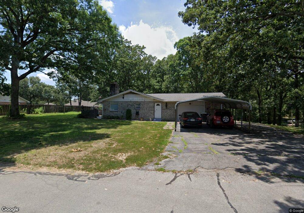
3721 Vickie Dr Jonesboro, AR 72401
Estimated Value: $149,000 - $210,000
--
Bed
2
Baths
1,542
Sq Ft
$115/Sq Ft
Est. Value
About This Home
This home is located at 3721 Vickie Dr, Jonesboro, AR 72401 and is currently estimated at $176,846, approximately $114 per square foot. 3721 Vickie Dr is a home located in Craighead County with nearby schools including Nettleton High School and Montessori School of Jonesboro.
Ownership History
Date
Name
Owned For
Owner Type
Purchase Details
Closed on
Mar 21, 2024
Sold by
Scarborough Rickey N and Scarborough Darla
Bought by
Patel Dominic
Current Estimated Value
Home Financials for this Owner
Home Financials are based on the most recent Mortgage that was taken out on this home.
Original Mortgage
$132,000
Outstanding Balance
$129,809
Interest Rate
6.64%
Mortgage Type
VA
Estimated Equity
$47,037
Purchase Details
Closed on
Jun 6, 2017
Sold by
Scarborough Norman C
Bought by
Scarbotough Rickey N
Create a Home Valuation Report for This Property
The Home Valuation Report is an in-depth analysis detailing your home's value as well as a comparison with similar homes in the area
Home Values in the Area
Average Home Value in this Area
Purchase History
| Date | Buyer | Sale Price | Title Company |
|---|---|---|---|
| Patel Dominic | $135,000 | None Listed On Document | |
| Scarbotough Rickey N | -- | -- |
Source: Public Records
Mortgage History
| Date | Status | Borrower | Loan Amount |
|---|---|---|---|
| Open | Patel Dominic | $132,000 |
Source: Public Records
Tax History Compared to Growth
Tax History
| Year | Tax Paid | Tax Assessment Tax Assessment Total Assessment is a certain percentage of the fair market value that is determined by local assessors to be the total taxable value of land and additions on the property. | Land | Improvement |
|---|---|---|---|---|
| 2025 | $1,230 | $31,694 | $6,000 | $25,694 |
| 2024 | $1,230 | $31,694 | $6,000 | $25,694 |
| 2023 | $1,118 | $31,694 | $6,000 | $25,694 |
| 2022 | $711 | $31,694 | $6,000 | $25,694 |
| 2021 | $743 | $29,690 | $5,600 | $24,090 |
| 2020 | $743 | $29,690 | $5,600 | $24,090 |
| 2019 | $743 | $29,690 | $5,600 | $24,090 |
| 2018 | $768 | $29,690 | $5,600 | $24,090 |
| 2017 | $768 | $29,690 | $5,600 | $24,090 |
| 2016 | $762 | $23,140 | $4,400 | $18,740 |
| 2015 | $1,112 | $23,140 | $4,400 | $18,740 |
| 2014 | $762 | $23,140 | $4,400 | $18,740 |
Source: Public Records
Map
Nearby Homes
- 3502 Burdyshaw Dr
- 4120 Lynx Ln
- 4141 Bobcat Meadow Ln
- 4007 Sandra Ln
- 4145 Bobcat Meadow Ln
- 610 Airport Rd
- 1 E Johnson Ave
- 2412 E Johnson Ave
- 4201 Lynx Ln
- 0 Canera Unit 25018291
- 0 Canera Unit 25018279
- 1008 Cypress Pointe Cove
- 3413 Hudson Dr
- 4064 Gabriel Ct
- 5 Chancery Ln
- 34 Chancery Ln
- 0 Chancery Ln
- 3400 Hudson Dr
- 20 Canera Dr
- 500 N Airport
- 3715 Vickie Dr
- 1105 Kimberly Dr
- 3801 Vickie Dr
- 3718 Vickie Dr
- 3712 Burdyshaw Dr
- 1102 Kimberly Dr
- 3500 Burdyshaw Dr
- 3714 Vickie Dr
- 3709 Vickie Dr
- 3800 Burdyshaw Dr
- Lot 9 Burdyshaw
- Lot 10 Burdyshaw
- 1200 Kimberly Dr
- 3706 Burdyshaw Dr
- 3807 Vickie Dr
- 3812 Burdyshaw Dr
- 0 Burdyshaw Dr
- 3806 Vickie Dr
- 3801 Burdyshaw Dr
- 3719 Burdyshaw Dr