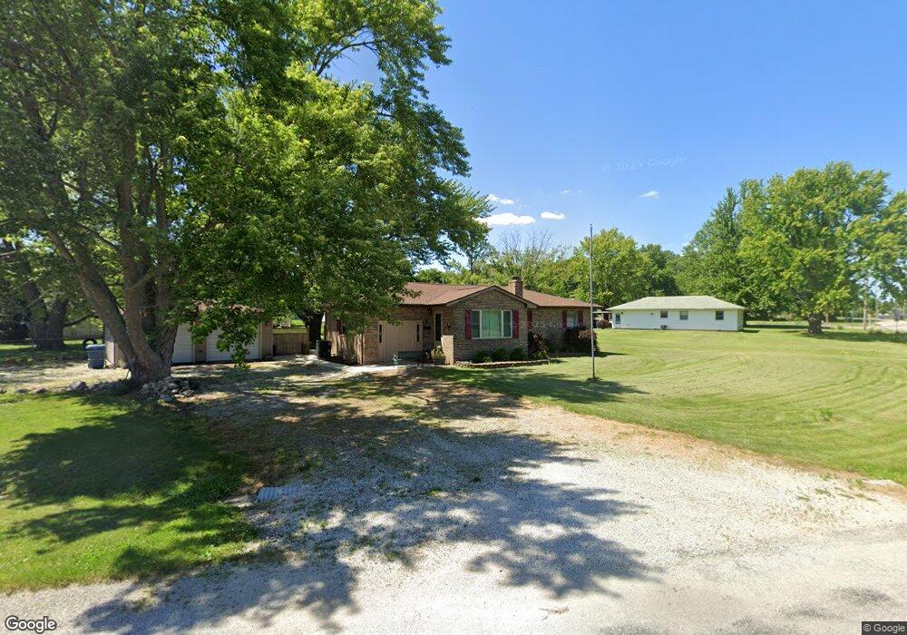
3725 Sand Creek Rd Decatur, IL 62521
Estimated Value: $130,504 - $160,000
3
Beds
1
Bath
1,341
Sq Ft
$109/Sq Ft
Est. Value
About This Home
This home is located at 3725 Sand Creek Rd, Decatur, IL 62521 and is currently estimated at $145,876, approximately $108 per square foot. 3725 Sand Creek Rd is a home located in Macon County with nearby schools including McGaughey Elementary School, Mt. Zion Elementary School, and Mt. Zion Intermediate School.
Ownership History
Date
Name
Owned For
Owner Type
Purchase Details
Closed on
Mar 17, 2014
Sold by
Dial Riki L
Bought by
Dial Deborah R
Current Estimated Value
Home Financials for this Owner
Home Financials are based on the most recent Mortgage that was taken out on this home.
Original Mortgage
$61,303
Outstanding Balance
$17,132
Interest Rate
3.31%
Mortgage Type
New Conventional
Estimated Equity
$128,744
Purchase Details
Closed on
Nov 1, 1995
Create a Home Valuation Report for This Property
The Home Valuation Report is an in-depth analysis detailing your home's value as well as a comparison with similar homes in the area
Home Values in the Area
Average Home Value in this Area
Purchase History
| Date | Buyer | Sale Price | Title Company |
|---|---|---|---|
| Dial Deborah R | -- | Decatur Title Co Llc | |
| -- | $60,000 | -- |
Source: Public Records
Mortgage History
| Date | Status | Borrower | Loan Amount |
|---|---|---|---|
| Open | Dial Deborah R | $61,303 |
Source: Public Records
Tax History Compared to Growth
Tax History
| Year | Tax Paid | Tax Assessment Tax Assessment Total Assessment is a certain percentage of the fair market value that is determined by local assessors to be the total taxable value of land and additions on the property. | Land | Improvement |
|---|---|---|---|---|
| 2024 | $2,190 | $38,080 | $4,456 | $33,624 |
| 2023 | $2,006 | $34,212 | $4,456 | $29,756 |
| 2022 | $1,893 | $32,639 | $4,251 | $28,388 |
| 2021 | $1,785 | $31,050 | $4,044 | $27,006 |
| 2020 | $1,679 | $29,430 | $3,833 | $25,597 |
| 2019 | $1,679 | $29,430 | $3,833 | $25,597 |
| 2018 | $1,596 | $28,309 | $3,687 | $24,622 |
| 2017 | $1,563 | $28,046 | $3,653 | $24,393 |
| 2016 | $1,571 | $27,987 | $3,645 | $24,342 |
| 2015 | $1,485 | $27,172 | $3,539 | $23,633 |
| 2014 | $1,406 | $26,903 | $3,504 | $23,399 |
| 2013 | $1,429 | $26,903 | $3,504 | $23,399 |
Source: Public Records
Map
Nearby Homes
- 3483 Nancy Rd
- 3137 Southland Rd
- 435 Dawson Rd
- 3020 S Laura St
- 2330 S Shores Dr
- 2605 S Forrest Green Dr
- 0 E Danceland Rd
- 2626 S Forrest Green Dr
- 2628 S Forrest Green Dr
- 4115 Meadow Park Dr
- 98 Ridgeway Dr
- 2125 Reserve Way
- 102 Phillips Dr
- 43 Ridgedale Dr
- 65 S Shores Dr
- 2940 Crestwood Dr
- 20 Ridge Dr
- 19 Peggy Ann Dr
- 405 Hackberry Dr
- 0 S Shores Dr
- 1685 Martin Dr
- 3738 Sand Creek Rd
- 3718 Sand Creek Rd
- 3718 Sand Creek Rd
- 1678 Powell Dr
- 3738 Sand Creek Rd
- 1675 Martin Dr
- 3670 Sand Creek Rd
- 3750 Sandcreek Rd
- 3763 Sand Creek Rd
- 1680 Martin Dr
- 3770 Sand Creek Rd
- 1690 Martin Dr
- 1668 Powell Dr
- 3650 Sand Creek Rd
- 1665 Martin Dr
- 1670 Martin Dr
- 3820 Sandcreek Rd
- 1660 Martin Dr
- 1658 Powell Dr