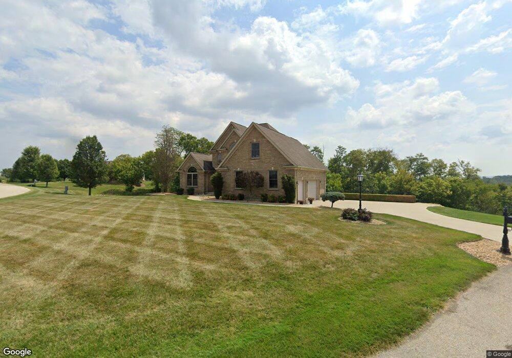
3726 Rolling Ridge Ct Lawrenceburg, IN 47025
Estimated Value: $361,000 - $645,000
3
Beds
3
Baths
3,593
Sq Ft
$141/Sq Ft
Est. Value
About This Home
This home is located at 3726 Rolling Ridge Ct, Lawrenceburg, IN 47025 and is currently estimated at $507,282, approximately $141 per square foot. 3726 Rolling Ridge Ct is a home located in Dearborn County with nearby schools including Lawrenceburg Primary School, Central Elementary School, and Greendale Middle School.
Ownership History
Date
Name
Owned For
Owner Type
Purchase Details
Closed on
May 15, 2012
Sold by
Palmer Thomas C and Palmer Amy R
Bought by
Palmer Ii Thomas C
Current Estimated Value
Home Financials for this Owner
Home Financials are based on the most recent Mortgage that was taken out on this home.
Original Mortgage
$346,000
Outstanding Balance
$239,951
Interest Rate
3.92%
Mortgage Type
New Conventional
Estimated Equity
$267,331
Create a Home Valuation Report for This Property
The Home Valuation Report is an in-depth analysis detailing your home's value as well as a comparison with similar homes in the area
Home Values in the Area
Average Home Value in this Area
Purchase History
| Date | Buyer | Sale Price | Title Company |
|---|---|---|---|
| Palmer Ii Thomas C | -- | -- |
Source: Public Records
Mortgage History
| Date | Status | Borrower | Loan Amount |
|---|---|---|---|
| Open | Palmer Ii Thomas C | $346,000 |
Source: Public Records
Tax History Compared to Growth
Tax History
| Year | Tax Paid | Tax Assessment Tax Assessment Total Assessment is a certain percentage of the fair market value that is determined by local assessors to be the total taxable value of land and additions on the property. | Land | Improvement |
|---|---|---|---|---|
| 2024 | $2,578 | $308,500 | $40,900 | $267,600 |
| 2023 | $2,748 | $314,700 | $40,900 | $273,800 |
| 2022 | $2,887 | $326,600 | $40,900 | $285,700 |
| 2021 | $2,771 | $305,700 | $40,900 | $264,800 |
| 2020 | $2,481 | $310,900 | $40,900 | $270,000 |
| 2019 | $2,696 | $316,100 | $40,900 | $275,200 |
| 2018 | $2,806 | $321,300 | $40,900 | $280,400 |
| 2017 | $2,501 | $295,000 | $40,900 | $254,100 |
| 2016 | $2,552 | $299,800 | $40,900 | $258,900 |
| 2014 | $2,328 | $307,200 | $40,900 | $266,300 |
Source: Public Records
Map
Nearby Homes
- 0 Rookwood Dr Unit 28
- 0 Rookwood Dr
- 113 Blue Sky Way
- 302 Sunset View
- 300 Riverscape Ct
- 501 Riverscape Ct
- 436 W Eads Pkwy
- 14997 Wilson Creek Rd
- 0 U S 50
- 151 Brown St
- 0 Crossbow Trail Unit 204758
- 0 W Eads Pkwy
- 163 Hardwood Ridge Dr
- 341 4th St
- 452 Ludlow St Unit 450
- 216 Oakey Ave
- 520 Sheldon St
- 951 Primrose Dr
- 0 Scenic Dr
- 801 Sunnyside Ave
- 15566 Rookwood Dr
- 3758 Rolling Ridge Ct
- 3725 Rolling Ridge Ct
- 15507 Rookwood Dr
- 15485 Hidden Pond Pass Ln
- 15619 Rookwood Dr
- 15480 Hidden Pond Pass
- 15675 Rookwood Dr
- 15451 Rookwood Dr
- 15707 Rookwood Dr
- 15494 Hidden Pond Pass Ln
- 3702 Valley Ridge Ct
- 15780 Rookwood Dr
- 15761 Rookwood Dr
- 34 Valley Ridge Ct
- 35 Valley Ridge Ct
- 15789 Rookwood Dr
- 0 Rookwood Dr
- 3665 Valley Ridge Ct
- 15827 Rookwood Dr