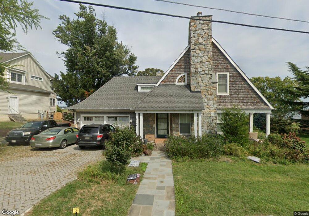
3727 Carroll Dr Edgewater, MD 21037
Estimated Value: $921,000 - $1,341,000
--
Bed
2
Baths
4,224
Sq Ft
$275/Sq Ft
Est. Value
About This Home
This home is located at 3727 Carroll Dr, Edgewater, MD 21037 and is currently estimated at $1,160,907, approximately $274 per square foot. 3727 Carroll Dr is a home located in Anne Arundel County with nearby schools including Mayo Elementary School, Central Middle School, and South River High School.
Ownership History
Date
Name
Owned For
Owner Type
Purchase Details
Closed on
Mar 27, 2023
Sold by
Hanson Patricia Margaret
Bought by
Patricia Margaret Hanson Living Trust and Mary Lynne Boss Living Trust
Current Estimated Value
Purchase Details
Closed on
Mar 1, 1995
Sold by
Carroll Dorothy A
Bought by
Hanson Patricia M
Home Financials for this Owner
Home Financials are based on the most recent Mortgage that was taken out on this home.
Original Mortgage
$184,500
Interest Rate
8.96%
Mortgage Type
Purchase Money Mortgage
Create a Home Valuation Report for This Property
The Home Valuation Report is an in-depth analysis detailing your home's value as well as a comparison with similar homes in the area
Home Values in the Area
Average Home Value in this Area
Purchase History
| Date | Buyer | Sale Price | Title Company |
|---|---|---|---|
| Patricia Margaret Hanson Living Trust | -- | None Listed On Document | |
| Hanson Patricia M | $205,000 | -- |
Source: Public Records
Mortgage History
| Date | Status | Borrower | Loan Amount |
|---|---|---|---|
| Previous Owner | Hanson Patricia M | $184,500 |
Source: Public Records
Tax History Compared to Growth
Tax History
| Year | Tax Paid | Tax Assessment Tax Assessment Total Assessment is a certain percentage of the fair market value that is determined by local assessors to be the total taxable value of land and additions on the property. | Land | Improvement |
|---|---|---|---|---|
| 2025 | $9,551 | $981,667 | -- | -- |
| 2024 | $9,551 | $919,033 | $0 | $0 |
| 2023 | $9,271 | $856,400 | $286,700 | $569,700 |
| 2022 | $8,689 | $841,700 | $0 | $0 |
| 2021 | $17,059 | $827,000 | $0 | $0 |
| 2020 | $2,788 | $812,300 | $319,000 | $493,300 |
| 2019 | $16,062 | $812,300 | $319,000 | $493,300 |
| 2018 | $8,237 | $812,300 | $319,000 | $493,300 |
| 2017 | $7,780 | $852,500 | $0 | $0 |
| 2016 | -- | $813,700 | $0 | $0 |
| 2015 | -- | $774,900 | $0 | $0 |
| 2014 | -- | $736,100 | $0 | $0 |
Source: Public Records
Map
Nearby Homes
- 1121 Paca Dr
- 1419 Bayside Dr
- 1201 Dixona Dr
- 3762 Beach Drive Blvd
- 1207 Bay View Ct
- 1403 (Lot 70) Old Ct
- 1272 Steele Ridge Dr
- Lot 71 Old Ct
- 4180 Shoreham Beach Rd
- 1407 (Lot 72) Old Ct
- 3689 1st Ave
- 3675 1st Ave
- 3685 1st Ave
- 1218 Pine Ave
- 1272 Mayo Ridge Rd
- 1027 Old Turkey Point Rd
- 910 Severn Ave
- 3635 Branhum Rd
- 1261 Mayo Ridge Rd
- 3661 2nd Ave
- 3725 Carroll Dr
- 3721 Carroll Dr
- 3730 Carroll Dr
- 3733 Carroll Dr
- 3719 Carroll Dr
- 3732 Carroll Dr
- 3722 Carroll Dr
- 3717 Carroll Dr
- 3718 Carroll Dr
- 1117 Wilson Dr
- 3716 Carroll Dr
- 3731 Ramsey Dr
- 3746 Ramsey Dr
- 3748 Ramsey Dr
- 3742 Ramsey Dr
- 1115 Wilson Dr
- 3729 Ramsey Dr
- 3736 Ramsey Dr
- 1251 Turkey Point Rd
- 1116 Wilson Dr