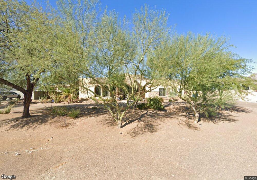
3728 N 202nd Dr Buckeye, AZ 85396
Estimated Value: $1,330,000 - $1,567,404
4
Beds
5
Baths
4,396
Sq Ft
$336/Sq Ft
Est. Value
About This Home
This home is located at 3728 N 202nd Dr, Buckeye, AZ 85396 and is currently estimated at $1,475,101, approximately $335 per square foot. 3728 N 202nd Dr is a home located in Maricopa County with nearby schools including Verrado Elementary School, Verrado Middle School, and Verrado High School.
Ownership History
Date
Name
Owned For
Owner Type
Purchase Details
Closed on
Aug 26, 2019
Sold by
Rayner Perry E
Bought by
Rayner Perry Eugene and Rayner Shannon Aleta
Current Estimated Value
Purchase Details
Closed on
Jun 19, 2019
Sold by
Rayner Perry Eugene and Rayner Shannon Aleta
Bought by
Rayner Perry Eugene and Rayner Shannon Aleta
Home Financials for this Owner
Home Financials are based on the most recent Mortgage that was taken out on this home.
Original Mortgage
$389,852
Outstanding Balance
$342,799
Interest Rate
4%
Mortgage Type
New Conventional
Estimated Equity
$1,132,302
Purchase Details
Closed on
Dec 21, 2010
Sold by
Rayner Shannon
Bought by
Rayner Perry E
Home Financials for this Owner
Home Financials are based on the most recent Mortgage that was taken out on this home.
Original Mortgage
$368,000
Interest Rate
4.35%
Mortgage Type
FHA
Purchase Details
Closed on
Dec 20, 2010
Sold by
Lawlor Keith and Lawlor Debbie
Bought by
Rayner Perry E
Home Financials for this Owner
Home Financials are based on the most recent Mortgage that was taken out on this home.
Original Mortgage
$368,000
Interest Rate
4.35%
Mortgage Type
FHA
Purchase Details
Closed on
Feb 15, 2010
Sold by
Rayner Perry F
Bought by
Rayner Perry Eugene and Rayner Shannon Aleta
Purchase Details
Closed on
Jan 31, 2006
Sold by
Brown Ty Llc
Bought by
Lawlor Keith and Lawlor Debbie
Home Financials for this Owner
Home Financials are based on the most recent Mortgage that was taken out on this home.
Original Mortgage
$292,500
Interest Rate
6.16%
Mortgage Type
Purchase Money Mortgage
Purchase Details
Closed on
Jan 3, 2006
Sold by
Security Title Agency Inc
Bought by
Brown T Y Llc
Home Financials for this Owner
Home Financials are based on the most recent Mortgage that was taken out on this home.
Original Mortgage
$292,500
Interest Rate
6.16%
Mortgage Type
Purchase Money Mortgage
Create a Home Valuation Report for This Property
The Home Valuation Report is an in-depth analysis detailing your home's value as well as a comparison with similar homes in the area
Home Values in the Area
Average Home Value in this Area
Purchase History
| Date | Buyer | Sale Price | Title Company |
|---|---|---|---|
| Rayner Perry Eugene | -- | None Available | |
| Rayner Perry Eugene | -- | None Available | |
| Rayner Perry Eugene | -- | None Available | |
| Rayner Perry E | -- | Fidelity National Title Ins | |
| Rayner Perry E | $460,000 | Fidelity National Title Ins | |
| Rayner Perry Eugene | -- | None Available | |
| Lawlor Keith | $325,000 | Security Title Agency Inc | |
| Brown T Y Llc | -- | Security Title Agency |
Source: Public Records
Mortgage History
| Date | Status | Borrower | Loan Amount |
|---|---|---|---|
| Open | Perry Rayner Family Trust | $60,000 | |
| Open | Rayner Perry Eugene | $389,852 | |
| Closed | Rayner Perry E | $39,000 | |
| Closed | Rayner Perry E | $368,000 | |
| Closed | Rayner Perry E | $368,000 | |
| Previous Owner | Lawlor Keith | $748,000 | |
| Previous Owner | Lawlor Keith | $292,500 |
Source: Public Records
Tax History Compared to Growth
Tax History
| Year | Tax Paid | Tax Assessment Tax Assessment Total Assessment is a certain percentage of the fair market value that is determined by local assessors to be the total taxable value of land and additions on the property. | Land | Improvement |
|---|---|---|---|---|
| 2025 | $8,029 | $65,234 | -- | -- |
| 2024 | $7,415 | $62,127 | -- | -- |
| 2023 | $7,415 | $107,580 | $21,510 | $86,070 |
| 2022 | $6,803 | $65,260 | $13,050 | $52,210 |
| 2021 | $6,907 | $63,820 | $12,760 | $51,060 |
| 2020 | $6,692 | $57,700 | $11,540 | $46,160 |
| 2019 | $7,076 | $56,450 | $11,290 | $45,160 |
| 2018 | $6,240 | $51,600 | $10,320 | $41,280 |
| 2017 | $5,928 | $47,680 | $9,530 | $38,150 |
| 2016 | $5,732 | $46,820 | $9,360 | $37,460 |
| 2015 | $5,361 | $38,700 | $7,736 | $30,964 |
Source: Public Records
Map
Nearby Homes
- 20399 W Springfield St
- 20409 W Thayer St
- 3746 N Acacia Way
- 20432 W Monarch Ct
- 3819 N Springfield St
- 4013 N Founder Cir
- 3727 N Springfield St
- 20269 W Glenrosa Ave
- 20261 W Glenrosa Ave
- 20253 W Glenrosa Ave
- 20481 W Crescent Dr
- 18963 W Crescent Dr
- 18909 W Crescent Dr
- 18975 W Crescent Dr
- 4051 N Founder Cir
- 3518 N 201st Ln
- 20507 W Daniel Place
- 20557 W Lost Creek Dr
- 4078 N Founder Cir
- 3951 N Founder Cir
- 3724 N 202nd Dr
- 20219 W Amelia Ave
- 20225 W Amelia Ave Unit 169
- 3720 N 202nd Dr Unit 193
- 3720 N 202nd Dr Unit 194
- 3727 N 202nd Dr
- 20213 W Amelia Ave Unit 172
- 3723 N 202nd Dr Unit 187
- 3716 N 202nd Dr
- 3716 N 202nd Dr Unit 194
- 3716 N 202nd Dr Unit 193
- 20348 W Springfield St
- 3977 N Kibbey Ct
- 20358 W Springfield St
- 3868 N Acacia Way
- 3982 N Kibbey Ct
- 3965 N Kibbey Ct
- 20364 W Springfield St
- 20368 W Springfield St
- 20224 W Amelia Ave Unit 168