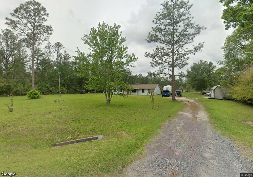
3729 Anthony Ferry Rd Sulphur, LA 70663
Estimated Value: $135,145 - $280,000
3
Beds
2
Baths
1,674
Sq Ft
$122/Sq Ft
Est. Value
About This Home
This home is located at 3729 Anthony Ferry Rd, Sulphur, LA 70663 and is currently estimated at $204,786, approximately $122 per square foot. 3729 Anthony Ferry Rd is a home located in Calcasieu Parish with nearby schools including DeQuincy Primary School, DeQuincy Elementary School, and DeQuincy Middle School.
Ownership History
Date
Name
Owned For
Owner Type
Purchase Details
Closed on
Oct 27, 2006
Sold by
Fruge Felice Keith and Fruge Felice Melissa Ann
Bought by
Cooley Calvin William
Current Estimated Value
Home Financials for this Owner
Home Financials are based on the most recent Mortgage that was taken out on this home.
Original Mortgage
$103,920
Outstanding Balance
$62,158
Interest Rate
6.41%
Mortgage Type
New Conventional
Estimated Equity
$142,628
Create a Home Valuation Report for This Property
The Home Valuation Report is an in-depth analysis detailing your home's value as well as a comparison with similar homes in the area
Home Values in the Area
Average Home Value in this Area
Purchase History
| Date | Buyer | Sale Price | Title Company |
|---|---|---|---|
| Cooley Calvin William | $129,900 | None Available |
Source: Public Records
Mortgage History
| Date | Status | Borrower | Loan Amount |
|---|---|---|---|
| Open | Cooley Calvin William | $103,920 |
Source: Public Records
Tax History Compared to Growth
Tax History
| Year | Tax Paid | Tax Assessment Tax Assessment Total Assessment is a certain percentage of the fair market value that is determined by local assessors to be the total taxable value of land and additions on the property. | Land | Improvement |
|---|---|---|---|---|
| 2024 | $701 | $5,860 | $1,900 | $3,960 |
| 2023 | $701 | $5,860 | $1,900 | $3,960 |
| 2022 | $697 | $5,860 | $1,900 | $3,960 |
| 2021 | $0 | $5,860 | $1,900 | $3,960 |
| 2020 | $658 | $5,380 | $1,820 | $3,560 |
| 2019 | $699 | $5,720 | $1,760 | $3,960 |
| 2018 | $691 | $5,720 | $1,760 | $3,960 |
| 2017 | $648 | $5,720 | $1,760 | $3,960 |
| 2016 | $691 | $5,720 | $1,760 | $3,960 |
| 2015 | $691 | $5,650 | $1,690 | $3,960 |
Source: Public Records
Map
Nearby Homes
- 594 Dublin Ln
- 497 High Hope Rd
- 0 High Hope Rd Unit SWL25100829
- 0 High Hope Rd Unit SWL24004647
- 0 High Hope Rd Unit SWL22000272
- 3737 Evelyn St
- 3611 Heurteurvant Rd
- 3635 Turk Vincent Rd
- 306 Sam Dunham Rd
- 3529 Alisha Ln
- 133 High Hope Rd
- 128 Sam Dunham Rd
- 0 Frank Parker Rd
- 3024 N Nolan Bunch Rd
- 1136 Dunn Ferry Rd
- 1124 Dunn Ferry Rd
- 0 Dunn Ferry Rd
- 3616 Frank Parker Rd
- 0 W Holbrook Cir Unit Lot 33 SWL25101009
- 0 W Holbrook Cir Unit Lot 35 SWL25101010
- 3863 Anthony Ferry Rd
- 0 Irish Ln
- 3730 Anthony Ferry Rd
- 0 Loretta Ln
- 590 Irish Ln
- 598 Irish Ln
- 3874 Anthony Ferry Rd
- 608 Loretta Ln
- 595 Dublin Ln
- 621 Loretta Ln
- 591 Dublin Ln
- 624 Loretta Ln
- 592 Dublin Ln
- 3893 Anthony Ferry Rd
- 3763 Anthony Ferry Rd
- 0 TBD Erin Ln
- 3892 Anthony Ferry Rd
- 628 Loretta Ln
- 620 Erin Ln
- 579 Bankens Rd