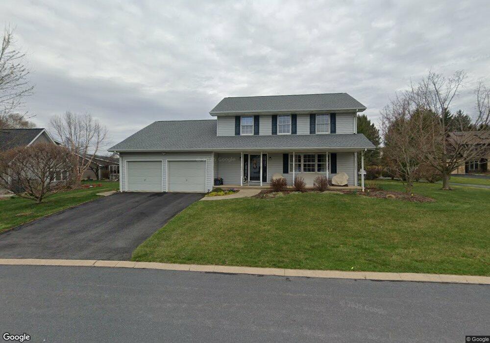
373 Cogan Cir State College, PA 16801
Estimated Value: $456,304 - $506,000
4
Beds
3
Baths
2,100
Sq Ft
$229/Sq Ft
Est. Value
About This Home
This home is located at 373 Cogan Cir, State College, PA 16801 and is currently estimated at $480,076, approximately $228 per square foot. 373 Cogan Cir is a home located in Centre County with nearby schools including Corl Street Elementary School, Park Forest Middle School, and State College Area High School.
Ownership History
Date
Name
Owned For
Owner Type
Purchase Details
Closed on
Aug 23, 2010
Sold by
Rush Dwayne C and Rush Nancy H
Bought by
Rush Dwayne C and Rush Nancy H
Current Estimated Value
Home Financials for this Owner
Home Financials are based on the most recent Mortgage that was taken out on this home.
Original Mortgage
$215,000
Interest Rate
4.3%
Mortgage Type
New Conventional
Purchase Details
Closed on
Dec 13, 2002
Bought by
Rush Dwayne C and Rush Rush
Create a Home Valuation Report for This Property
The Home Valuation Report is an in-depth analysis detailing your home's value as well as a comparison with similar homes in the area
Home Values in the Area
Average Home Value in this Area
Purchase History
| Date | Buyer | Sale Price | Title Company |
|---|---|---|---|
| Rush Dwayne C | -- | Lsi Title Agency Inc | |
| Rush Dwayne C | $213,900 | -- |
Source: Public Records
Mortgage History
| Date | Status | Borrower | Loan Amount |
|---|---|---|---|
| Closed | Rush Dwayne C | $215,000 |
Source: Public Records
Tax History Compared to Growth
Tax History
| Year | Tax Paid | Tax Assessment Tax Assessment Total Assessment is a certain percentage of the fair market value that is determined by local assessors to be the total taxable value of land and additions on the property. | Land | Improvement |
|---|---|---|---|---|
| 2025 | $5,284 | $85,320 | $13,955 | $71,365 |
| 2024 | $4,941 | $85,320 | $13,955 | $71,365 |
| 2023 | $4,941 | $85,320 | $13,955 | $71,365 |
| 2022 | $4,808 | $85,320 | $13,955 | $71,365 |
| 2021 | $4,808 | $85,320 | $13,955 | $71,365 |
| 2020 | $4,808 | $85,320 | $13,955 | $71,365 |
| 2019 | $4,041 | $85,320 | $13,955 | $71,365 |
| 2018 | $4,642 | $85,320 | $13,955 | $71,365 |
| 2017 | $4,585 | $85,320 | $13,955 | $71,365 |
| 2016 | -- | $85,320 | $13,955 | $71,365 |
| 2015 | -- | $85,320 | $13,955 | $71,365 |
| 2014 | -- | $85,320 | $13,955 | $71,365 |
Source: Public Records
Map
Nearby Homes
- 3296 Shellers Bend Unit 105
- 121 Washington Place
- 3291 Shellers Bend Unit 702
- 3291 Shellers Bend Unit 733
- 805 Stratford Dr Unit 8
- 803 Stratford Dr
- 814 Wheatfield Dr
- 1245-54 Westerly Pkwy
- 511 Hawknest Rd
- 1442 & 1450 W College Ave
- 335 S Buckhout St
- 185 Wiltree Ct Unit 185
- 234 S Buckhout St
- 325 S Sparks St
- 114 Gala Dr Unit 114
- 3416 W College Ave
- 179 Apple View Dr
- 178 Apple View Dr
- 131 Apple View Dr
- 114 Apple View Dr
- 375 Cogan Cir
- 371 Cogan Cir
- 377 Cogan Cir
- 374 Cogan Cir
- 3031 Broadmoor Ln
- 379 Cogan Cir
- 3011 Broadmoor Ln
- 370 High Point Cove
- 378 Cogan Cir
- 372 High Point Cove
- 380 Cogan Cir
- 368 High Point Cove
- 374 High Point Cove
- 376 Cogan Cir
- 381 Cogan Cir
- 3030 Wells Terrace
- 3020 Broadmoor Ln
- 3020 Wells Terrace
- 3012 Broadmoor Ln
- 3030 Broadmoor Ln