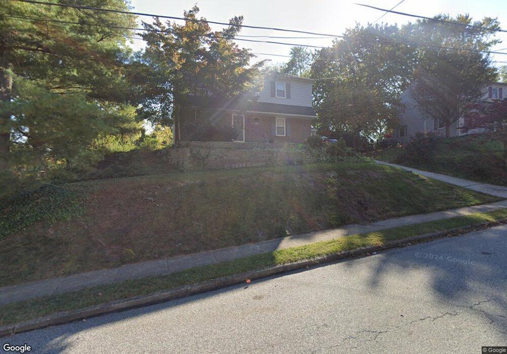
373 Covered Bridge Rd King of Prussia, PA 19406
Estimated Value: $461,000 - $556,000
4
Beds
3
Baths
1,904
Sq Ft
$273/Sq Ft
Est. Value
About This Home
This home is located at 373 Covered Bridge Rd, King of Prussia, PA 19406 and is currently estimated at $519,473, approximately $272 per square foot. 373 Covered Bridge Rd is a home located in Montgomery County with nearby schools including Caley Elementary School, Upper Merion Middle School, and Upper Merion High School.
Ownership History
Date
Name
Owned For
Owner Type
Purchase Details
Closed on
Mar 29, 2024
Sold by
Keil Michael and Keil Marie
Bought by
Keil Joseph and Keil Brooke
Current Estimated Value
Home Financials for this Owner
Home Financials are based on the most recent Mortgage that was taken out on this home.
Original Mortgage
$347,310
Outstanding Balance
$342,179
Interest Rate
6.94%
Mortgage Type
VA
Estimated Equity
$177,294
Purchase Details
Closed on
Feb 27, 1997
Sold by
Roberts Gerald W and Roberts Catherine M
Bought by
Keil Michael and Keil Marie
Create a Home Valuation Report for This Property
The Home Valuation Report is an in-depth analysis detailing your home's value as well as a comparison with similar homes in the area
Home Values in the Area
Average Home Value in this Area
Purchase History
| Date | Buyer | Sale Price | Title Company |
|---|---|---|---|
| Keil Joseph | $340,000 | None Listed On Document | |
| Keil Joseph | $340,000 | None Listed On Document | |
| Keil Michael | -- | -- |
Source: Public Records
Mortgage History
| Date | Status | Borrower | Loan Amount |
|---|---|---|---|
| Open | Keil Joseph | $347,310 | |
| Closed | Keil Joseph | $347,310 |
Source: Public Records
Tax History Compared to Growth
Tax History
| Year | Tax Paid | Tax Assessment Tax Assessment Total Assessment is a certain percentage of the fair market value that is determined by local assessors to be the total taxable value of land and additions on the property. | Land | Improvement |
|---|---|---|---|---|
| 2025 | $4,640 | $150,530 | $54,650 | $95,880 |
| 2024 | $4,640 | $150,530 | $54,650 | $95,880 |
| 2023 | $4,475 | $150,530 | $54,650 | $95,880 |
| 2022 | $4,283 | $150,530 | $54,650 | $95,880 |
| 2021 | $4,150 | $150,530 | $54,650 | $95,880 |
| 2020 | $3,966 | $150,530 | $54,650 | $95,880 |
| 2019 | $4,359 | $150,530 | $54,650 | $95,880 |
| 2018 | $3,899 | $150,530 | $54,650 | $95,880 |
| 2017 | $3,758 | $150,530 | $54,650 | $95,880 |
| 2016 | $3,700 | $150,530 | $54,650 | $95,880 |
| 2015 | $3,563 | $150,530 | $54,650 | $95,880 |
| 2014 | $3,563 | $150,530 | $54,650 | $95,880 |
Source: Public Records
Map
Nearby Homes
- 245 Chapel Ln Unit 80B
- 251 Chapel Ln Unit 83B
- 243 Chapel Ln Unit 79A
- 345 W Signal Hill Rd
- 735 Champlain Dr
- 394 Stonybrook Rd
- 548 Susan Dr
- 156 Green Hill Rd
- 200 Prince Frederick St Unit J3
- 603 Nantucket Cir
- 501 W Dekalb Pike
- 176 Riversedge Dr
- 237 E Valley Forge Rd
- 143 Riversedge Dr Unit CONDO 143
- 121 Woodstream Dr Unit CONDO 121
- 351 Riverview Rd
- 612 Brewster Aly Unit 74
- 608 Brewster Aly
- 167 Woodstream Dr Unit CONDO 167
- 1914 Yorktown S
- 377 Covered Bridge Rd
- 369 Covered Bridge Rd
- 382 W Valley Forge Rd
- 374 W Valley Forge Rd
- 381 Covered Bridge Rd
- 376 Covered Bridge Rd
- 372 Covered Bridge Rd
- 365 Covered Bridge Rd
- 380 Covered Bridge Rd
- 386 W Valley Forge Rd
- 368 Covered Bridge Rd
- 385 Covered Bridge Rd
- 370 W Valley Forge Rd
- 364 Covered Bridge Rd
- 390 W Valley Forge Rd
- 384 Covered Bridge Rd
- 389 Covered Bridge Rd
- 335 Rees Dr
- 333 Rees Dr
- 331 Rees Dr