Estimated Value: $501,000 - $590,000
3
Beds
2
Baths
1,494
Sq Ft
$355/Sq Ft
Est. Value
About This Home
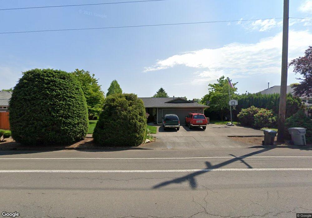
This home is located at 373 NE Territorial Rd, Canby, OR 97013 and is currently estimated at $530,832, approximately $355 per square foot. 373 NE Territorial Rd is a home located in Clackamas County with nearby schools including Josefa L. Sambrano Elementary School, William Knight Elementary School, and Baker Prairie Middle School.
Ownership History
Date
Name
Owned For
Owner Type
Purchase Details
Closed on
Aug 19, 2004
Sold by
Worth Shirley A and Worth Theodore R
Bought by
Canucci Gary A and Canucci Tamara D
Current Estimated Value
Home Financials for this Owner
Home Financials are based on the most recent Mortgage that was taken out on this home.
Original Mortgage
$190,018
Outstanding Balance
$93,185
Interest Rate
5.94%
Mortgage Type
FHA
Estimated Equity
$437,647
Purchase Details
Closed on
Jul 16, 2002
Sold by
Worth Shirley Anne
Bought by
Worth Theodore R and Worth Shirley A
Home Financials for this Owner
Home Financials are based on the most recent Mortgage that was taken out on this home.
Original Mortgage
$105,200
Interest Rate
6.69%
Purchase Details
Closed on
Jun 18, 2002
Sold by
Sammons Ronald A
Bought by
Worth Shirley Anne
Home Financials for this Owner
Home Financials are based on the most recent Mortgage that was taken out on this home.
Original Mortgage
$105,200
Interest Rate
6.69%
Create a Home Valuation Report for This Property
The Home Valuation Report is an in-depth analysis detailing your home's value as well as a comparison with similar homes in the area
Home Values in the Area
Average Home Value in this Area
Purchase History
| Date | Buyer | Sale Price | Title Company |
|---|---|---|---|
| Canucci Gary A | $193,000 | Chicago Title Insurance Comp | |
| Worth Theodore R | -- | Transnation Title Insurance | |
| Worth Shirley Anne | $150,000 | -- |
Source: Public Records
Mortgage History
| Date | Status | Borrower | Loan Amount |
|---|---|---|---|
| Open | Canucci Gary A | $190,018 | |
| Previous Owner | Worth Theodore R | $105,200 |
Source: Public Records
Tax History Compared to Growth
Tax History
| Year | Tax Paid | Tax Assessment Tax Assessment Total Assessment is a certain percentage of the fair market value that is determined by local assessors to be the total taxable value of land and additions on the property. | Land | Improvement |
|---|---|---|---|---|
| 2025 | $5,307 | $299,541 | -- | -- |
| 2024 | $5,158 | $290,817 | -- | -- |
| 2023 | $5,158 | $282,347 | $0 | $0 |
| 2022 | $4,744 | $274,124 | $0 | $0 |
| 2021 | $4,569 | $266,140 | $0 | $0 |
| 2020 | $4,487 | $258,389 | $0 | $0 |
| 2019 | $4,273 | $250,864 | $0 | $0 |
| 2018 | $4,177 | $243,557 | $0 | $0 |
| 2017 | $4,072 | $236,463 | $0 | $0 |
| 2016 | $3,936 | $229,576 | $0 | $0 |
| 2015 | $3,801 | $222,889 | $0 | $0 |
| 2014 | $3,691 | $216,397 | $0 | $0 |
Source: Public Records
Map
Nearby Homes
- 1751 N Laurelwood Loop
- 312 NE 14th Ave
- 187 NE 14th Ave
- 660 NE 20th Ave
- 832 NE 17th Ave
- 838 NE 17th Ave
- 853 NE 17th Ave
- 844 NE 17th Ave
- 1721 N Hyssop St
- 860 NE 14th Ave
- 2152 N Laurelwood St
- 878 NE 17th Ave
- 952 NE 17th Ave
- 947 NE 17th Ave
- 1750 N Oak St
- 1009 NE 17th Ave
- 1614 NW 16th Ave
- 184 NE 10th Ave
- 318 NE 9th Ave
- 1200 NE Territorial Rd Unit 93
- 353 NE Territorial Rd
- 1691 NE Laurelwood Cir
- 1505 NE Laurelwood Cir
- 1501 NE Laurelwood Cir
- 1511 NE Laurelwood Cir
- 1730 N Laurelwood Loop
- 323 NE Territorial Rd
- 1735 N Laurelwood Loop
- 1515 NE Laurelwood Cir
- 1742 N Laurelwood Loop
- 1660 NE Laurelwood Cir
- 1698 NE Laurelwood Cir
- 1530 NE Laurelwood Cir
- 1510 NE Laurelwood Cir
- 1747 N Laurelwood Loop
- 1737 N Laurelwood Loop
- 1620 NE Laurelwood Cir
- 1620 N Locust St
- 1720 N Locust St
- 1519 NE Laurelwood Cir