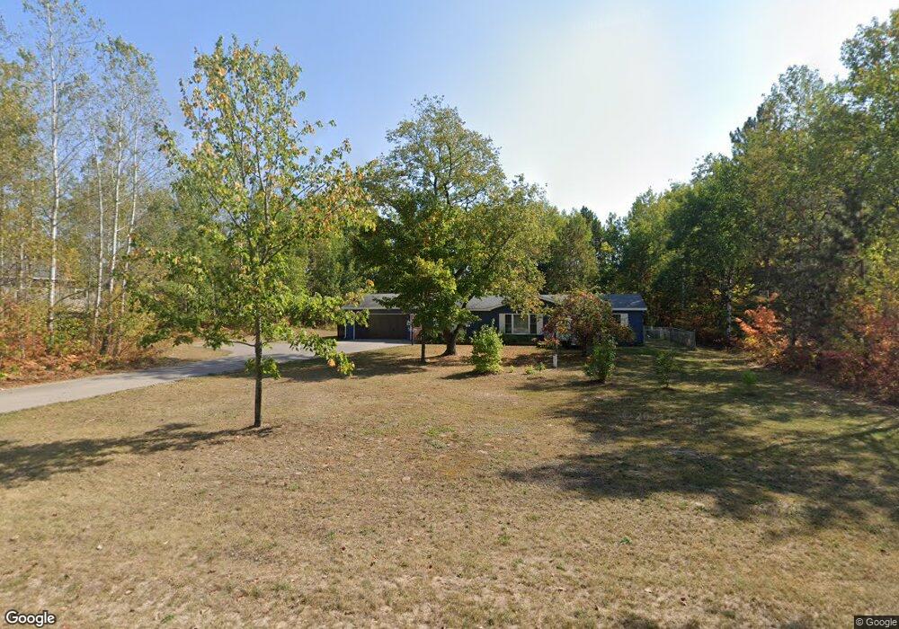
373 Poplar Rd Pellston, MI 49769
Estimated Value: $230,000 - $239,000
3
Beds
2
Baths
1,140
Sq Ft
$205/Sq Ft
Est. Value
About This Home
This home is located at 373 Poplar Rd, Pellston, MI 49769 and is currently estimated at $234,008, approximately $205 per square foot. 373 Poplar Rd is a home located in Emmet County with nearby schools including Pellston Elementary School and Pellston Middle/High School.
Ownership History
Date
Name
Owned For
Owner Type
Purchase Details
Closed on
Sep 11, 2020
Sold by
Peltier Michael S
Bought by
Peltier Michael S and Peltier Yvonne M
Current Estimated Value
Purchase Details
Closed on
Jan 23, 2020
Sold by
Peltier Michael S
Bought by
Peltier Michael S and Peltier Yvonne M
Purchase Details
Closed on
Mar 19, 2010
Sold by
Fannie Mae
Bought by
Peltier Michael S
Purchase Details
Closed on
Apr 23, 2009
Sold by
Balchik Jack J
Bought by
Federal National Mortgage Association
Purchase Details
Closed on
Mar 1, 1990
Sold by
Carter Wd L434 P637
Bought by
Hopkins Rps
Create a Home Valuation Report for This Property
The Home Valuation Report is an in-depth analysis detailing your home's value as well as a comparison with similar homes in the area
Home Values in the Area
Average Home Value in this Area
Purchase History
| Date | Buyer | Sale Price | Title Company |
|---|---|---|---|
| Peltier Michael S | -- | -- | |
| Peltier Michael S | -- | -- | |
| Peltier Michael S | $48,000 | -- | |
| Federal National Mortgage Association | $98,628 | -- | |
| Hopkins Rps | $2,400 | -- |
Source: Public Records
Tax History Compared to Growth
Tax History
| Year | Tax Paid | Tax Assessment Tax Assessment Total Assessment is a certain percentage of the fair market value that is determined by local assessors to be the total taxable value of land and additions on the property. | Land | Improvement |
|---|---|---|---|---|
| 2025 | $1,242 | $87,200 | $87,200 | $0 |
| 2024 | $1,242 | $72,900 | $72,900 | $0 |
| 2023 | $1,158 | $68,900 | $68,900 | $0 |
| 2022 | $1,158 | $52,800 | $52,800 | $0 |
| 2021 | $1,203 | $38,900 | $38,900 | $0 |
| 2020 | $1,209 | $39,400 | $39,400 | $0 |
| 2019 | -- | $38,900 | $38,900 | $0 |
| 2018 | -- | $33,500 | $33,500 | $0 |
| 2017 | -- | $33,900 | $33,900 | $0 |
| 2016 | -- | $34,000 | $34,000 | $0 |
| 2015 | -- | $33,800 | $0 | $0 |
| 2014 | -- | $33,800 | $0 | $0 |
Source: Public Records
Map
Nearby Homes
- 000 Vacant U S 31
- 6457 State St
- 6421 Airport Crossing Rd Unit 1
- 7840 Douglas Lake Rd
- 3117 Jackie Ln
- TBD Teal Rd
- 4333 U S 31
- 9670 Silver Strand Rd
- 9485 Ingleside Rd
- 4189 N Ayr Rd
- 2564 E Brutus Rd
- 5100 N Bay Way
- 10999 Koepke Rd
- 6167 Lambert Dr
- 1830 Indian Point Rd
- 10222 W Munro Lake Dr
- 5383 N Conway Rd
- 4310 E Burt Lake Rd
- 1975 &1995 Club House Dr
- 1975 + 1995 Club House Dr