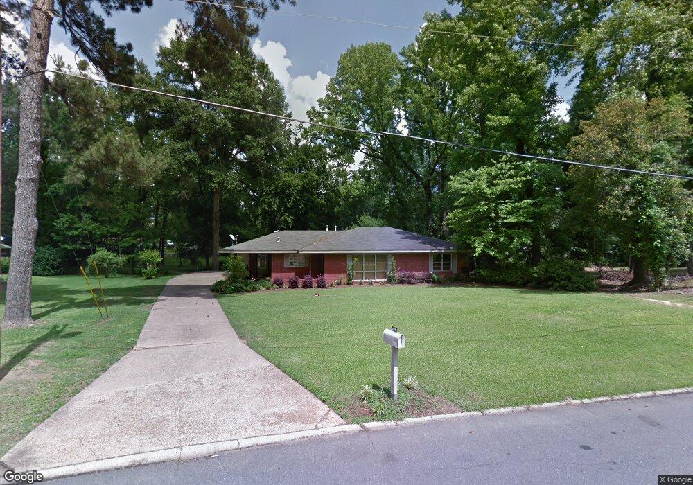
3730 Cornell Dr Shreveport, LA 71107
Freestate-North Highlands NeighborhoodEstimated Value: $160,119 - $198,000
3
Beds
2
Baths
1,643
Sq Ft
$110/Sq Ft
Est. Value
About This Home
This home is located at 3730 Cornell Dr, Shreveport, LA 71107 and is currently estimated at $181,030, approximately $110 per square foot. 3730 Cornell Dr is a home located in Caddo Parish with nearby schools including North Highlands Elementary School, Judson Fundamental Elementary School, and Fairfield Magnet School.
Ownership History
Date
Name
Owned For
Owner Type
Purchase Details
Closed on
Dec 15, 2016
Sold by
Brown Able Nancy Leah
Bought by
Able John
Current Estimated Value
Home Financials for this Owner
Home Financials are based on the most recent Mortgage that was taken out on this home.
Original Mortgage
$50,000,000
Outstanding Balance
$42,001,421
Interest Rate
4.3%
Mortgage Type
Unknown
Estimated Equity
-$41,820,391
Create a Home Valuation Report for This Property
The Home Valuation Report is an in-depth analysis detailing your home's value as well as a comparison with similar homes in the area
Home Values in the Area
Average Home Value in this Area
Purchase History
| Date | Buyer | Sale Price | Title Company |
|---|---|---|---|
| Able John | -- | None Available |
Source: Public Records
Mortgage History
| Date | Status | Borrower | Loan Amount |
|---|---|---|---|
| Open | Able John | $50,000,000 | |
| Previous Owner | Able John Wesley | $75,000 | |
| Previous Owner | Able John Wesley | $82,600 |
Source: Public Records
Tax History Compared to Growth
Tax History
| Year | Tax Paid | Tax Assessment Tax Assessment Total Assessment is a certain percentage of the fair market value that is determined by local assessors to be the total taxable value of land and additions on the property. | Land | Improvement |
|---|---|---|---|---|
| 2024 | $1,102 | $7,069 | $1,756 | $5,313 |
| 2023 | $1,113 | $6,985 | $1,672 | $5,313 |
| 2022 | $1,113 | $6,985 | $1,672 | $5,313 |
| 2021 | $1,096 | $6,985 | $1,672 | $5,313 |
| 2020 | $1,096 | $6,985 | $1,672 | $5,313 |
| 2019 | $1,145 | $7,081 | $1,672 | $5,409 |
| 2018 | $912 | $7,081 | $1,672 | $5,409 |
| 2017 | $1,163 | $7,081 | $1,672 | $5,409 |
| 2015 | -- | $6,760 | $1,670 | $5,090 |
| 2014 | -- | $6,760 | $1,670 | $5,090 |
| 2013 | -- | $6,760 | $1,670 | $5,090 |
Source: Public Records
Map
Nearby Homes
- 810 Poleman Rd
- 3812 Clintwood Dr
- 736 Dodd Dr
- 3530 Old Mooringsport Rd
- 3818 Eddy Place
- 3718 Eddy Place
- 743 Lincoln Dr
- 3223 Dearborn St
- 3212 Dearborn St
- 3212 Tanglewood Dr
- 0 Timberlane Dr
- 3421 N Market St
- 906 Lincoln Dr
- 3940 Jeffery Kyle Dr
- 3843 Joseph Randall Dr
- 964 Winter Garden Dr Unit 37
- 4875 N Market St
- 000 N Market St
- 961 Pine Hill Rd
- 842 Navaho Trail
- 3736 Cornell Dr
- 3319 Terrace Dr
- 3317 Terrace Dr
- 3725 Cornell Dr
- 3323 Terrace Dr
- 3735 Cornell Dr
- 3742 Cornell Dr
- 3712 Cornell Dr
- 3711 Cornell Dr
- 3313 Terrace Dr
- 3706 Cornell Dr
- 3706 Cornell Dr
- 3325 Terrace Dr
- 601 Wesley Ave
- 3748 Cornell Dr
- 3322 Terrace Dr
- 0 Cornell Dr
- 3705 Cornell Dr
- 605 Wesley Ave
- 3316 Terrace Dr