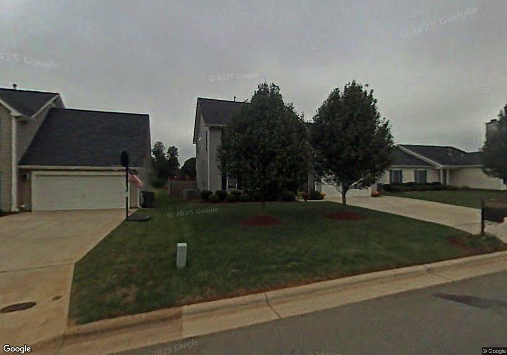
3732 Shadow Ridge Dr High Point, NC 27265
Bent Tree NeighborhoodEstimated Value: $351,000 - $408,000
3
Beds
3
Baths
2,254
Sq Ft
$164/Sq Ft
Est. Value
About This Home
This home is located at 3732 Shadow Ridge Dr, High Point, NC 27265 and is currently estimated at $370,541, approximately $164 per square foot. 3732 Shadow Ridge Dr is a home located in Guilford County with nearby schools including Southwest Elementary School, Southwest Guilford Middle School, and Southwest Guilford High School.
Ownership History
Date
Name
Owned For
Owner Type
Purchase Details
Closed on
Jun 19, 2002
Sold by
D R Horton Inc
Bought by
Jaffe Steven M and Jaffe Joann
Current Estimated Value
Home Financials for this Owner
Home Financials are based on the most recent Mortgage that was taken out on this home.
Original Mortgage
$113,750
Interest Rate
8.85%
Create a Home Valuation Report for This Property
The Home Valuation Report is an in-depth analysis detailing your home's value as well as a comparison with similar homes in the area
Home Values in the Area
Average Home Value in this Area
Purchase History
| Date | Buyer | Sale Price | Title Company |
|---|---|---|---|
| Jaffe Steven M | $175,000 | -- |
Source: Public Records
Mortgage History
| Date | Status | Borrower | Loan Amount |
|---|---|---|---|
| Previous Owner | Jaffe Steven M | $113,750 |
Source: Public Records
Tax History
| Year | Tax Paid | Tax Assessment Tax Assessment Total Assessment is a certain percentage of the fair market value that is determined by local assessors to be the total taxable value of land and additions on the property. | Land | Improvement |
|---|---|---|---|---|
| 2025 | $4,171 | $302,700 | $60,000 | $242,700 |
| 2024 | $4,171 | $302,700 | $60,000 | $242,700 |
| 2023 | $4,171 | $302,700 | $60,000 | $242,700 |
| 2022 | $4,080 | $302,700 | $60,000 | $242,700 |
| 2021 | $2,633 | $191,100 | $34,000 | $157,100 |
| 2020 | $2,633 | $191,100 | $34,000 | $157,100 |
| 2019 | $2,633 | $191,100 | $0 | $0 |
| 2018 | $2,620 | $191,100 | $0 | $0 |
| 2017 | $2,633 | $191,100 | $0 | $0 |
| 2016 | $2,543 | $181,300 | $0 | $0 |
| 2015 | $2,556 | $181,300 | $0 | $0 |
| 2014 | $2,600 | $181,300 | $0 | $0 |
Source: Public Records
Map
Nearby Homes
- 4335 Holstein Dr
- 3838 Galloway Ct
- 4485 Alderny Cir
- 4340 Southern Oak Dr
- 3855 Thistleberry Rd
- 3650 Single Leaf Ct
- 4408 Alderny Cir
- 748 Carneros Cir
- 717 Piedmont Crossing Dr
- 715 Piedmont Crossing Dr Unit 14
- Richmond Plan at Williard Place
- Cameron Plan at Williard Place
- Southport Plan at Williard Place
- Columbia Plan at Williard Place
- Bailey Plan at Williard Place
- 1515 Skeet Club Rd
- 3273 Alyssa Way
- 4716 Willowstone Dr
- 4714 Willowstone Dr
- 4712 Willowstone Dr
- 3728 Shadow Ridge Dr
- 3736 Shadow Ridge Dr
- 3724 Shadow Ridge Dr
- 3740 Shadow Ridge Dr
- 3667 Canopy Oak Ct
- 3720 Shadow Ridge Dr
- 3663 Canopy Oak Ct
- 3689 Shadow Ridge Dr
- 3685 Shadow Ridge Dr
- 3659 Canopy Oak Ct
- 3712 Shadow Ridge Dr
- 3666 Canopy Oak Ct
- 3658 Canopy Oak Ct
- 3662 Canopy Oak Ct
- 2500 Willard Dairy Rd
- 3691 Wood Cove Dr
- 3708 Shadow Ridge Dr
- 3655 Canopy Oak Ct
- 3687 Wood Cove Dr
- 3654 Canopy Oak Ct