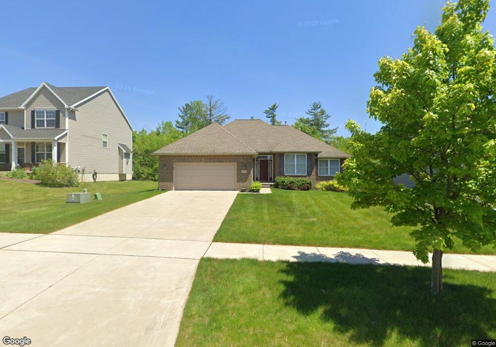
3735 Burnham Rd Unit 18 Ann Arbor, MI 48108
Estimated Value: $556,000 - $717,000
3
Beds
2
Baths
1,828
Sq Ft
$336/Sq Ft
Est. Value
About This Home
This home is located at 3735 Burnham Rd Unit 18, Ann Arbor, MI 48108 and is currently estimated at $615,110, approximately $336 per square foot. 3735 Burnham Rd Unit 18 is a home located in Washtenaw County with nearby schools including Bryant Elementary School, Pattengill Elementary School, and Tappan Middle School.
Ownership History
Date
Name
Owned For
Owner Type
Purchase Details
Closed on
Sep 2, 2010
Sold by
Peters Building Co
Bought by
Xia Meng and Lu Mingrui
Current Estimated Value
Home Financials for this Owner
Home Financials are based on the most recent Mortgage that was taken out on this home.
Original Mortgage
$218,800
Outstanding Balance
$144,847
Interest Rate
4.49%
Estimated Equity
$470,263
Create a Home Valuation Report for This Property
The Home Valuation Report is an in-depth analysis detailing your home's value as well as a comparison with similar homes in the area
Home Values in the Area
Average Home Value in this Area
Purchase History
| Date | Buyer | Sale Price | Title Company |
|---|---|---|---|
| Xia Meng | $273,508 | None Available |
Source: Public Records
Mortgage History
| Date | Status | Borrower | Loan Amount |
|---|---|---|---|
| Open | Xia Meng | $218,800 |
Source: Public Records
Tax History Compared to Growth
Tax History
| Year | Tax Paid | Tax Assessment Tax Assessment Total Assessment is a certain percentage of the fair market value that is determined by local assessors to be the total taxable value of land and additions on the property. | Land | Improvement |
|---|---|---|---|---|
| 2025 | $9,939 | $267,579 | $0 | $0 |
| 2024 | $6,300 | $249,706 | $0 | $0 |
| 2023 | $6,009 | $240,800 | $0 | $0 |
| 2022 | $9,650 | $216,500 | $0 | $0 |
| 2021 | $9,371 | $211,000 | $0 | $0 |
| 2020 | $9,068 | $213,300 | $0 | $0 |
| 2019 | $8,578 | $197,000 | $197,000 | $0 |
| 2018 | $8,403 | $186,400 | $0 | $0 |
| 2017 | $8,062 | $189,100 | $0 | $0 |
| 2016 | $4,870 | $151,022 | $0 | $0 |
| 2015 | -- | $150,571 | $0 | $0 |
| 2014 | -- | $148,787 | $0 | $0 |
| 2013 | -- | $148,787 | $0 | $0 |
Source: Public Records
Map
Nearby Homes
- 1670 W Ellsworth Rd
- 1998 Bancroft Dr
- 1631 Weatherstone Dr
- 3426 Breckland Ct Unit 59
- 1579 Oakfield Dr Unit 123
- 4107 Boulder Pond Dr Unit 33
- 1573 Oakfield Dr Unit 120
- 3956 Bridle Pass Unit 28
- 3928 Steamboat Ct
- 1533 Weatherstone Dr
- 1623 Long Meadow Trail Unit 59
- 1468 Fox Pointe Cir
- 1354 Fox Pointe Cir
- 1452 Millbrook Trail Unit 178
- 5431 Poppydrew Ln Unit 58
- 1429 Millbrook Trail Unit 172
- 1307 Millbrook Trail
- 2130 Park Dr Unit 1
- 2134 Park Dr Unit 2
- Lincoln Plan at Townes on the Green
- 3727 Burnham Rd
- 3743 Burnham Rd Unit 19
- 3719 Burnham Rd Unit 16
- 3730 Burnham Rd
- 3746 Burnham Rd Unit 13
- 3691 Burnham Rd Unit 24
- 3767 Burnham Rd
- 3754 Burnham Rd Unit 12
- 3775 Burnham Rd
- 3690 Burnham Rd Unit 23
- 3675 Burnham Rd Unit 25
- 1871 Regina Dr
- 3783 Burnham Rd
- 3783 Burnham Rd Unit 22
- 3734 Arcadia Dr Unit 29
- 3676 Burnham Rd Unit 22
- 3791 Burnham Rd
- 3760 Burnham Rd Unit 11
- 3657 Burnham Rd Unit 26
- 3746 Arcadia Dr Unit 28