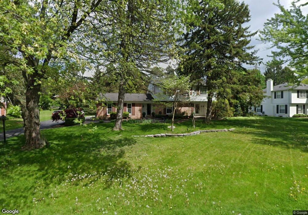
3735 Burning Tree Dr Bloomfield Hills, MI 48302
Estimated Value: $658,302 - $729,000
4
Beds
3
Baths
2,577
Sq Ft
$271/Sq Ft
Est. Value
About This Home
This home is located at 3735 Burning Tree Dr, Bloomfield Hills, MI 48302 and is currently estimated at $698,576, approximately $271 per square foot. 3735 Burning Tree Dr is a home located in Oakland County with nearby schools including Way Elementary School, South Hills Middle School, and Bloomfield Hills High School.
Ownership History
Date
Name
Owned For
Owner Type
Purchase Details
Closed on
Jun 24, 2002
Sold by
Williams Kent C
Bought by
Brophy Howard M
Current Estimated Value
Home Financials for this Owner
Home Financials are based on the most recent Mortgage that was taken out on this home.
Original Mortgage
$406,000
Outstanding Balance
$171,787
Interest Rate
6.82%
Estimated Equity
$526,789
Create a Home Valuation Report for This Property
The Home Valuation Report is an in-depth analysis detailing your home's value as well as a comparison with similar homes in the area
Home Values in the Area
Average Home Value in this Area
Purchase History
| Date | Buyer | Sale Price | Title Company |
|---|---|---|---|
| Brophy Howard M | -- | -- |
Source: Public Records
Mortgage History
| Date | Status | Borrower | Loan Amount |
|---|---|---|---|
| Open | Brophy Howard M | $406,000 |
Source: Public Records
Tax History Compared to Growth
Tax History
| Year | Tax Paid | Tax Assessment Tax Assessment Total Assessment is a certain percentage of the fair market value that is determined by local assessors to be the total taxable value of land and additions on the property. | Land | Improvement |
|---|---|---|---|---|
| 2024 | $3,301 | $243,810 | $0 | $0 |
| 2023 | $3,195 | $223,860 | $0 | $0 |
| 2022 | $9,380 | $226,060 | $0 | $0 |
| 2021 | $9,851 | $224,430 | $0 | $0 |
| 2020 | $2,922 | $222,990 | $0 | $0 |
| 2019 | $7,454 | $232,310 | $0 | $0 |
| 2018 | $5,634 | $221,500 | $0 | $0 |
| 2017 | $5,594 | $214,450 | $0 | $0 |
| 2016 | $5,605 | $198,150 | $0 | $0 |
| 2015 | -- | $182,730 | $0 | $0 |
| 2014 | -- | $162,390 | $0 | $0 |
| 2011 | -- | $131,270 | $0 | $0 |
Source: Public Records
Map
Nearby Homes
- 3797 Burning Tree Dr
- 3715 Lahser Rd
- 3531 Brookside Dr
- 830 N Pemberton Rd
- 3515 Brookside Dr
- 3403 Chickering Ln
- 801 W Long Lake Rd
- 3627 Shallow Brook Dr
- 3435 Devon Brook Dr
- 921 Pine Thistle Ln
- 4255 Telegraph Rd
- 284 Woodwind Dr
- 931 Vaughan Rd
- 3060 Chickering Ln
- 4650 Lahser Rd
- 362 Keswick Rd
- 559 Barrington Park
- 240 Applewood Ln
- 965 Bloomfield Woods Unit 4
- 969 Bloomfield Woods
- 3745 Burning Tree Dr
- 3725 Burning Tree Dr
- 3748 Thornbrier Way
- 3760 Thornbrier Way
- 3736 Thornbrier Way
- 3753 Burning Tree Dr
- 3715 Burning Tree Dr
- 3740 Burning Tree Dr
- 3730 Burning Tree Dr
- 3728 Thornbrier Way
- 0 Thornbrier Way
- 3772 Thornbrier Way
- 3750 Burning Tree Dr
- 3720 Burning Tree Dr
- 3771 Burning Tree Dr
- 3718 Thornbrier Way
- 3705 Burning Tree Dr
- 3741 Thornbrier Way
- 3747 Thornbrier Way
- 3753 Thornbrier Way