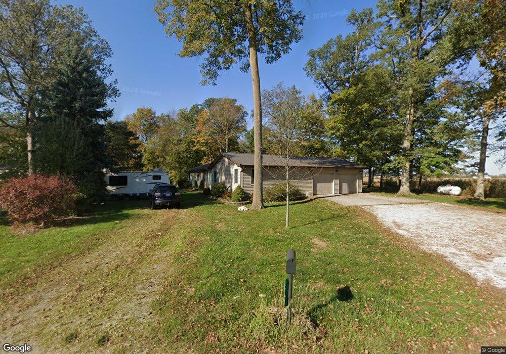
3735 Erastus Durbin Rd Fort Recovery, OH 45846
Estimated Value: $315,489 - $505,000
4
Beds
2
Baths
1,960
Sq Ft
$193/Sq Ft
Est. Value
About This Home
This home is located at 3735 Erastus Durbin Rd, Fort Recovery, OH 45846 and is currently estimated at $377,872, approximately $192 per square foot. 3735 Erastus Durbin Rd is a home located in Mercer County with nearby schools including Fort Recovery Elementary School, Fort Recovery Middle School, and Fort Recovery High School.
Ownership History
Date
Name
Owned For
Owner Type
Purchase Details
Closed on
Feb 16, 2013
Sold by
Dues Scott G
Bought by
Dues Scott G and Dues Trisha M
Current Estimated Value
Home Financials for this Owner
Home Financials are based on the most recent Mortgage that was taken out on this home.
Original Mortgage
$140,200
Interest Rate
3.38%
Mortgage Type
New Conventional
Purchase Details
Closed on
Jul 20, 2012
Sold by
Dues Frank G and Dues Rebecca S
Bought by
Dues Scott G
Create a Home Valuation Report for This Property
The Home Valuation Report is an in-depth analysis detailing your home's value as well as a comparison with similar homes in the area
Home Values in the Area
Average Home Value in this Area
Purchase History
| Date | Buyer | Sale Price | Title Company |
|---|---|---|---|
| Dues Scott G | -- | Attorney | |
| Dues Scott G | -- | Attorney |
Source: Public Records
Mortgage History
| Date | Status | Borrower | Loan Amount |
|---|---|---|---|
| Closed | Dues Scott G | $140,200 |
Source: Public Records
Tax History Compared to Growth
Tax History
| Year | Tax Paid | Tax Assessment Tax Assessment Total Assessment is a certain percentage of the fair market value that is determined by local assessors to be the total taxable value of land and additions on the property. | Land | Improvement |
|---|---|---|---|---|
| 2024 | $2,567 | $91,600 | $15,160 | $76,440 |
| 2023 | $2,567 | $91,600 | $15,160 | $76,440 |
| 2022 | $2,339 | $74,800 | $9,910 | $64,890 |
| 2021 | $2,347 | $74,800 | $9,910 | $64,890 |
| 2020 | $2,342 | $74,800 | $9,910 | $64,890 |
| 2019 | $1,873 | $57,510 | $8,330 | $49,180 |
| 2018 | $1,941 | $57,510 | $8,330 | $49,180 |
| 2017 | $1,746 | $57,510 | $8,330 | $49,180 |
| 2016 | $1,538 | $46,380 | $8,580 | $37,800 |
| 2015 | $1,476 | $46,380 | $8,580 | $37,800 |
| 2014 | $1,500 | $46,380 | $8,580 | $37,800 |
| 2013 | $1,435 | $42,180 | $7,810 | $34,370 |
Source: Public Records
Map
Nearby Homes
- 1291 State Route 219
- 820 Mary Ln
- 912 Emerald Ave
- 821 Butler St
- 401 N Cedar St
- 420 S 1st St
- 501 N 2nd St
- 314 E North St
- 426 E Walnut St
- 402 E Elizabeth St
- 0 Ohio 118
- 207 W Butler St
- 304 S Wayne St
- 721 Lilac Dr
- 201 W Wiggs St
- 4543 Lange Rd
- 2332 State Route 29
- 6699 Gause Rd
- 0 Anderson Lots 10 11 & 12 Ln Unit 1037885
- 0 Springer 1-6 & Roadway 14-16 Unit 1037883
- 2441 Philothea Rd
- 2494 Philothea Rd
- 2402 Philothea Rd
- 2438 Philothea Rd
- 2609 Siegrist Jutte Rd
- 2634 Siegrist Jutte Rd
- 2692 Philothea Rd
- 2215 Philothea Rd
- 2698 Philothea Rd
- 2198 Philothea Rd
- 2745 Siegrist Jutte Rd
- 2800 Siegrist Jutte Rd
- 2809 Siegrist Jutte Rd
- 4213 Erastus Durbin Rd
- 2866 Philothea Rd
- 3690 Burrville Rd
- 3260 Erastus Durbin Rd
- 4247 Erastus Durbin Rd
- 3759 Township Line Rd