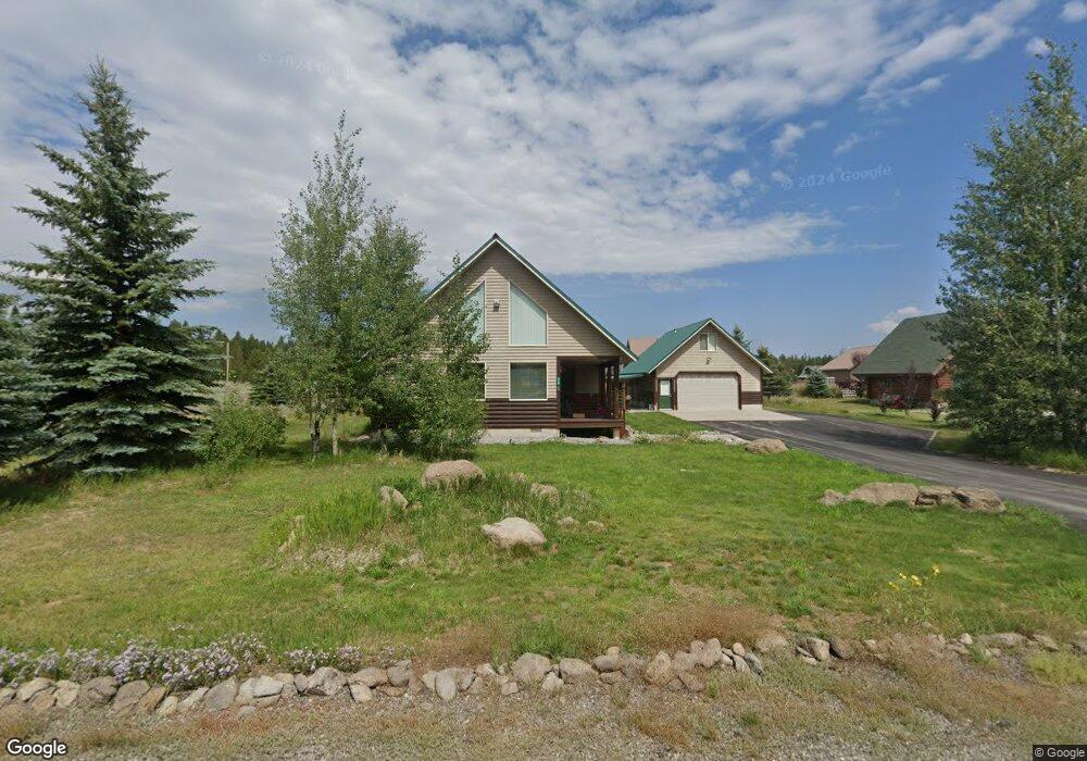
3739 Holiday Dr Island Park, ID 83429
Estimated Value: $716,000 - $874,000
3
Beds
2
Baths
1,792
Sq Ft
$438/Sq Ft
Est. Value
About This Home
This home is located at 3739 Holiday Dr, Island Park, ID 83429 and is currently estimated at $785,501, approximately $438 per square foot. 3739 Holiday Dr is a home with nearby schools including Ashton Elementary School and North Fremont Junior/Senior High School.
Ownership History
Date
Name
Owned For
Owner Type
Purchase Details
Closed on
Aug 31, 2020
Sold by
Renger Marilyn Hanson and Renger Robert Carl
Bought by
Renger Robert C and Renger Marilyn H
Current Estimated Value
Home Financials for this Owner
Home Financials are based on the most recent Mortgage that was taken out on this home.
Original Mortgage
$169,000
Interest Rate
2.9%
Mortgage Type
New Conventional
Purchase Details
Closed on
Apr 17, 2018
Sold by
Renger Robert C and Renger Marilyn
Bought by
Renger Robert C and Renger Marilyn H
Create a Home Valuation Report for This Property
The Home Valuation Report is an in-depth analysis detailing your home's value as well as a comparison with similar homes in the area
Home Values in the Area
Average Home Value in this Area
Purchase History
| Date | Buyer | Sale Price | Title Company |
|---|---|---|---|
| Renger Robert C | -- | Alliance Title | |
| Renger Marilyn Hanson | -- | Alliance Ttl Rexburg Office | |
| Renger Robert C | -- | None Available |
Source: Public Records
Mortgage History
| Date | Status | Borrower | Loan Amount |
|---|---|---|---|
| Closed | Renger Marilyn Hanson | $169,000 |
Source: Public Records
Tax History Compared to Growth
Tax History
| Year | Tax Paid | Tax Assessment Tax Assessment Total Assessment is a certain percentage of the fair market value that is determined by local assessors to be the total taxable value of land and additions on the property. | Land | Improvement |
|---|---|---|---|---|
| 2025 | $3,292 | $570,049 | $73,500 | $496,549 |
| 2024 | $3,292 | $538,688 | $73,500 | $465,188 |
| 2023 | $3,302 | $538,688 | $73,500 | $465,188 |
| 2022 | $3,576 | $433,574 | $63,000 | $370,574 |
| 2021 | $3,231 | $285,898 | $39,900 | $245,998 |
| 2020 | $3,174 | $263,829 | $33,600 | $230,229 |
| 2019 | $3,107 | $263,829 | $33,600 | $230,229 |
| 2018 | $2,810 | $218,099 | $33,600 | $184,499 |
| 2017 | $29 | $212,360 | $32,592 | $179,768 |
| 2016 | $2,810 | $212,360 | $32,592 | $179,768 |
| 2015 | $2,777 | $212,360 | $0 | $0 |
| 2014 | $2,491 | $212,431 | $0 | $0 |
| 2013 | $2,491 | $212,431 | $0 | $0 |
Source: Public Records
Map
Nearby Homes
- TBD Robbins Cir
- 3424 Cedar Dr
- 3423 Oakwood Dr
- 3775 Willow Dr
- 3769 Lava Ln
- 3773 Lava Ln
- 3336 Shooting Star Ln
- 3334 Lupine Dr
- TBD Pinon Dr
- 3771 Mule Ear Rd
- 4121 Spruce Dr
- 3735 Riverside Dr
- 3789 Homestead Dr
- 3626 Sparrow Hawk St
- 3797 Taylor Mountain Dr
- 0000 Buffalo Dr
- 3922 Snow Cap Dr
- 3930 Snow Cap Dr
- 3380 E Eagle Dr Unit LOT 33
- 1650 Shadow Loop S
- 3741 Holiday Dr
- 3736 Holiday Dr
- 3738 Holiday Dr
- 3428 W Robbins Cir
- 3745 Holiday Dr
- 3424 W Robbins Cir
- 3737 Holiday Dr
- 3749 Holiday Dr
- 3740 Holiday Dr
- 3744 Weber Dr
- 3430 W Robbins Cir
- 3745 Weber Dr
- 3427 W Robbins Cir
- 3422 W Robbins Cir
- 3432 W Robbins Cir
- 3744 Holiday Dr
- 3739 S Robbins Cir
- 3423 Robbins Cir