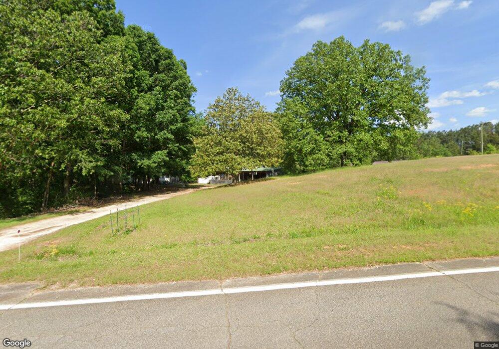
374 Burnette Rd Toccoa, GA 30577
Estimated Value: $90,935 - $241,000
2
Beds
1
Bath
948
Sq Ft
$145/Sq Ft
Est. Value
About This Home
This home is located at 374 Burnette Rd, Toccoa, GA 30577 and is currently estimated at $137,234, approximately $144 per square foot. 374 Burnette Rd is a home located in Franklin County with nearby schools including Franklin County High School.
Ownership History
Date
Name
Owned For
Owner Type
Purchase Details
Closed on
May 30, 2023
Sold by
Thurmond Anthony R
Bought by
Thurmond Lorri C and Manning John D
Current Estimated Value
Home Financials for this Owner
Home Financials are based on the most recent Mortgage that was taken out on this home.
Original Mortgage
$56,800
Outstanding Balance
$55,099
Interest Rate
6.39%
Mortgage Type
New Conventional
Estimated Equity
$82,135
Purchase Details
Closed on
Nov 19, 2018
Sold by
Thurmond Hubert
Bought by
Thurmond Anthony R
Purchase Details
Closed on
Jul 7, 1979
Bought by
Thurmond Hubert
Create a Home Valuation Report for This Property
The Home Valuation Report is an in-depth analysis detailing your home's value as well as a comparison with similar homes in the area
Purchase History
| Date | Buyer | Sale Price | Title Company |
|---|---|---|---|
| Thurmond Lorri C | $60,000 | -- | |
| Thurmond Anthony R | -- | -- | |
| Thurmond Hubert | -- | -- |
Source: Public Records
Mortgage History
| Date | Status | Borrower | Loan Amount |
|---|---|---|---|
| Open | Thurmond Lorri C | $56,800 |
Source: Public Records
Tax History Compared to Growth
Tax History
| Year | Tax Paid | Tax Assessment Tax Assessment Total Assessment is a certain percentage of the fair market value that is determined by local assessors to be the total taxable value of land and additions on the property. | Land | Improvement |
|---|---|---|---|---|
| 2025 | $745 | $32,232 | $7,618 | $24,614 |
| 2024 | $638 | $26,811 | $3,082 | $23,729 |
| 2023 | $629 | $24,374 | $2,802 | $21,572 |
| 2022 | $562 | $21,773 | $2,173 | $19,600 |
| 2021 | $523 | $18,993 | $2,173 | $16,820 |
| 2020 | $528 | $18,993 | $2,173 | $16,820 |
| 2019 | $510 | $18,993 | $2,173 | $16,820 |
| 2018 | $197 | $17,341 | $3,063 | $14,278 |
| 2017 | $205 | $17,341 | $3,063 | $14,278 |
| 2016 | $156 | $15,361 | $3,063 | $12,298 |
| 2015 | -- | $15,361 | $3,063 | $12,298 |
| 2014 | -- | $14,353 | $3,063 | $11,290 |
| 2013 | -- | $14,554 | $3,063 | $11,491 |
Source: Public Records
Map
Nearby Homes
- 1035 McFarlin Bridge Rd
- 0 Red Hill Rd Unit 10564928
- 2845 Hunters Creek Rd
- 319 Hunters Creek Rd
- 249 Hunters Creek Trail
- 3577 Hunters Creek Rd
- 6060 Highway 320
- 0 Farmers Academy Rd Unit 20094392
- 0 Broad River Rd Unit 10667078
- 125 Lewis Crump Rd
- 0 Highway 106 Tract A
- 380 Stephens Rd
- 695 Crump Mill Rd
- LOT 10 Bent Tree Rd
- 340 Mcfarlin Blvd
- 451 Toms Creek Rd
- 964 Gooseneck Rd
- 312 Gennings Dr
- 0 Williams Bridge Rd Unit 25752991
- 701 Sunshine Rd
- 2064 Red Hill Rd
- 1940 Red Hill Rd
- 417 Burnette Rd
- 2100 Red Hill Rd
- 2061 Red Hill Rd
- 2188 Red Hill Rd
- 1870 Red Hill Rd
- 1870 Red Hill Rd
- 1927 Red Hill Rd
- 1840 Red Hill Rd
- 575 Burnette Rd
- 2122 Hunters Creek Rd
- 794 Burnette Rd
- 2026 Hunters Creek Rd
- 595 Burnette Rd
- 701 Burnette Rd
- 2270 Hunters Creek Rd
- 0 Burnette Rd Unit 8111885
- 2155 Hunters Creek Rd
- 751 Burnette Rd Unit 2 ACRES
