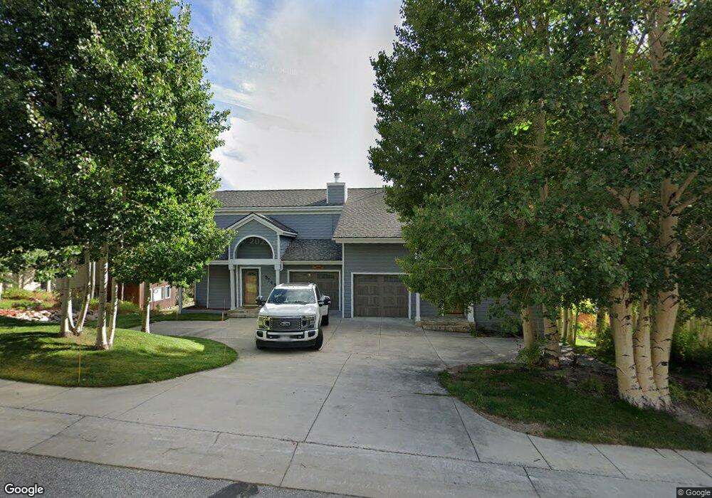
374 Ensign Dr Unit B Dillon, CO 80435
Estimated Value: $1,643,000 - $2,528,165
4
Beds
4
Baths
1,776
Sq Ft
$1,115/Sq Ft
Est. Value
About This Home
This home is located at 374 Ensign Dr Unit B, Dillon, CO 80435 and is currently estimated at $1,979,388, approximately $1,114 per square foot. 374 Ensign Dr Unit B is a home located in Summit County with nearby schools including Dillon Valley Elementary School, Summit Middle School, and Summit High School.
Ownership History
Date
Name
Owned For
Owner Type
Purchase Details
Closed on
Jan 13, 2016
Sold by
Mclain Richard and Mclain Kristi J
Bought by
Mclain Richard
Current Estimated Value
Purchase Details
Closed on
Jul 30, 2015
Sold by
Mclain Richard and Mclain Kristi J
Bought by
Mclain Richard
Purchase Details
Closed on
Oct 9, 2008
Sold by
Loeffler Gloria R and Loeffler Robert D
Bought by
Mclain Richard L and Mclain Kristi J
Home Financials for this Owner
Home Financials are based on the most recent Mortgage that was taken out on this home.
Original Mortgage
$576,000
Outstanding Balance
$381,554
Interest Rate
6.35%
Mortgage Type
Commercial
Estimated Equity
$1,597,834
Purchase Details
Closed on
May 1, 2006
Sold by
Loeffler Gloria R
Bought by
Loeffler Gloria R and Loeffler Robert D
Purchase Details
Closed on
Nov 14, 2005
Sold by
Weinstein Jay S and Weinstein Susan
Bought by
Loeffler Gloria R
Create a Home Valuation Report for This Property
The Home Valuation Report is an in-depth analysis detailing your home's value as well as a comparison with similar homes in the area
Home Values in the Area
Average Home Value in this Area
Purchase History
| Date | Buyer | Sale Price | Title Company |
|---|---|---|---|
| Mclain Richard | -- | None Available | |
| Mclain Richard | -- | None Available | |
| Mclain Richard L | $960,000 | Land Title Guarantee Company | |
| Loeffler Gloria R | -- | None Available | |
| Loeffler Gloria R | $866,000 | Stewart Title Of Summit Cnty |
Source: Public Records
Mortgage History
| Date | Status | Borrower | Loan Amount |
|---|---|---|---|
| Open | Mclain Richard L | $576,000 |
Source: Public Records
Tax History Compared to Growth
Tax History
| Year | Tax Paid | Tax Assessment Tax Assessment Total Assessment is a certain percentage of the fair market value that is determined by local assessors to be the total taxable value of land and additions on the property. | Land | Improvement |
|---|---|---|---|---|
| 2024 | $6,882 | $109,130 | -- | -- |
| 2023 | $6,882 | $105,445 | $0 | $0 |
| 2022 | $4,826 | $70,834 | $0 | $0 |
| 2021 | $5,163 | $72,873 | $0 | $0 |
| 2020 | $4,124 | $61,670 | $0 | $0 |
| 2019 | $4,022 | $61,670 | $0 | $0 |
| 2018 | $3,834 | $56,549 | $0 | $0 |
| 2017 | $3,538 | $56,549 | $0 | $0 |
| 2016 | $3,401 | $54,876 | $0 | $0 |
| 2015 | $3,312 | $54,876 | $0 | $0 |
| 2014 | $3,406 | $55,847 | $0 | $0 |
| 2013 | -- | $55,847 | $0 | $0 |
Source: Public Records
Map
Nearby Homes
- 73 Ensign Dr Unit A
- 17 James Ct
- 72 Corinthian Cir Unit 102
- 32 Corinthian Cir Unit 302
- 32 Corinthian Cir Unit 202
- 32 Corinthian Cir Unit 204
- 32 Corinthian Cir Unit 101
- 612 Tenderfoot St Unit 36
- 414 Tenderfoot St Unit 16
- 410 Tenderfoot St Unit 44
- 220 E La Bonte St Unit 306/308
- 210 La Bonte St Unit 131
- 205 La Bonte St Unit 1108
- 235 E La Bonte St Unit 207
- 330 E La Bonte St Unit 2
- 160 La Bonte St
- 160 E La Bonte St Unit 306
- 160 E La Bonte St Unit 203
- 315 High Meadow Dr
- 315 High Meadow Dr Unit 56C
- 374 Ensign Dr Unit A
- 384 Ensign Dr
- 444 Ensign Dr
- 354 Ensign Dr
- 373A Ensign Dr
- 373 Ensign Dr
- 373 Ensign Dr Unit A
- 434 Ensign Dr Unit A
- 394 Ensign Dr Unit B
- 334 Ensign Dr Unit B
- 334 Ensign Dr Unit A
- 334 Ensign Dr
- 393 Ensign Dr
- 73A Ensign Dr
- 73 Ensign Dr
- 73 Ensign Dr Unit 73A
- 113 Ensign Dr Unit B
- 113 Ensign Dr Unit A
- 353 Ensign Dr Unit A
- 353 Ensign Dr