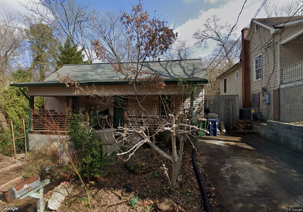
374 Flint St Athens, GA 30601
Chicopee-Dudley NeighborhoodEstimated Value: $309,094 - $404,000
--
Bed
--
Bath
1,632
Sq Ft
$217/Sq Ft
Est. Value
About This Home
This home is located at 374 Flint St, Athens, GA 30601 and is currently estimated at $353,524, approximately $216 per square foot. 374 Flint St is a home located in Clarke County with nearby schools including Howard B. Stroud Elementary School, Coile Middle School, and Cedar Shoals High School.
Ownership History
Date
Name
Owned For
Owner Type
Purchase Details
Closed on
Jul 23, 2002
Sold by
Jennings Brenda B
Bought by
Fernandez Robert A
Current Estimated Value
Purchase Details
Closed on
Oct 10, 1995
Sold by
Laflamme Daniel F and Laflamme Anne M
Bought by
Jennings Brenda B
Purchase Details
Closed on
Mar 10, 1995
Sold by
Wormley Janie Ray
Bought by
Laflamme Daniel F and Laflamme Anne M
Create a Home Valuation Report for This Property
The Home Valuation Report is an in-depth analysis detailing your home's value as well as a comparison with similar homes in the area
Home Values in the Area
Average Home Value in this Area
Purchase History
| Date | Buyer | Sale Price | Title Company |
|---|---|---|---|
| Fernandez Robert A | $87,000 | -- | |
| Jennings Brenda B | $15,000 | -- | |
| Laflamme Daniel F | $8,000 | -- |
Source: Public Records
Tax History Compared to Growth
Tax History
| Year | Tax Paid | Tax Assessment Tax Assessment Total Assessment is a certain percentage of the fair market value that is determined by local assessors to be the total taxable value of land and additions on the property. | Land | Improvement |
|---|---|---|---|---|
| 2025 | $3,720 | $119,792 | $23,400 | $96,392 |
| 2024 | $3,720 | $113,086 | $23,400 | $89,686 |
| 2023 | $3,534 | $106,420 | $21,600 | $84,820 |
| 2022 | $2,393 | $75,021 | $16,200 | $58,821 |
| 2021 | $2,060 | $61,136 | $16,200 | $44,936 |
| 2020 | $1,882 | $55,836 | $16,200 | $39,636 |
| 2019 | $1,695 | $49,932 | $12,600 | $37,332 |
| 2018 | $1,656 | $48,780 | $12,600 | $36,180 |
| 2017 | $1,586 | $46,706 | $12,600 | $34,106 |
| 2016 | $1,586 | $46,705 | $12,600 | $34,105 |
| 2015 | $1,588 | $46,705 | $12,600 | $34,105 |
| 2014 | $1,590 | $46,706 | $12,600 | $34,106 |
Source: Public Records
Map
Nearby Homes
- 239 Madison Heights
- 560 Rosa Nell Howard St
- 185 First St
- 178 First St
- 118 Ruth Dr Unit 130
- 118 Ruth Dr Unit 140
- 118 Ruth Dr Unit 310
- 118 Ruth Dr Unit 610
- 320 First St
- 318 First St
- 211 North Ave Unit 1333
- 239 Ruth St Unit 15
- 600 Pulaski St
- 455 Ruth St
- 464 Ruth St
- 131 E Broad St Unit 707
- 131 E Broad St Unit 706
- 131 E Broad St Unit 503
- 370 Flint St
- 340 Flint St
- 387 Flint St
- 265 Rosa Nell Howard St
- 328 Flint St
- 275 Odd St
- 265 Odd St
- 234 Fourth St
- 285 Odd St
- 285 Rosa Nell Howard St
- 250 Rosa Nell Howard St
- 674 Dr Martin Luther King jr Pkwy
- 674 Dr Martin Luther King Pkwy
- 236 Fourth St
- 674 Doctor Martin Luther King Junior Pkwy
- 674 Dr Martin Luther King Pkwy
- 260 Rosa Nell Howard St
- 300 Odd St
- 270 Rosa Nell Howard St
- 540 Dr Martin Luther King Pkwy