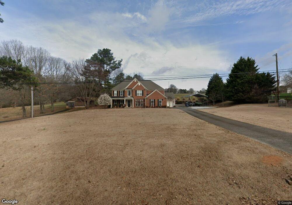
374 Henson Way Canton, GA 30115
Union Hill NeighborhoodEstimated Value: $697,000 - $787,000
5
Beds
4
Baths
3,394
Sq Ft
$214/Sq Ft
Est. Value
About This Home
This home is located at 374 Henson Way, Canton, GA 30115 and is currently estimated at $727,361, approximately $214 per square foot. 374 Henson Way is a home located in Cherokee County with nearby schools including Avery Elementary School, Creekland Middle School, and Creekview High School.
Ownership History
Date
Name
Owned For
Owner Type
Purchase Details
Closed on
Oct 20, 2005
Sold by
Fowler Homer
Bought by
Connelly Kevin and Connelly Jennifer
Current Estimated Value
Home Financials for this Owner
Home Financials are based on the most recent Mortgage that was taken out on this home.
Original Mortgage
$248,000
Interest Rate
5.9%
Create a Home Valuation Report for This Property
The Home Valuation Report is an in-depth analysis detailing your home's value as well as a comparison with similar homes in the area
Home Values in the Area
Average Home Value in this Area
Purchase History
| Date | Buyer | Sale Price | Title Company |
|---|---|---|---|
| Connelly Kevin | $42,000 | -- |
Source: Public Records
Mortgage History
| Date | Status | Borrower | Loan Amount |
|---|---|---|---|
| Closed | Connelly Kevin | $248,000 |
Source: Public Records
Tax History Compared to Growth
Tax History
| Year | Tax Paid | Tax Assessment Tax Assessment Total Assessment is a certain percentage of the fair market value that is determined by local assessors to be the total taxable value of land and additions on the property. | Land | Improvement |
|---|---|---|---|---|
| 2025 | $6,589 | $284,560 | $34,320 | $250,240 |
| 2024 | $6,193 | $265,360 | $27,720 | $237,640 |
| 2023 | $5,753 | $241,240 | $22,320 | $218,920 |
| 2022 | $4,684 | $191,040 | $21,440 | $169,600 |
| 2021 | $4,246 | $155,520 | $17,880 | $137,640 |
| 2020 | $3,864 | $138,880 | $17,880 | $121,000 |
| 2019 | $3,597 | $128,800 | $17,880 | $110,920 |
| 2018 | $3,454 | $123,080 | $17,880 | $105,200 |
| 2017 | $3,515 | $310,700 | $17,880 | $106,400 |
| 2016 | $3,222 | $282,500 | $14,880 | $98,120 |
| 2015 | $3,272 | $284,000 | $14,400 | $99,200 |
| 2014 | $3,122 | $270,700 | $11,920 | $96,360 |
Source: Public Records
Map
Nearby Homes
- 1205 Sterlington Dr
- 1209 Sterlington Dr
- 1217 Sterlington Dr
- 1216 Sterlington Dr
- 1281 Sterlington Dr
- 2001 Epperson Rd
- 826 Buffington Way
- 182 Oak Forest Dr
- 1107 Forest Creek Dr
- 105 Widgeon Ct
- 205 Northampton Ct
- 220 Forest Creek Ln
- 258 Arliss Dr
- 102 Carmichael Dr
- 7820 E Cherokee Dr
- 8143 E Cherokee Dr
- 4972 Cumming Hwy
- 6428 E Cherokee Dr
- 170 Wheeler Martin Dr
- 174 Wheeler Martin Dr
- 430 Henson Way
- 322 Henson Way
- 329 Henson Way
- 770 Henson Way
- 461 Henson Way
- 502 Henson Way
- 837 Henson Way
- 8645 Union Hill Rd
- 501 Henson Way
- 501 Henson Way
- 541 Henson Way
- 150 Adams Rd
- 00 Adams Rd
- 150 Henson Way
- 0 Adams Rd Unit 6095609
- 0 Adams Rd Unit 8479159
- 8815 Union Hill Rd
- 560 Henson Way
- 377 Adams Rd
- 8853 Union Hill Rd