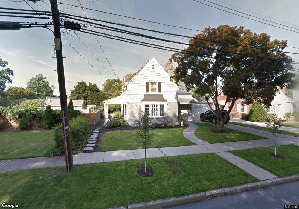
374 N 29th St Camp Hill, PA 17011
Estimated Value: $371,761 - $407,000
3
Beds
2
Baths
1,588
Sq Ft
$244/Sq Ft
Est. Value
About This Home
This home is located at 374 N 29th St, Camp Hill, PA 17011 and is currently estimated at $386,690, approximately $243 per square foot. 374 N 29th St is a home located in Cumberland County with nearby schools including Eisenhower Elementary School, Hoover Elementary School, and Camp Hill Middle School.
Ownership History
Date
Name
Owned For
Owner Type
Purchase Details
Closed on
Sep 7, 2007
Sold by
Smith Margaret M
Bought by
Garlick Daryle R
Current Estimated Value
Home Financials for this Owner
Home Financials are based on the most recent Mortgage that was taken out on this home.
Original Mortgage
$213,750
Outstanding Balance
$136,506
Interest Rate
6.74%
Mortgage Type
New Conventional
Estimated Equity
$250,184
Create a Home Valuation Report for This Property
The Home Valuation Report is an in-depth analysis detailing your home's value as well as a comparison with similar homes in the area
Home Values in the Area
Average Home Value in this Area
Purchase History
| Date | Buyer | Sale Price | Title Company |
|---|---|---|---|
| Garlick Daryle R | $225,000 | -- |
Source: Public Records
Mortgage History
| Date | Status | Borrower | Loan Amount |
|---|---|---|---|
| Open | Garlick Daryle R | $213,750 |
Source: Public Records
Tax History Compared to Growth
Tax History
| Year | Tax Paid | Tax Assessment Tax Assessment Total Assessment is a certain percentage of the fair market value that is determined by local assessors to be the total taxable value of land and additions on the property. | Land | Improvement |
|---|---|---|---|---|
| 2025 | $6,023 | $232,600 | $34,500 | $198,100 |
| 2024 | $5,347 | $216,300 | $34,500 | $181,800 |
| 2023 | $4,557 | $216,300 | $34,500 | $181,800 |
| 2022 | $5,048 | $216,300 | $34,500 | $181,800 |
| 2021 | $4,916 | $216,300 | $34,500 | $181,800 |
| 2020 | $4,807 | $216,300 | $34,500 | $181,800 |
| 2019 | $4,711 | $216,300 | $34,500 | $181,800 |
| 2018 | $4,611 | $216,300 | $34,500 | $181,800 |
| 2017 | $6,811 | $216,300 | $34,500 | $181,800 |
| 2016 | -- | $216,300 | $34,500 | $181,800 |
| 2015 | -- | $216,300 | $34,500 | $181,800 |
| 2014 | -- | $216,300 | $34,500 | $181,800 |
Source: Public Records
Map
Nearby Homes
- 451 Country Club Rd
- 441 N 25th St
- 2702 Logan St
- 527 Devon Rd
- 2424 Lincoln St
- 103 N 26th St
- 3005 Market St
- 3309 Market St
- 3011 Chestnut St
- 3311 Chestnut St
- 2067 Clarendon St
- 27 S 34th St
- 3450 Walnut St
- 1915 Logan St
- 3437 Market St
- 2166 Yale Ave
- 118 Ashford Way
- 307 S 24th St
- 411 S 32nd St
- 95 Foxcroft Dr
- 380 N 29th St
- 362 N 29th St
- 386 N Twenty Ninth St
- 380 Regent St
- 386 N 29th St
- 2921 Cumberland Blvd
- 375 N 29th St
- 371 N 29th St
- 381 N 29th St
- 363 N 29th St
- 389 N 29th St
- 2930 Beverly Rd
- 355 N 29th St
- 2901 Beverly Rd
- 368 Regent St
- 351 N 29th St
- 366 N 28th St
- 2921 Beverly Rd
- 360 N 28th St
- 351 Regent St