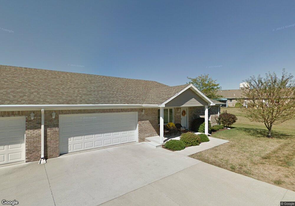
374 S Fork Dr Unit 374 Crawfordsville, IN 47933
Estimated Value: $202,449 - $243,000
2
Beds
2
Baths
1,300
Sq Ft
$165/Sq Ft
Est. Value
About This Home
This home is located at 374 S Fork Dr Unit 374, Crawfordsville, IN 47933 and is currently estimated at $215,112, approximately $165 per square foot. 374 S Fork Dr Unit 374 is a home located in Montgomery County with nearby schools including Mollie B. Hoover Elementary School, Laura Hose Elementary School, and Meredith Nicholson Elementary School.
Ownership History
Date
Name
Owned For
Owner Type
Purchase Details
Closed on
Aug 25, 2020
Sold by
Bridwell Carla L
Bought by
Bridwell Carla L and York Ryan
Current Estimated Value
Purchase Details
Closed on
Apr 3, 2019
Sold by
Radford Barbara J and Radford Phillip J
Bought by
Bridwell Carla L
Purchase Details
Closed on
Aug 4, 2011
Sold by
Liv Howell Richard L
Bought by
Radford Robert W and Radford Barbara J
Create a Home Valuation Report for This Property
The Home Valuation Report is an in-depth analysis detailing your home's value as well as a comparison with similar homes in the area
Home Values in the Area
Average Home Value in this Area
Purchase History
| Date | Buyer | Sale Price | Title Company |
|---|---|---|---|
| Bridwell Carla L | -- | None Available | |
| Bridwell Carla L | -- | Partners Title Group Inc | |
| Radford Robert W | -- | None Available |
Source: Public Records
Tax History Compared to Growth
Tax History
| Year | Tax Paid | Tax Assessment Tax Assessment Total Assessment is a certain percentage of the fair market value that is determined by local assessors to be the total taxable value of land and additions on the property. | Land | Improvement |
|---|---|---|---|---|
| 2024 | $497 | $177,900 | $19,800 | $158,100 |
| 2023 | $1,206 | $181,600 | $19,800 | $161,800 |
| 2022 | $1,206 | $165,300 | $19,800 | $145,500 |
| 2021 | $790 | $142,200 | $19,800 | $122,400 |
| 2020 | $615 | $137,200 | $19,800 | $117,400 |
| 2019 | $668 | $137,600 | $19,800 | $117,800 |
| 2018 | $1,380 | $127,800 | $16,200 | $111,600 |
| 2017 | $1,433 | $126,700 | $16,200 | $110,500 |
| 2016 | $687 | $122,200 | $16,200 | $106,000 |
| 2014 | $521 | $119,600 | $16,200 | $103,400 |
| 2013 | $521 | $116,500 | $16,200 | $100,300 |
Source: Public Records
Map
Nearby Homes
- 3 Sterling Ln
- 1 Sterling Ln
- 00 N Nucor Rd
- 00 E Co Rd 350 Rd S
- 00 E State Road 32
- 1603 John St
- 917 S State Road 47
- 408 Hughes St
- 411 Vandalia Ct
- 1503 Payton St
- 1404 Payton St
- 1121 Mill St
- 1107 Danville Ave
- 0 S Us 231 Unit MBR22024646
- Ironwood Plan at Hawkview
- Chestnut Plan at Hawkview
- Ashton Plan at Hawkview
- Cooper Plan at Hawkview
- Juniper Plan at Hawkview
- Norway Plan at Hawkview
- 376 S Fork Dr
- 378 S Fork Dr
- 375 S Fork Dr
- 370 S Fork Dr
- 375 Southfork Dr
- 372 Southfork Dr
- 372 S Fork Dr Unit 372
- 373 S Fork Dr
- 376 Southfork Dr
- 373 Southfork Dr
- 377 S Fork Dr
- 377 Southfork Dr
- 371 Southfork Dr
- 371 S Fork Dr
- 378 Southfork Dr
- 374 Southfork Dr
- 368 Southfork Dr
- 368 S Fork Dr
- 379 Southfork Dr
- 380 S Fork Dr