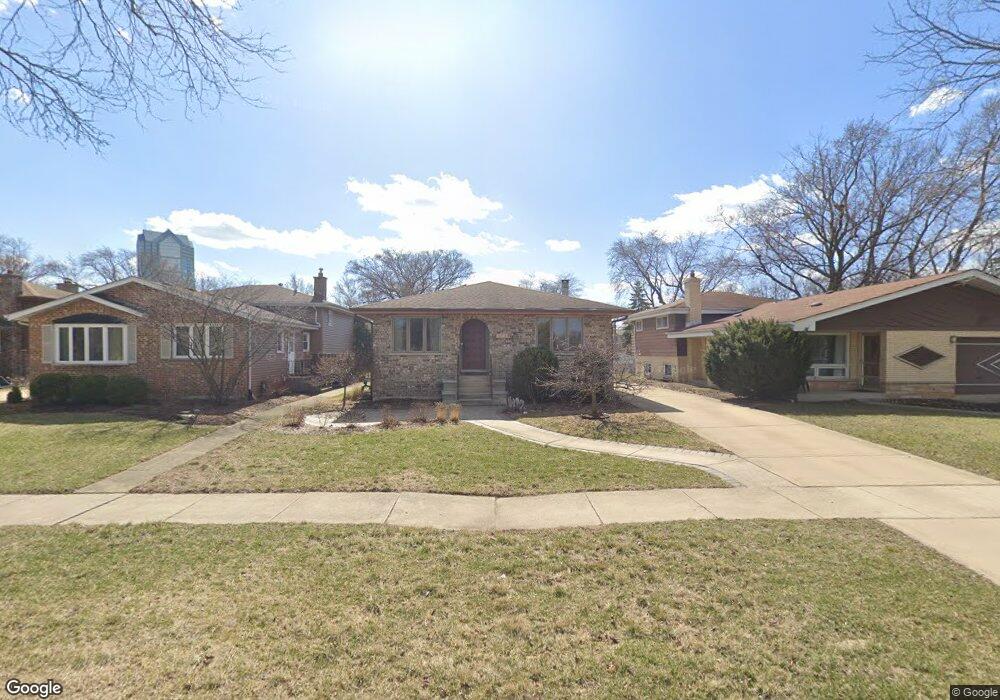
374 W Commonwealth Ln Elmhurst, IL 60126
Estimated Value: $427,215 - $661,000
3
Beds
--
Bath
1,560
Sq Ft
$367/Sq Ft
Est. Value
About This Home
This home is located at 374 W Commonwealth Ln, Elmhurst, IL 60126 and is currently estimated at $572,054, approximately $366 per square foot. 374 W Commonwealth Ln is a home located in DuPage County with nearby schools including Salt Creek Elementary School, Stella May Swartz Elementary School, and John E Albright Middle School.
Ownership History
Date
Name
Owned For
Owner Type
Purchase Details
Closed on
Jun 9, 2006
Sold by
Le Var Michael J and Le Var Melinda A
Bought by
Horne Justin M and Horne Rebecca A
Current Estimated Value
Home Financials for this Owner
Home Financials are based on the most recent Mortgage that was taken out on this home.
Original Mortgage
$320,000
Outstanding Balance
$189,708
Interest Rate
6.72%
Mortgage Type
Purchase Money Mortgage
Estimated Equity
$382,346
Purchase Details
Closed on
Jan 6, 1998
Sold by
Levar Michael J and Schmidt Melinda A
Bought by
Levar Michael J and Schmidt Melinda A
Purchase Details
Closed on
Sep 26, 1997
Sold by
Delulio Alexander J and Delulio Renate E
Bought by
Schmidt Melinda A and Levar Michael J
Home Financials for this Owner
Home Financials are based on the most recent Mortgage that was taken out on this home.
Original Mortgage
$166,400
Interest Rate
6.87%
Create a Home Valuation Report for This Property
The Home Valuation Report is an in-depth analysis detailing your home's value as well as a comparison with similar homes in the area
Home Values in the Area
Average Home Value in this Area
Purchase History
| Date | Buyer | Sale Price | Title Company |
|---|---|---|---|
| Horne Justin M | $400,000 | Attorneys Title Guaranty Fun | |
| Levar Michael J | -- | -- | |
| Schmidt Melinda A | $208,000 | -- |
Source: Public Records
Mortgage History
| Date | Status | Borrower | Loan Amount |
|---|---|---|---|
| Open | Horne Justin M | $320,000 | |
| Previous Owner | Schmidt Melinda A | $166,400 |
Source: Public Records
Tax History
| Year | Tax Paid | Tax Assessment Tax Assessment Total Assessment is a certain percentage of the fair market value that is determined by local assessors to be the total taxable value of land and additions on the property. | Land | Improvement |
|---|---|---|---|---|
| 2024 | $7,116 | $139,479 | $34,432 | $105,047 |
| 2023 | $6,104 | $128,980 | $31,840 | $97,140 |
| 2022 | $5,856 | $124,000 | $30,610 | $93,390 |
| 2021 | $5,959 | $120,920 | $29,850 | $91,070 |
| 2020 | $5,895 | $118,270 | $29,200 | $89,070 |
| 2019 | $5,664 | $112,440 | $27,760 | $84,680 |
| 2018 | $5,561 | $107,740 | $26,270 | $81,470 |
| 2017 | $5,474 | $102,660 | $25,030 | $77,630 |
| 2016 | $5,154 | $96,710 | $23,580 | $73,130 |
| 2015 | $5,078 | $90,100 | $21,970 | $68,130 |
| 2014 | $5,585 | $94,200 | $20,060 | $74,140 |
| 2013 | $5,528 | $95,520 | $20,340 | $75,180 |
Source: Public Records
Map
Nearby Homes
- 465 W Verret St
- 3 Dewalt Ct
- 1S045 Spring Rd Unit H2
- 1S045 Spring Rd Unit 1D
- 2 S Atrium Way Unit 606
- 1S055 Spring Rd Unit 1C
- 20 Oak Tree Ct
- 4 Oak Brook Club Dr Unit G205
- 1200 S Prospect Ave Unit 108
- 130 Crab Apple Ln
- 936 S Mitchell Ave
- 1 Oak Brook Club Dr Unit A310
- 1 Oak Brook Club Dr Unit B301
- 1 Oak Brook Club Dr Unit A105
- 868 S Spring Rd
- 625 E Van Buren St
- 849 S Swain Ave
- 110 W Butterfield Rd Unit 502S
- 878 S Parkside Ave
- 881 S Bryan St
- 370 W Commonwealth Ln
- 378 W Commonwealth Ln
- 382 W Commonwealth Ln
- 366 W Commonwealth Ln
- 386 W Commonwealth Ln
- 401 W Avery St
- 393 W Avery St
- 405 W Avery St
- 397 W Avery St
- 389 W Avery St
- 403 W Butterfield Rd
- 409 W Avery St
- 415 W Butterfield Rd
- 407 W Butterfield Rd
- 411 W Butterfield Rd
- 396 W Commonwealth Ln
- 419 W Butterfield Rd
- 417 W Avery St
- 423 W Butterfield Rd
- 391 W Commonwealth Ln
Your Personal Tour Guide
Ask me questions while you tour the home.