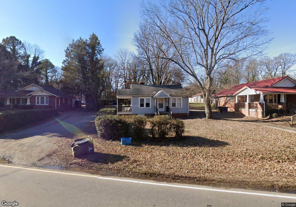
3740 S Main St Winston Salem, NC 27127
Union Ridge NeighborhoodEstimated Value: $127,000 - $146,000
2
Beds
1
Bath
764
Sq Ft
$179/Sq Ft
Est. Value
About This Home
This home is located at 3740 S Main St, Winston Salem, NC 27127 and is currently estimated at $136,979, approximately $179 per square foot. 3740 S Main St is a home located in Forsyth County with nearby schools including Konnoak Elementary School, Philo-Hill Magnet Academy, and Parkland High.
Ownership History
Date
Name
Owned For
Owner Type
Purchase Details
Closed on
Feb 10, 2025
Sold by
Bad Company Properties Llc
Bought by
Srp Winston I Llc
Current Estimated Value
Home Financials for this Owner
Home Financials are based on the most recent Mortgage that was taken out on this home.
Original Mortgage
$12,000,000
Outstanding Balance
$11,928,692
Interest Rate
6.91%
Mortgage Type
New Conventional
Estimated Equity
-$11,791,713
Purchase Details
Closed on
Jun 13, 1991
Bought by
C W Myers Trading Post Inc
Create a Home Valuation Report for This Property
The Home Valuation Report is an in-depth analysis detailing your home's value as well as a comparison with similar homes in the area
Home Values in the Area
Average Home Value in this Area
Purchase History
| Date | Buyer | Sale Price | Title Company |
|---|---|---|---|
| Srp Winston I Llc | $6,930,000 | None Listed On Document | |
| Srp Winston I Llc | $6,930,000 | None Listed On Document | |
| C W Myers Trading Post Inc | -- | -- |
Source: Public Records
Mortgage History
| Date | Status | Borrower | Loan Amount |
|---|---|---|---|
| Open | Srp Winston I Llc | $12,000,000 | |
| Closed | Srp Winston I Llc | $12,000,000 |
Source: Public Records
Tax History Compared to Growth
Tax History
| Year | Tax Paid | Tax Assessment Tax Assessment Total Assessment is a certain percentage of the fair market value that is determined by local assessors to be the total taxable value of land and additions on the property. | Land | Improvement |
|---|---|---|---|---|
| 2024 | $619 | $46,200 | $15,800 | $30,400 |
| 2023 | $619 | $46,200 | $15,800 | $30,400 |
| 2022 | $607 | $46,200 | $15,800 | $30,400 |
| 2021 | $596 | $46,200 | $15,800 | $30,400 |
| 2020 | $428 | $31,000 | $12,300 | $18,700 |
| 2019 | $431 | $31,000 | $12,300 | $18,700 |
| 2018 | $409 | $31,000 | $12,300 | $18,700 |
| 2016 | $409 | $31,111 | $12,600 | $18,511 |
| 2015 | $403 | $31,111 | $12,600 | $18,511 |
| 2014 | $391 | $31,111 | $12,600 | $18,511 |
Source: Public Records
Map
Nearby Homes
- 320 Skyview Dr
- 3627 S Main St
- 330 Skyview Dr
- 3932 Lexwin Ave
- 133 Southview Dr
- 653 Clemson Cir
- 626 Clemson Cir
- 3755 Wyandotte Ave
- 817 Orchestra Dr
- 3214 Anderson Dr
- 3362 Rosemont Ave
- 148 Garland St
- 214 Cassell St
- 3121 Luther St
- 4080 Clinard Ave
- 4097 Clinard Ave
- 2467 Fiddlers Glenn Dr
- 828 Brickwood Ct
- 816 Brickwood Ct
- Cary Plan at Petticoat Junction
- 3746 S Main St
- 3734 S Main St
- 3730 S Main St
- 3747 S Main St
- 3680 Cornell Blvd
- 3741 S Main St
- 3710 S Main St
- 3729 S Main St
- 3679 Cornell Blvd
- 3702 S Main St
- 3725 S Main St
- 3801 S Main St
- 3803 S Main St
- 2019 Arnold Ave
- 2019 Arnold Ave Unit 17B
- 3721 S Main St
- 3700 S Main St
- 3721 Konnoak Dr
- 3733 Konnoak Dr
- 3672 Cornell Blvd