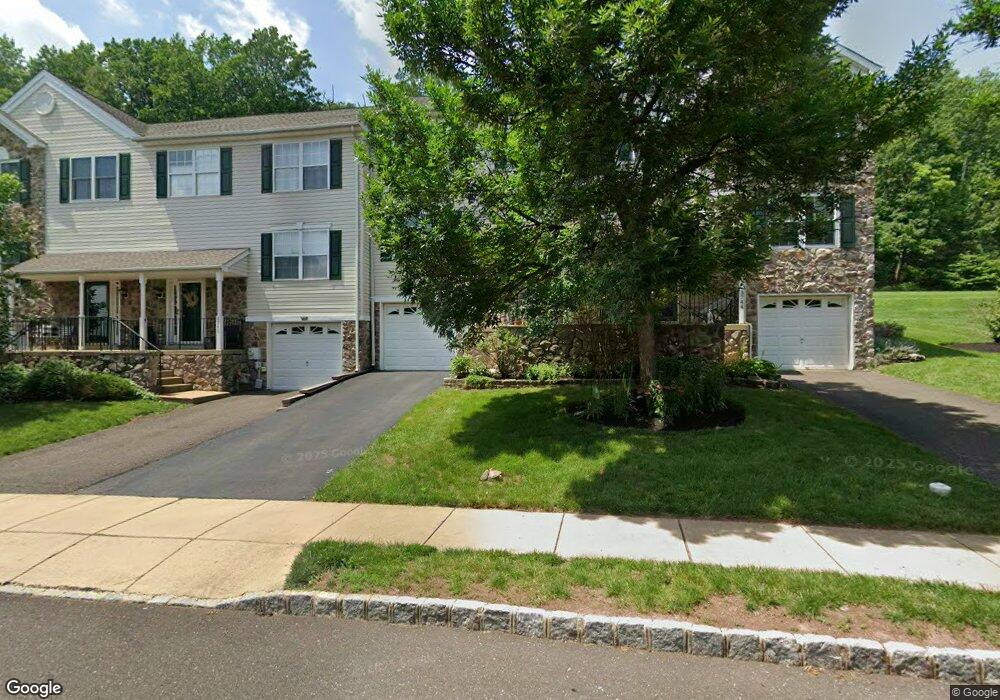
3742 Swetland Dr Doylestown, PA 18902
Plumstead NeighborhoodEstimated Value: $433,000 - $448,000
3
Beds
3
Baths
1,728
Sq Ft
$255/Sq Ft
Est. Value
About This Home
This home is located at 3742 Swetland Dr, Doylestown, PA 18902 and is currently estimated at $440,703, approximately $255 per square foot. 3742 Swetland Dr is a home located in Bucks County with nearby schools including Groveland Elementary School, Tohickon Middle School, and Central Bucks High School-West.
Ownership History
Date
Name
Owned For
Owner Type
Purchase Details
Closed on
Nov 28, 2005
Sold by
Piancastelli John
Bought by
Murphy Robin G
Current Estimated Value
Purchase Details
Closed on
Jul 31, 1998
Sold by
Patriots Ridge Corp
Bought by
Piancastelli John R
Home Financials for this Owner
Home Financials are based on the most recent Mortgage that was taken out on this home.
Original Mortgage
$138,800
Interest Rate
6.92%
Create a Home Valuation Report for This Property
The Home Valuation Report is an in-depth analysis detailing your home's value as well as a comparison with similar homes in the area
Home Values in the Area
Average Home Value in this Area
Purchase History
| Date | Buyer | Sale Price | Title Company |
|---|---|---|---|
| Murphy Robin G | $283,000 | T A Title Ins Co-Ed Sliker | |
| Piancastelli John R | $143,125 | -- |
Source: Public Records
Mortgage History
| Date | Status | Borrower | Loan Amount |
|---|---|---|---|
| Previous Owner | Piancastelli John R | $138,800 |
Source: Public Records
Tax History Compared to Growth
Tax History
| Year | Tax Paid | Tax Assessment Tax Assessment Total Assessment is a certain percentage of the fair market value that is determined by local assessors to be the total taxable value of land and additions on the property. | Land | Improvement |
|---|---|---|---|---|
| 2025 | $4,782 | $27,520 | $2,280 | $25,240 |
| 2024 | $4,782 | $27,520 | $2,280 | $25,240 |
| 2023 | $4,630 | $27,520 | $2,280 | $25,240 |
| 2022 | $4,578 | $27,520 | $2,280 | $25,240 |
| 2021 | $4,527 | $27,520 | $2,280 | $25,240 |
| 2020 | $4,527 | $27,520 | $2,280 | $25,240 |
| 2019 | $4,499 | $27,520 | $2,280 | $25,240 |
| 2018 | $4,499 | $27,520 | $2,280 | $25,240 |
| 2017 | $4,437 | $27,520 | $2,280 | $25,240 |
| 2016 | $4,437 | $27,520 | $2,280 | $25,240 |
| 2015 | -- | $27,520 | $2,280 | $25,240 |
| 2014 | -- | $27,520 | $2,280 | $25,240 |
Source: Public Records
Map
Nearby Homes
- 3765 William Daves Rd
- 3723 William Daves Rd
- 4748 Bishop Cir
- 3838 Jacob Stout Rd
- 3711 Jacob Stout Rd Unit 5
- 114 Blackfriars Cir
- 100 Bishops Gate Ln Unit 67
- 301 Windy Run Rd
- 194 Victoria Ct Unit 143
- 3923 Ferry Rd
- 4263 Kleinot Dr
- 4317 Kleinot Dr
- 4464 Kleinot Dr
- 4330 Kleinot Dr
- 4246 Kleinot Dr
- 4306 Kleinot Dr
- 4298 Kleinot Dr
- 90 Chapman Ave
- 418 North St
- 3867 Charter Club Dr
- 3740 Swetland Dr
- 3744 Swetland Dr
- 3738 Swetland Dr
- 3746 Swetland Dr
- 3748 Swetland Dr
- 3736 Swetland Dr
- LOT 6 Waid Way
- 3741 Swetland Dr
- 3723 Swetland Dr
- 3743 Swetland Dr
- 3750 Swetland Dr
- 3734 Swetland Dr
- 3747 Swetland Dr
- 3752 Swetland Dr
- 3732 Swetland Dr
- 3749 Swetland Dr
- 3721 Swetland Dr
- 3754 Swetland Dr
- 3730 Swetland Dr