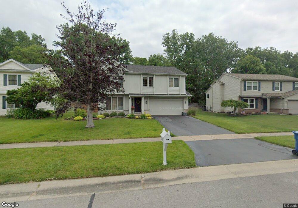
3742 Wild Pheasant Ln Sylvania, OH 43560
Estimated Value: $311,000 - $316,725
4
Beds
3
Baths
1,890
Sq Ft
$167/Sq Ft
Est. Value
About This Home
This home is located at 3742 Wild Pheasant Ln, Sylvania, OH 43560 and is currently estimated at $314,931, approximately $166 per square foot. 3742 Wild Pheasant Ln is a home located in Lucas County with nearby schools including Stranahan Elementary School, Sylvania Timberstone Junior High School, and Sylvania Southview High School.
Ownership History
Date
Name
Owned For
Owner Type
Purchase Details
Closed on
Dec 22, 1999
Sold by
Swade Amal
Bought by
Cline Douglas A and Cline Kristin M
Current Estimated Value
Home Financials for this Owner
Home Financials are based on the most recent Mortgage that was taken out on this home.
Original Mortgage
$156,750
Outstanding Balance
$46,043
Interest Rate
7.7%
Estimated Equity
$268,888
Purchase Details
Closed on
May 26, 1999
Sold by
Gayer Jeffrey C and Gayer Denise L
Bought by
Swade Amal
Purchase Details
Closed on
Dec 13, 1993
Sold by
Wehrle Inc An#
Purchase Details
Closed on
Apr 2, 1993
Create a Home Valuation Report for This Property
The Home Valuation Report is an in-depth analysis detailing your home's value as well as a comparison with similar homes in the area
Home Values in the Area
Average Home Value in this Area
Purchase History
| Date | Buyer | Sale Price | Title Company |
|---|---|---|---|
| Cline Douglas A | $165,000 | Louisville Title Agency For | |
| Swade Amal | -- | Louisville Title Agency For | |
| -- | $154,500 | -- | |
| -- | $34,900 | -- |
Source: Public Records
Mortgage History
| Date | Status | Borrower | Loan Amount |
|---|---|---|---|
| Open | Cline Douglas A | $156,750 |
Source: Public Records
Tax History
| Year | Tax Paid | Tax Assessment Tax Assessment Total Assessment is a certain percentage of the fair market value that is determined by local assessors to be the total taxable value of land and additions on the property. | Land | Improvement |
|---|---|---|---|---|
| 2025 | -- | $88,095 | $21,805 | $66,290 |
| 2024 | $2,840 | $88,095 | $21,805 | $66,290 |
| 2023 | $5,959 | $79,380 | $18,270 | $61,110 |
| 2022 | $5,960 | $79,380 | $18,270 | $61,110 |
| 2021 | $6,105 | $79,380 | $18,270 | $61,110 |
| 2020 | $6,050 | $69,650 | $16,065 | $53,585 |
| 2019 | $5,827 | $69,650 | $16,065 | $53,585 |
| 2018 | $5,245 | $69,650 | $16,065 | $53,585 |
| 2017 | $5,051 | $54,915 | $11,060 | $43,855 |
| 2016 | $4,954 | $156,900 | $31,600 | $125,300 |
| 2015 | $4,672 | $156,900 | $31,600 | $125,300 |
| 2014 | $4,442 | $52,820 | $10,640 | $42,180 |
| 2013 | $4,442 | $52,820 | $10,640 | $42,180 |
Source: Public Records
Map
Nearby Homes
- 3761 Wild Pheasant Ln
- 3769 Sylvanwood Dr
- 3733 Fairwood Dr
- 3845 Fairwood Dr
- 3658 Fairwood Dr
- 6713 Worth Ave Unit A
- 21 Shenandoah Cir
- 6562 Woodhall Dr
- 6563 Kingsbridge Dr Unit 18
- 4344 Todd Dr
- 6913 Fredericksburg Dr S
- 6853 Fredericksburg Dr
- 6442 Coppersmith Rd
- 4624 Vicksburg Dr
- 6059 Blossman Rd
- 4605 Charlesgate Rd
- 6753 Carrie Pine Ln
- 4025 Sherwood Forest Manor Rd Unit 4
- 7032 Cinnamon Teal Ct
- 4541 Sheringham Ln
- 3750 Wild Pheasant Ln
- 3736 Wild Pheasant Ln
- 3756 Wild Pheasant Ln
- 3728 Wild Pheasant Ln
- 3764 Wild Pheasant Ln
- 3745 Wild Pheasant Ln
- 3753 Wild Pheasant Ln
- 6764 Monarch Dr
- 3731 Wild Pheasant Ln
- 6756 Monarch Dr
- 3774 Wild Pheasant Ln
- 3725 Wild Pheasant Ln
- 6759 Sparrow Hill Rd
- 6748 Monarch Dr
- 3767 Wild Pheasant Ln
- 3717 Wild Pheasant Ln
- 3754 Barleyton Cir
- 6753 Sparrow Hill Rd
- 3806 Wild Pheasant Ln
- 3758 Barleyton Cir
Your Personal Tour Guide
Ask me questions while you tour the home.