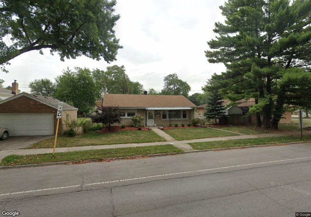
3743 Kemman Ave Brookfield, IL 60513
Estimated Value: $290,000 - $356,000
2
Beds
1
Bath
1,011
Sq Ft
$310/Sq Ft
Est. Value
About This Home
This home is located at 3743 Kemman Ave, Brookfield, IL 60513 and is currently estimated at $313,561, approximately $310 per square foot. 3743 Kemman Ave is a home located in Cook County with nearby schools including S. E. Gross Middle School, Brook Park Elementary School, and Riverside Brookfield High School.
Ownership History
Date
Name
Owned For
Owner Type
Purchase Details
Closed on
Apr 27, 2015
Sold by
Ledford Alan C and Ledford Jean M
Bought by
Andrys Starlin
Current Estimated Value
Home Financials for this Owner
Home Financials are based on the most recent Mortgage that was taken out on this home.
Original Mortgage
$112,000
Outstanding Balance
$88,028
Interest Rate
4.25%
Mortgage Type
New Conventional
Estimated Equity
$225,533
Purchase Details
Closed on
Mar 14, 2013
Sold by
Ledford Alan C and Ledord Jean M
Bought by
Ledford Alan C and Ledford Jean M
Create a Home Valuation Report for This Property
The Home Valuation Report is an in-depth analysis detailing your home's value as well as a comparison with similar homes in the area
Home Values in the Area
Average Home Value in this Area
Purchase History
| Date | Buyer | Sale Price | Title Company |
|---|---|---|---|
| Andrys Starlin | $140,000 | First American | |
| Ledford Alan C | -- | None Available |
Source: Public Records
Mortgage History
| Date | Status | Borrower | Loan Amount |
|---|---|---|---|
| Open | Andrys Starlin | $112,000 |
Source: Public Records
Tax History Compared to Growth
Tax History
| Year | Tax Paid | Tax Assessment Tax Assessment Total Assessment is a certain percentage of the fair market value that is determined by local assessors to be the total taxable value of land and additions on the property. | Land | Improvement |
|---|---|---|---|---|
| 2024 | $6,315 | $21,000 | $5,586 | $15,414 |
| 2023 | $7,002 | $21,000 | $5,586 | $15,414 |
| 2022 | $7,002 | $20,224 | $4,841 | $15,383 |
| 2021 | $6,829 | $20,224 | $4,841 | $15,383 |
| 2020 | $6,742 | $20,224 | $4,841 | $15,383 |
| 2019 | $6,519 | $19,960 | $4,282 | $15,678 |
| 2018 | $6,257 | $19,960 | $4,282 | $15,678 |
| 2017 | $5,789 | $19,960 | $4,282 | $15,678 |
| 2016 | $5,237 | $16,565 | $3,910 | $12,655 |
| 2015 | $4,988 | $16,565 | $3,910 | $12,655 |
| 2014 | $4,935 | $16,565 | $3,910 | $12,655 |
| 2013 | $5,030 | $17,903 | $3,910 | $13,993 |
Source: Public Records
Map
Nearby Homes
- 326 Kemman Ave
- 314 Beach Ave
- 3800 Harrison Ave
- 525 Homestead Rd
- 30 Washington Ave
- 4111 Eberly Ave
- 3923 Madison Ave
- 141 N La Grange Rd Unit 504
- 141 N La Grange Rd Unit 905
- 4125 Deyo Ave
- 4167 Eberly Ave
- 31 Bluff Ave
- 31 Richmond Ave
- 148 Sawyer Ave
- 415 N Ashland Ave
- 3931 Maple Ave
- 3336 Grand Blvd
- 28 6th Ave Unit 1D
- 9532 Jackson Ave
- 511 E Cossitt Ave
- 3749 Kemman Ave
- 3735 Kemman Ave
- 3731 Kemman Ave
- 3740 Blanchan Ave
- 3744 Blanchan Ave
- 3738 Blanchan Ave
- 3748 Blanchan Ave
- 3734 Blanchan Ave
- 3729 Kemman Ave
- 3801 Kemman Ave
- 406 Kemman Ave
- 410 Kemman Ave
- 402 Kemman Ave
- 3725 Kemman Ave
- 3728 Blanchan Ave
- 416 Kemman Ave
- 3800 Blanchan Ave
- 3805 Kemman Ave
- 3721 Kemman Ave
- 3724 Blanchan Ave