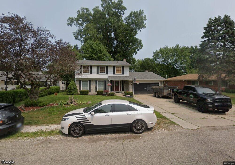
37442 Radde St Clinton Township, MI 48036
Estimated Value: $261,000 - $302,000
4
Beds
3
Baths
1,979
Sq Ft
$139/Sq Ft
Est. Value
About This Home
This home is located at 37442 Radde St, Clinton Township, MI 48036 and is currently estimated at $275,856, approximately $139 per square foot. 37442 Radde St is a home located in Macomb County with nearby schools including Tenniswood Elementary School, L'Anse Creuse Middle School - South, and L'Anse Creuse High School.
Ownership History
Date
Name
Owned For
Owner Type
Purchase Details
Closed on
Apr 24, 2019
Sold by
Estate Of Suzanne J Maler
Bought by
Puma Erik J
Current Estimated Value
Home Financials for this Owner
Home Financials are based on the most recent Mortgage that was taken out on this home.
Original Mortgage
$152,290
Outstanding Balance
$133,618
Interest Rate
4.2%
Mortgage Type
New Conventional
Estimated Equity
$142,238
Purchase Details
Closed on
Aug 23, 2016
Sold by
Hite Julie and Hewitt Shauna
Bought by
Maier Suzanne J and Hite Julie
Create a Home Valuation Report for This Property
The Home Valuation Report is an in-depth analysis detailing your home's value as well as a comparison with similar homes in the area
Home Values in the Area
Average Home Value in this Area
Purchase History
| Date | Buyer | Sale Price | Title Company |
|---|---|---|---|
| Puma Erik J | $157,000 | Devon Title Agency | |
| Maier Suzanne J | -- | None Available |
Source: Public Records
Mortgage History
| Date | Status | Borrower | Loan Amount |
|---|---|---|---|
| Open | Puma Erik J | $152,290 |
Source: Public Records
Tax History Compared to Growth
Tax History
| Year | Tax Paid | Tax Assessment Tax Assessment Total Assessment is a certain percentage of the fair market value that is determined by local assessors to be the total taxable value of land and additions on the property. | Land | Improvement |
|---|---|---|---|---|
| 2025 | $4,819 | $117,500 | $0 | $0 |
| 2024 | $2,823 | $113,000 | $0 | $0 |
| 2023 | $2,672 | $106,100 | $0 | $0 |
| 2022 | $4,321 | $96,000 | $0 | $0 |
| 2021 | $3,671 | $87,800 | $0 | $0 |
| 2020 | $3,742 | $87,200 | $0 | $0 |
| 2019 | $3,572 | $80,500 | $0 | $0 |
| 2018 | $2,842 | $72,900 | $0 | $0 |
| 2017 | $2,439 | $69,500 | $13,400 | $56,100 |
| 2016 | $2,424 | $69,500 | $0 | $0 |
| 2015 | -- | $64,900 | $0 | $0 |
| 2014 | -- | $61,500 | $0 | $0 |
| 2011 | -- | $60,500 | $12,200 | $48,300 |
Source: Public Records
Map
Nearby Homes
- 23429 Myrtle St
- 37321 Stonegate Cir
- 23551 Myrtle St
- 23611 Aviva St
- 22771 Ulrich St
- 37466 Stonegate Cir Unit 116
- 23207 Dale Allen St
- 0 Harper Ave Unit 25036997
- 0 Harper Ave Unit 20240019629
- 22948 E Schafer St
- 23786 Thornton St
- 23571 Demley Dr
- 23661 Demley Dr
- 23346 Demley Dr
- 23732 Demley Dr
- 22459 Katzman St
- 22317 E Schafer St
- 23528 King Dr
- 38481 Riverside Dr
- 23614 King Dr
- 37420 Radde St
- 37453 Ladue St
- 37402 Radde St Unit Bldg-Unit
- 37402 Radde St
- 37482 Radde St
- 37522 Radde St
- 37471 Ladue St
- 37443 Radde St
- 37489 Ladue St
- 37437 Radde St
- 37499 Radde St
- 23415 Denton St
- 23433 Denton St
- 37515 Ladue St
- 37435 Ladue St
- 37531 Ladue St
- 23451 Denton St
- 37357 Radde St
- 37505 Radde St
- 37602 Radde St