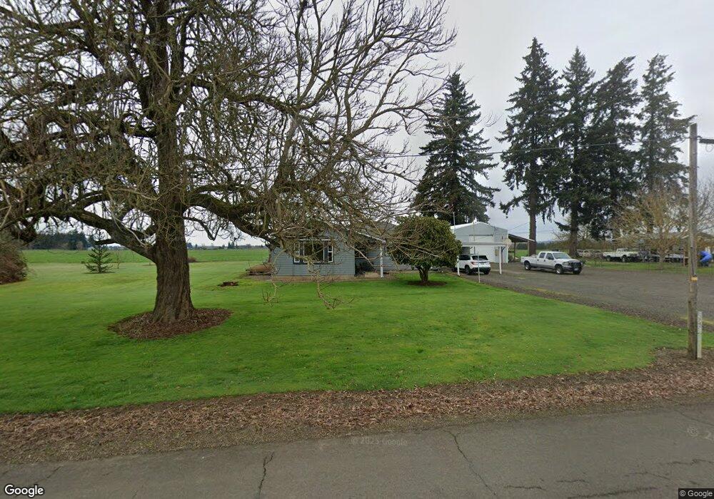
37479 Kgal Dr Lebanon, OR 97355
Estimated Value: $510,195 - $542,000
3
Beds
2
Baths
1,608
Sq Ft
$327/Sq Ft
Est. Value
About This Home
This home is located at 37479 Kgal Dr, Lebanon, OR 97355 and is currently estimated at $526,098, approximately $327 per square foot. 37479 Kgal Dr is a home located in Linn County with nearby schools including Pioneer School, Lebanon High School, and CSC Lebanon Learning Opportunities Center.
Ownership History
Date
Name
Owned For
Owner Type
Purchase Details
Closed on
Sep 25, 2008
Sold by
Puttbrese Carol A
Bought by
Puttbrese Wayne L
Current Estimated Value
Purchase Details
Closed on
Jan 11, 2008
Sold by
Libra Sylvia J
Bought by
Libra Sylvia J and Puttbrese Wayne
Home Financials for this Owner
Home Financials are based on the most recent Mortgage that was taken out on this home.
Original Mortgage
$137,000
Interest Rate
5.96%
Mortgage Type
Stand Alone Refi Refinance Of Original Loan
Create a Home Valuation Report for This Property
The Home Valuation Report is an in-depth analysis detailing your home's value as well as a comparison with similar homes in the area
Home Values in the Area
Average Home Value in this Area
Purchase History
| Date | Buyer | Sale Price | Title Company |
|---|---|---|---|
| Puttbrese Wayne L | -- | None Available | |
| Libra Sylvia J | -- | Ticor Title |
Source: Public Records
Mortgage History
| Date | Status | Borrower | Loan Amount |
|---|---|---|---|
| Previous Owner | Libra Sylvia J | $137,000 |
Source: Public Records
Tax History Compared to Growth
Tax History
| Year | Tax Paid | Tax Assessment Tax Assessment Total Assessment is a certain percentage of the fair market value that is determined by local assessors to be the total taxable value of land and additions on the property. | Land | Improvement |
|---|---|---|---|---|
| 2025 | $3,924 | $264,870 | -- | -- |
| 2024 | $3,822 | $257,160 | -- | -- |
| 2023 | $3,710 | $249,670 | $0 | $0 |
| 2022 | $3,632 | $242,400 | $0 | $0 |
| 2021 | $3,477 | $235,340 | $0 | $0 |
| 2020 | $3,406 | $228,490 | $0 | $0 |
| 2019 | $3,319 | $221,840 | $0 | $0 |
| 2018 | $3,235 | $215,380 | $0 | $0 |
| 2017 | $3,153 | $209,110 | $0 | $0 |
| 2016 | $3,001 | $203,020 | $0 | $0 |
| 2015 | $2,794 | $194,860 | $0 | $0 |
| 2014 | $2,884 | $197,110 | $0 | $0 |
Source: Public Records
Map
Nearby Homes
- 34117 Santiam Hwy
- 33788 Brewster Rd
- 37295 Cemetery (Next To) Rd
- 33510 Millview Way
- 91 W Mary St
- 515 W Mary St
- 180 Eaton St
- 59 Eaton St
- 330 Wheeler St
- 330 Wheeler Behind - Parcel 3 St
- 35 S Main St
- 183 E Dodge St
- 537 W Morton St
- 121 S Williams (125) St
- 160 Tangent St
- 151 Cleveland St
- 178 S Main St
- 232 E Carolina St
- 650 Tangent St
- 363 S 2nd St