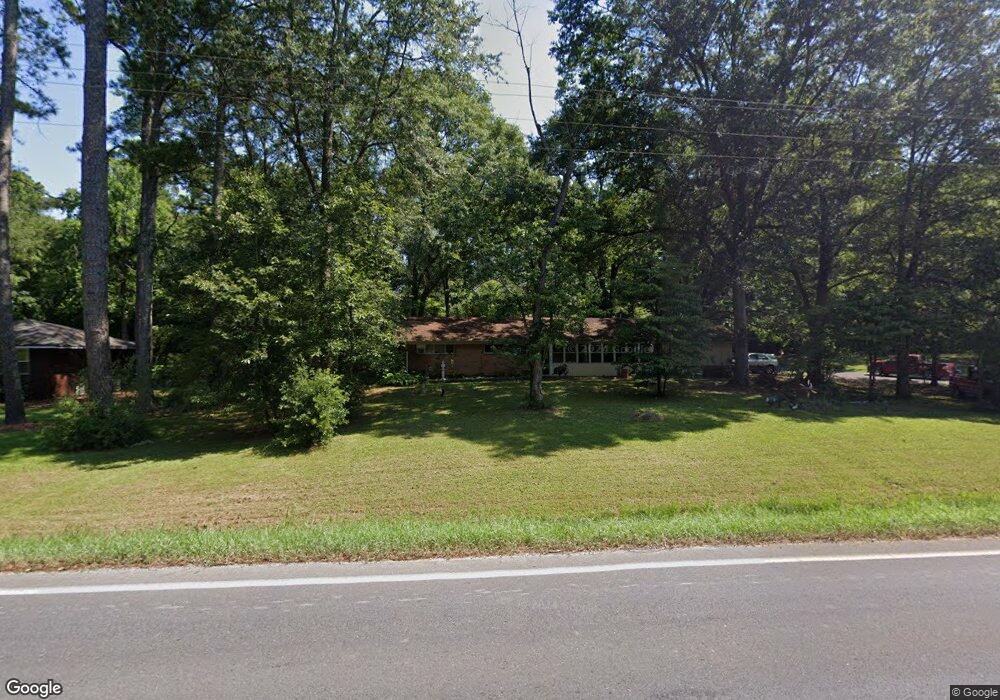
3749 Airport Rd SE Dalton, GA 30721
Estimated Value: $190,000 - $260,000
--
Bed
2
Baths
1,828
Sq Ft
$127/Sq Ft
Est. Value
About This Home
This home is located at 3749 Airport Rd SE, Dalton, GA 30721 and is currently estimated at $231,579, approximately $126 per square foot. 3749 Airport Rd SE is a home located in Whitfield County with nearby schools including Cedar Ridge Elementary School, Eastbrook Middle School, and Southeast Whitfield County High School.
Ownership History
Date
Name
Owned For
Owner Type
Purchase Details
Closed on
Aug 31, 2018
Sold by
Richardson Dorothy Sue
Bought by
Zacher Kenneth O
Current Estimated Value
Home Financials for this Owner
Home Financials are based on the most recent Mortgage that was taken out on this home.
Original Mortgage
$98,400
Outstanding Balance
$85,818
Interest Rate
4.6%
Mortgage Type
New Conventional
Estimated Equity
$145,761
Create a Home Valuation Report for This Property
The Home Valuation Report is an in-depth analysis detailing your home's value as well as a comparison with similar homes in the area
Home Values in the Area
Average Home Value in this Area
Purchase History
| Date | Buyer | Sale Price | Title Company |
|---|---|---|---|
| Zacher Kenneth O | $123,000 | -- |
Source: Public Records
Mortgage History
| Date | Status | Borrower | Loan Amount |
|---|---|---|---|
| Open | Zacher Kenneth O | $98,400 |
Source: Public Records
Tax History Compared to Growth
Tax History
| Year | Tax Paid | Tax Assessment Tax Assessment Total Assessment is a certain percentage of the fair market value that is determined by local assessors to be the total taxable value of land and additions on the property. | Land | Improvement |
|---|---|---|---|---|
| 2024 | $924 | $76,941 | $4,017 | $72,924 |
| 2023 | $924 | $37,652 | $2,634 | $35,018 |
| 2022 | $730 | $33,300 | $2,585 | $30,715 |
| 2021 | $730 | $33,300 | $2,585 | $30,715 |
| 2020 | $743 | $33,300 | $2,585 | $30,715 |
| 2019 | $750 | $33,300 | $2,585 | $30,715 |
| 2018 | $164 | $32,898 | $2,183 | $30,715 |
| 2017 | $165 | $32,898 | $2,183 | $30,715 |
| 2016 | $117 | $30,141 | $2,183 | $27,958 |
| 2014 | $87 | $30,787 | $2,829 | $27,958 |
| 2013 | -- | $30,786 | $2,829 | $27,957 |
Source: Public Records
Map
Nearby Homes
- 3657 Airport Rd
- 01 Headrick Cir SE
- 00 Headrick Cir SE
- 1142 Ben Hill Rd SE
- 760 Keith Rd SE
- 296 Wagner Dr
- 4322 Banks Dr SE
- 2200 Ridge Rd SE
- 1271 Ridge Rd SE
- 00 Tibbs Bridge Rd
- 215 Wagner Dr
- 0 Tibbs Bridge Rd SE
- 185 Cedar Ridge Rd
- 129 Hillwood Dr
- 00 Hill Rd
- 0 Ledford Ave SE
- 1401 Eastbrook Dr SE
- 4386 Tibbs Bridge Rd SE
- TBD Old Grade Rd
- 0 Old Grade Rd
- 3761 Airport Rd SE
- 3728 Airport Rd SE
- 1134 Mobley Mill Rd SE
- 3742 Airport Rd SE
- 1128 Mobley Mill Rd SE
- 3691 Kingsport Dr
- 3741 Airport Rd SE
- 1221 Lynn Dr SE
- 1131 Mobley Mill Rd SE
- 1122 Mobley Mill Rd SE
- 1132 Mobley Mill Rd SE
- 1223 Lynn Dr SE
- 1129 Mobley Mill Rd SE
- 140 Della Way
- 138 Crabapple Ln
- 3768 Airport Rd SE
- 3685 Kingsport Dr
- 3777 Airport Rd SE
- 1216 Lynn Dr SE
- 1124 Rodger Dr