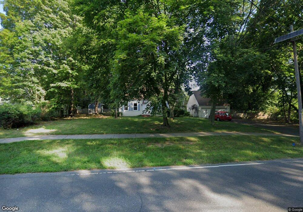
375 Clarksville Rd Princeton Junction, NJ 08550
Estimated Value: $800,527 - $886,000
--
Bed
--
Bath
1,872
Sq Ft
$444/Sq Ft
Est. Value
About This Home
This home is located at 375 Clarksville Rd, Princeton Junction, NJ 08550 and is currently estimated at $831,382, approximately $444 per square foot. 375 Clarksville Rd is a home located in Mercer County with nearby schools including Maurice Hawk Elementary School, Millstone River School, and Thomas R. Grover Middle School.
Ownership History
Date
Name
Owned For
Owner Type
Purchase Details
Closed on
May 18, 2023
Sold by
Given Not
Bought by
Cipollone Revocable Family Trust
Current Estimated Value
Purchase Details
Closed on
Aug 30, 2001
Sold by
Safferstein Harold
Bought by
Cipollone Peter
Home Financials for this Owner
Home Financials are based on the most recent Mortgage that was taken out on this home.
Original Mortgage
$260,080
Interest Rate
7.06%
Purchase Details
Closed on
Jun 30, 1997
Sold by
Luttrell Gregory
Bought by
Saferstein Harold and Peterson Karen
Home Financials for this Owner
Home Financials are based on the most recent Mortgage that was taken out on this home.
Original Mortgage
$189,000
Interest Rate
7.86%
Purchase Details
Closed on
Jul 30, 1992
Sold by
Staats Vincent and Staats Sarah
Bought by
Luttrell Gregory B and Luttrell Barbara A
Create a Home Valuation Report for This Property
The Home Valuation Report is an in-depth analysis detailing your home's value as well as a comparison with similar homes in the area
Home Values in the Area
Average Home Value in this Area
Purchase History
| Date | Buyer | Sale Price | Title Company |
|---|---|---|---|
| Cipollone Revocable Family Trust | -- | None Listed On Document | |
| Cipollone Revocable Family Trust | -- | None Listed On Document | |
| Cipollone Peter | $325,100 | -- | |
| Saferstein Harold | $209,824 | -- | |
| Luttrell Gregory B | $183,000 | -- |
Source: Public Records
Mortgage History
| Date | Status | Borrower | Loan Amount |
|---|---|---|---|
| Previous Owner | Cipollone Peter | $260,080 | |
| Previous Owner | Saferstein Harold | $189,000 |
Source: Public Records
Tax History Compared to Growth
Tax History
| Year | Tax Paid | Tax Assessment Tax Assessment Total Assessment is a certain percentage of the fair market value that is determined by local assessors to be the total taxable value of land and additions on the property. | Land | Improvement |
|---|---|---|---|---|
| 2025 | $13,507 | $440,700 | $256,000 | $184,700 |
| 2024 | $12,943 | $440,700 | $256,000 | $184,700 |
| 2023 | $12,943 | $440,700 | $256,000 | $184,700 |
| 2022 | $12,692 | $440,700 | $256,000 | $184,700 |
| 2021 | $12,586 | $440,700 | $256,000 | $184,700 |
| 2020 | $12,357 | $440,700 | $256,000 | $184,700 |
| 2019 | $12,216 | $440,700 | $256,000 | $184,700 |
| 2018 | $12,102 | $440,700 | $256,000 | $184,700 |
| 2017 | $11,850 | $440,700 | $256,000 | $184,700 |
| 2016 | $11,595 | $440,700 | $256,000 | $184,700 |
| 2015 | $11,326 | $440,700 | $256,000 | $184,700 |
| 2014 | $11,194 | $440,700 | $256,000 | $184,700 |
Source: Public Records
Map
Nearby Homes
- 90 Princeton Hightstown Rd
- 3103 Justin Dr
- 1005 Justin Dr Unit 1002
- 2902 Justin Dr
- 1402 Justin Dr Unit 1403
- 3102 Justin Dr
- 2904 Justin Dr Unit 2903
- 1402 Justin Dr
- 1002 Justin Dr Unit 1005
- 2902 Justin Dr Unit 2905
- 3102 Justin Dr Unit 3104
- 1005 Justin Dr
- 1004 Justin Dr
- 1002 Justin Dr
- 1004 Justin Dr Unit 1003
- 2904 Justin Dr
- 103 Harris Rd
- 20 Berkshire Dr
- 951 Alexander Rd
- 43 Wallace Rd