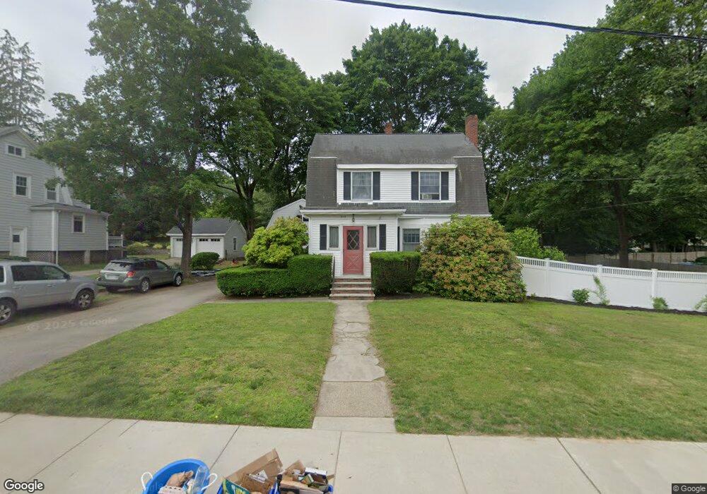
375 Common St Walpole, MA 02081
Estimated Value: $695,000 - $868,000
4
Beds
2
Baths
1,562
Sq Ft
$478/Sq Ft
Est. Value
About This Home
This home is located at 375 Common St, Walpole, MA 02081 and is currently estimated at $746,376, approximately $477 per square foot. 375 Common St is a home located in Norfolk County with nearby schools including Boyden School, Eleanor N. Johnson Middle School, and Walpole High School.
Ownership History
Date
Name
Owned For
Owner Type
Purchase Details
Closed on
Jun 18, 2010
Sold by
Foley Richard J and Foley Rebecca L
Bought by
Omalley William T and Omalley Anne J
Current Estimated Value
Home Financials for this Owner
Home Financials are based on the most recent Mortgage that was taken out on this home.
Original Mortgage
$268,300
Outstanding Balance
$180,344
Interest Rate
5.03%
Mortgage Type
Purchase Money Mortgage
Estimated Equity
$566,032
Purchase Details
Closed on
Jun 30, 1989
Sold by
Foley Noreen T
Bought by
Foley Richard J
Create a Home Valuation Report for This Property
The Home Valuation Report is an in-depth analysis detailing your home's value as well as a comparison with similar homes in the area
Home Values in the Area
Average Home Value in this Area
Purchase History
| Date | Buyer | Sale Price | Title Company |
|---|---|---|---|
| Omalley William T | $427,500 | -- | |
| Foley Richard J | $180,000 | -- |
Source: Public Records
Mortgage History
| Date | Status | Borrower | Loan Amount |
|---|---|---|---|
| Open | Foley Richard J | $60,500 | |
| Open | Omalley William T | $268,300 | |
| Previous Owner | Foley Richard J | $132,000 | |
| Previous Owner | Foley Richard J | $140,800 |
Source: Public Records
Tax History
| Year | Tax Paid | Tax Assessment Tax Assessment Total Assessment is a certain percentage of the fair market value that is determined by local assessors to be the total taxable value of land and additions on the property. | Land | Improvement |
|---|---|---|---|---|
| 2025 | $8,066 | $628,700 | $335,200 | $293,500 |
| 2024 | $7,837 | $592,800 | $322,200 | $270,600 |
| 2023 | $7,545 | $543,200 | $280,300 | $262,900 |
| 2022 | $7,305 | $505,200 | $259,500 | $245,700 |
| 2021 | $6,969 | $469,600 | $244,800 | $224,800 |
| 2020 | $6,895 | $460,000 | $231,000 | $229,000 |
| 2019 | $6,599 | $437,000 | $222,200 | $214,800 |
| 2018 | $6,296 | $412,300 | $214,100 | $198,200 |
| 2017 | $6,077 | $396,400 | $205,800 | $190,600 |
| 2016 | $5,729 | $368,200 | $197,900 | $170,300 |
| 2015 | $5,561 | $354,200 | $188,400 | $165,800 |
| 2014 | $5,354 | $339,700 | $188,400 | $151,300 |
Source: Public Records
Map
Nearby Homes
- 37 Alice Ave
- 145 South St Unit 5
- 6 Eleanor Rd
- 50 Riverside Place
- 587 Common St
- 224 School St Unit 9
- 222 School St Unit 9
- 1110 Main St
- 635 Old Post Rd Unit 303
- 635 Old Post Rd Unit 302
- 635 Old Post Rd Unit 210
- 635 Old Post Rd Unit 2-203
- 1391 Main St Unit 308
- 1391 Main St Unit 306
- 1391 Main St Unit 304
- 26 Drake Cir
- 0 U S Route 1
- 9 Pearl St
- 881 Main St Unit 9
- 3 Stone Hill Terrace
- 379 Common St
- 367 Common St
- 34 Pocahontas St
- 30 Pocahontas St
- 11 Ossipee St
- 385 Common St
- 374 Common St
- 365 Common St
- 26 Pocahontas St
- 376 Common St
- 368 Common St
- 358 Common St
- 378 Common St
- 35 Pocahontas St
- 347 Common St
- 41 Pocahontas St
- 21 Pocahontas St
- 12 Pocahontas St
- 20 Hutchinson Rd
- 356 Common St
Your Personal Tour Guide
Ask me questions while you tour the home.