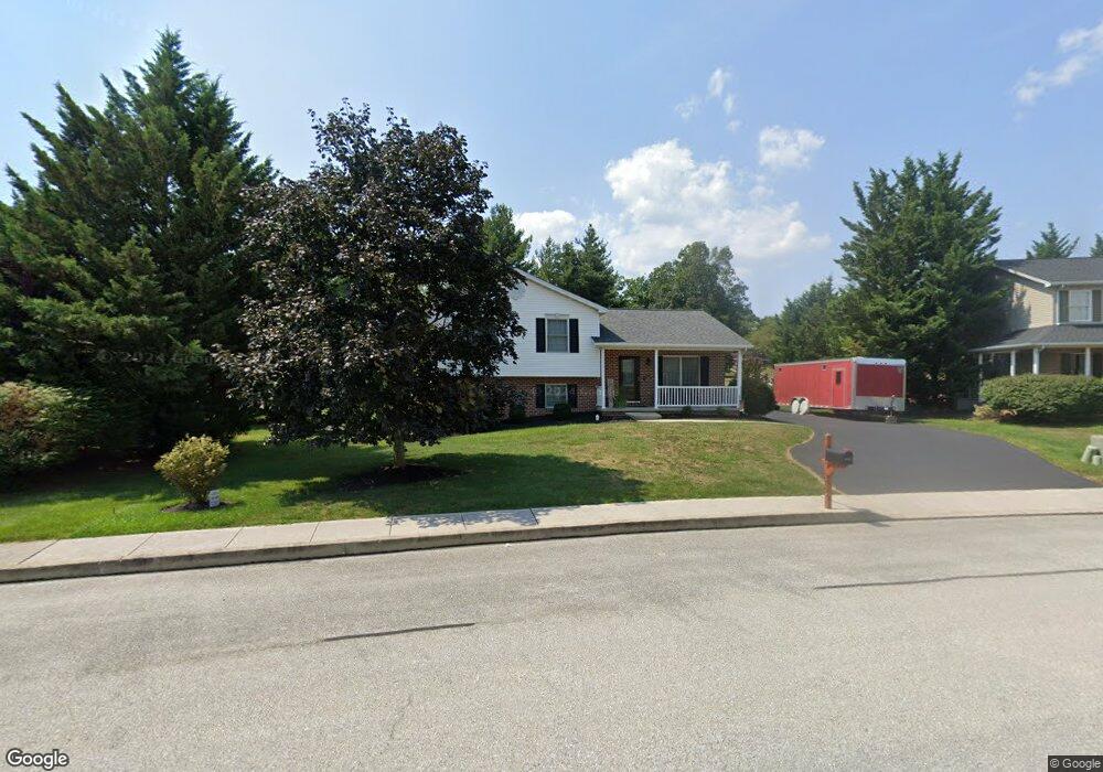
375 Lafayette Dr Unit 8 Littlestown, PA 17340
Estimated Value: $282,000 - $322,000
3
Beds
3
Baths
1,180
Sq Ft
$260/Sq Ft
Est. Value
About This Home
This home is located at 375 Lafayette Dr Unit 8, Littlestown, PA 17340 and is currently estimated at $307,267, approximately $260 per square foot. 375 Lafayette Dr Unit 8 is a home located in Adams County with nearby schools including Rolling Acres El School, Maple Avenue Middle School, and Littlestown Senior High School.
Ownership History
Date
Name
Owned For
Owner Type
Purchase Details
Closed on
May 23, 2008
Sold by
Heritage Hills Ii
Bought by
Bruce Janet E
Current Estimated Value
Purchase Details
Closed on
Jun 30, 1998
Bought by
Boggs Debra L
Create a Home Valuation Report for This Property
The Home Valuation Report is an in-depth analysis detailing your home's value as well as a comparison with similar homes in the area
Home Values in the Area
Average Home Value in this Area
Purchase History
| Date | Buyer | Sale Price | Title Company |
|---|---|---|---|
| Bruce Janet E | $303,300 | -- | |
| Boggs Debra L | $140,400 | -- |
Source: Public Records
Mortgage History
| Date | Status | Borrower | Loan Amount |
|---|---|---|---|
| Open | Boggs Debra L | $124,500 |
Source: Public Records
Tax History Compared to Growth
Tax History
| Year | Tax Paid | Tax Assessment Tax Assessment Total Assessment is a certain percentage of the fair market value that is determined by local assessors to be the total taxable value of land and additions on the property. | Land | Improvement |
|---|---|---|---|---|
| 2025 | $4,211 | $183,200 | $43,900 | $139,300 |
| 2024 | $4,058 | $183,200 | $43,900 | $139,300 |
| 2023 | $3,901 | $183,200 | $43,900 | $139,300 |
| 2022 | $3,877 | $183,200 | $43,900 | $139,300 |
| 2021 | $3,763 | $183,200 | $43,900 | $139,300 |
| 2020 | $3,718 | $183,200 | $43,900 | $139,300 |
| 2019 | $3,606 | $183,200 | $43,900 | $139,300 |
| 2018 | $3,541 | $183,200 | $43,900 | $139,300 |
| 2017 | $3,449 | $183,200 | $43,900 | $139,300 |
| 2016 | -- | $183,200 | $43,900 | $139,300 |
| 2015 | -- | $183,200 | $43,900 | $139,300 |
| 2014 | -- | $183,200 | $43,900 | $139,300 |
Source: Public Records
Map
Nearby Homes
- 15 Yorktowne Ct Unit 97
- 28 Gettysburg Ct Unit 60
- 129 W King St
- 117 Charles St
- 115 Charles St
- 22 Rita Marie Ave
- 61 E King St
- 52 Stayman Way Unit 81
- 140 Apple Grove Ln Unit 425
- 135 Apple Grove Ln Unit 438
- 211 E King St
- 1024 Frederick Pike Unit 6
- 161 Stoners Cir
- 440 N Queen St
- 162 Newark St
- 449 Glenwyn Dr
- 535 Lumber St
- 58 Windsor Ct
- 48 Windsor Ct
- 41 Smith Cir
- 371 Lafayette Dr Unit 7
- 385 Lafayette Dr Unit 9
- 365 Lafayette Dr Unit 6
- 368 Lafayette Dr Unit 187
- 375 Lexington Way Unit 10
- 380 McSherry Woods Dr
- 390 Lafayette Dr Unit 186
- 390 McSherry Woods Dr Unit 1
- 385 Lexington Way Unit 11
- 370 McSherry Woods Dr Unit 1
- 355 Lafayette Dr Unit 5
- 358 Lafayette Dr Unit 188
- 400 McSherry Woods Dr Unit 2
- 360 McSherry Woods Dr Unit 2
- 395 Lexington Way Unit 12
- 345 Lafayette Dr Unit 4
- 350 McSherry Woods Dr Unit 3
- 341 Lexington Way Unit 184
- 346 Lafayette Dr Unit 189
- 405 Lexington Way Unit 13