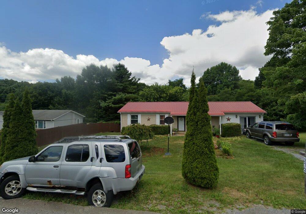
375 Laredo St Tazewell, VA 24651
Estimated Value: $128,227 - $179,000
3
Beds
2
Baths
1,500
Sq Ft
$95/Sq Ft
Est. Value
About This Home
This home is located at 375 Laredo St, Tazewell, VA 24651 and is currently estimated at $142,057, approximately $94 per square foot. 375 Laredo St is a home located in Tazewell County.
Ownership History
Date
Name
Owned For
Owner Type
Purchase Details
Closed on
Mar 20, 2008
Sold by
Absher Barry Dale
Bought by
King Tina M
Current Estimated Value
Home Financials for this Owner
Home Financials are based on the most recent Mortgage that was taken out on this home.
Original Mortgage
$92,500
Outstanding Balance
$63,550
Interest Rate
5.75%
Mortgage Type
USDA
Estimated Equity
$78,507
Purchase Details
Closed on
Feb 26, 2007
Sold by
Myers Glenna B and Myers Dennis W
Bought by
Absher Barry Dale
Home Financials for this Owner
Home Financials are based on the most recent Mortgage that was taken out on this home.
Original Mortgage
$59,850
Interest Rate
6.27%
Mortgage Type
Credit Line Revolving
Create a Home Valuation Report for This Property
The Home Valuation Report is an in-depth analysis detailing your home's value as well as a comparison with similar homes in the area
Home Values in the Area
Average Home Value in this Area
Purchase History
| Date | Buyer | Sale Price | Title Company |
|---|---|---|---|
| King Tina M | $90,000 | -- | |
| Absher Barry Dale | $66,500 | -- |
Source: Public Records
Mortgage History
| Date | Status | Borrower | Loan Amount |
|---|---|---|---|
| Open | King Tina M | $92,500 | |
| Previous Owner | Absher Barry Dale | $59,850 |
Source: Public Records
Tax History Compared to Growth
Tax History
| Year | Tax Paid | Tax Assessment Tax Assessment Total Assessment is a certain percentage of the fair market value that is determined by local assessors to be the total taxable value of land and additions on the property. | Land | Improvement |
|---|---|---|---|---|
| 2025 | $602 | $103,800 | $20,000 | $83,800 |
| 2023 | $546 | $94,200 | $18,000 | $76,200 |
| 2022 | $546 | $94,200 | $18,000 | $76,200 |
| 2021 | $546 | $94,200 | $18,000 | $76,200 |
| 2020 | $546 | $94,200 | $18,000 | $76,200 |
| 2019 | $546 | $94,200 | $18,000 | $76,200 |
| 2018 | $538 | $94,200 | $18,000 | $76,200 |
| 2017 | $538 | $97,900 | $18,000 | $79,900 |
| 2016 | -- | $97,900 | $18,000 | $79,900 |
| 2015 | -- | $97,900 | $18,000 | $79,900 |
| 2014 | -- | $97,900 | $18,000 | $79,900 |
| 2013 | -- | $97,900 | $18,000 | $79,900 |
Source: Public Records
Map
Nearby Homes
- TBD Laredo St
- 214 Kelley St
- 365 Olympic Dr
- 335 Tacoma Rd
- 2059 Clearfork Rd
- 340 Foxborough St
- 3225 Lynn Hollow Rd
- 1665 Tiptop Rd
- TBA Tba Beverly Hills Dr
- 379 Freedom Ave
- 561 Hillsboro Dr
- 481 Hill St
- TBD Kulchar Ln
- 1353 Fincastle Turnpike
- TBD Burkes Garden Rd
- 412 Yorkshire Rd
- 799 Dogwood Rd
- 0 Goose Creek Rd
- 2256 Whitley Branch Rd
- 133 Wausau St
- 389 Laredo St
- 341 Laredo St
- 372 Laredo St
- 325 Laredo St
- 422 Laredo St
- 398 Fox St
- 327 Laredo St
- 352 Laredo St
- 336 Laredo St
- 323 Laredo St
- 309 Hummingbird Hill
- 309 Hummingbird Hill
- 327 Hill St
- 314 Laredo St
- 303 Laredo St
- 449 Hummingbird Hill
- 373 Hummingbird Hill
- 292 Laredo St
- 281 Laredo St
- 253 Hummingbird Hill