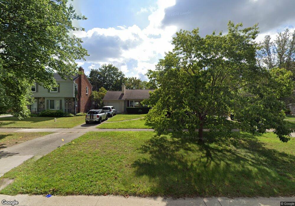
375 Moross Rd Grosse Pointe Farms, MI 48236
Estimated Value: $312,000 - $360,259
--
Bed
2
Baths
1,287
Sq Ft
$255/Sq Ft
Est. Value
About This Home
This home is located at 375 Moross Rd, Grosse Pointe Farms, MI 48236 and is currently estimated at $327,565, approximately $254 per square foot. 375 Moross Rd is a home located in Wayne County with nearby schools including Kerby Elementary School, Brownell Middle School, and Grosse Pointe South High School.
Ownership History
Date
Name
Owned For
Owner Type
Purchase Details
Closed on
Dec 22, 2006
Sold by
Deutsche Bank National Trust Co
Bought by
Ibus Rodney
Current Estimated Value
Purchase Details
Closed on
Jan 4, 2006
Sold by
Reed Donald E and Bachman Reed Catherine M
Bought by
Deutsche Bank National Trust Co and Cdc Mortgage Capital Trust 2003 He1 Mort
Purchase Details
Closed on
Dec 9, 2002
Sold by
Ulrich Keith and Ulrich Michelle
Bought by
Reed Donald
Purchase Details
Closed on
Jan 13, 1997
Sold by
Margaret K Novitsky
Bought by
Joseph L Simasko
Create a Home Valuation Report for This Property
The Home Valuation Report is an in-depth analysis detailing your home's value as well as a comparison with similar homes in the area
Home Values in the Area
Average Home Value in this Area
Purchase History
| Date | Buyer | Sale Price | Title Company |
|---|---|---|---|
| Ibus Rodney | $170,000 | Attorneys Title Agency Llc | |
| Deutsche Bank National Trust Co | $243,470 | None Available | |
| Reed Donald | $265,000 | Lawyers Title Insurance Co | |
| Joseph L Simasko | $105,000 | -- |
Source: Public Records
Tax History Compared to Growth
Tax History
| Year | Tax Paid | Tax Assessment Tax Assessment Total Assessment is a certain percentage of the fair market value that is determined by local assessors to be the total taxable value of land and additions on the property. | Land | Improvement |
|---|---|---|---|---|
| 2025 | $2,991 | $180,300 | $0 | $0 |
| 2024 | $2,991 | $163,300 | $0 | $0 |
| 2023 | $5,028 | $153,100 | $0 | $0 |
| 2022 | $5,028 | $140,800 | $0 | $0 |
| 2021 | $5,028 | $130,600 | $0 | $0 |
| 2019 | $4,944 | $108,600 | $0 | $0 |
| 2018 | $2,530 | $103,700 | $0 | $0 |
| 2017 | $4,390 | $101,200 | $0 | $0 |
| 2016 | $4,602 | $99,400 | $0 | $0 |
| 2015 | $9,115 | $100,500 | $0 | $0 |
| 2013 | $8,830 | $88,300 | $0 | $0 |
| 2012 | $2,350 | $88,300 | $24,700 | $63,600 |
Source: Public Records
Map
Nearby Homes
- 419 Maison Rd
- 343 Beaupre Ave
- 450 Roland Rd
- 432 Calvin Ave
- 265 Williams Ave
- 410 Roland Ct
- 471 Touraine Rd
- 22200 Moross Rd
- 486 Bournemouth Rd
- 5228 Hillcrest St
- 5056 Lafontaine St
- 441 Manor St
- 5047 Anatole St
- 463 Colonial Ct
- 1597 Newcastle Rd
- 415 Lothrop Rd
- 5522 Ashley St
- 18721 Chandler Park Dr
- 273 Ridge Rd
- 343 Mount Vernon Ave
- 377 Moross Rd
- 379 Moross Rd
- 371 Moross Rd
- 378 Hillcrest Ave
- 376 Hillcrest Ave
- 380 Hillcrest Ave
- 345 Piche St
- 385 Moross Rd
- 382 Hillcrest Ave
- 372 Hillcrest Ave
- 370 Hillcrest Ave
- 384 Hillcrest Ave
- 389 Moross Rd
- 386 Hillcrest Ave
- 367 Moross Rd
- 368 Hillcrest Ave
- 365 Moross Rd
- 395 Moross Rd
- 332 Chalfonte Ave
- 366 Hillcrest Ave