S
Seller's Agent in 2022
SONIA MACSAY
FREEDOM REAL ESTATE GROUP LLC


Estimated Value: $72,675 - $254,000
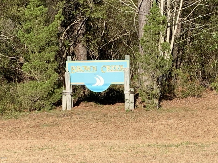
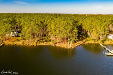
One acre on beautiful Brown's Creek, one of the most extensive creek systems in the area. A wooded lot ready for your dream home! Fishing, shrimping, canoeing, boating, bird watching-the possibilities are endless! Excellent water depth with easy access to the Neuse River, Pamlico Sound and the Inner Coastal waterway. Only minutes away from the unique and intriguing town of Oriental.
Last Agent to Sell the Property
SONIA MACSAY
FREEDOM REAL ESTATE GROUP LLC License #312689 Listed on: 03/04/2020
| Date | Buyer | Sale Price | Title Company |
|---|---|---|---|
| Mcintyre Jason W | $65,000 | None Listed On Document | |
| Donovan Daniel J | $66,000 | -- |
| Date | Status | Borrower | Loan Amount |
|---|---|---|---|
| Previous Owner | Mcintyre Jason W | $48,750 |
| Date | Event | Price | List to Sale | Price per Sq Ft |
|---|---|---|---|---|
| 03/31/2022 03/31/22 | Sold | $65,000 | +4.0% | -- |
| 12/06/2021 12/06/21 | Pending | -- | -- | -- |
| 11/13/2021 11/13/21 | Price Changed | $62,500 | -16.7% | -- |
| 03/04/2020 03/04/20 | For Sale | $75,000 | -- | -- |
| Year | Tax Paid | Tax Assessment Tax Assessment Total Assessment is a certain percentage of the fair market value that is determined by local assessors to be the total taxable value of land and additions on the property. | Land | Improvement |
|---|---|---|---|---|
| 2025 | $706 | $100,000 | $100,000 | $0 |
| 2024 | $706 | $100,000 | $100,000 | $0 |
| 2023 | $686 | $100,000 | $100,000 | $0 |
| 2022 | $686 | $100,000 | $100,000 | $0 |
| 2021 | $686 | $100,000 | $100,000 | $0 |
| 2020 | $686 | $100,000 | $100,000 | $0 |
| 2019 | $618 | $90,000 | $90,000 | $0 |
| 2018 | $618 | $0 | $0 | $0 |
| 2017 | $618 | $0 | $0 | $0 |
| 2016 | $618 | $0 | $0 | $0 |
| 2015 | $618 | $90,000 | $90,000 | $0 |
| 2014 | $618 | $90,000 | $90,000 | $0 |
S
Seller's Agent in 2022
SONIA MACSAY
FREEDOM REAL ESTATE GROUP LLC

Buyer's Agent in 2022
Homer Tyre
Tyre Realty Group Inc.
(252) 684-3539
1 in this area
658 Total Sales
Source: Hive MLS
MLS Number: 100207768
APN: K07-18-10
Disclaimer: Certain information contained herein is derived from information provided by parties other than Homes.com. All information provided is deemed reliable, but is not guaranteed to be accurate and should be independently verified.
![]() The data relating to real estate on this web site comes in part from the Internet Data Exchange program of Hive MLS LLC. All information is deemed reliable but not guaranteed and should be independently verified. All properties are subject to prior sale, change, or withdrawal. Neither listing broker(s) nor Homesnap, Inc. shall be responsible for any typographical errors, misinformation, or misprints, and shall be held totally harmless from any damages arising from reliance upon these data. ©2026 Hive MLS LLC
The data relating to real estate on this web site comes in part from the Internet Data Exchange program of Hive MLS LLC. All information is deemed reliable but not guaranteed and should be independently verified. All properties are subject to prior sale, change, or withdrawal. Neither listing broker(s) nor Homesnap, Inc. shall be responsible for any typographical errors, misinformation, or misprints, and shall be held totally harmless from any damages arising from reliance upon these data. ©2026 Hive MLS LLC
Ask me questions while you tour the home.