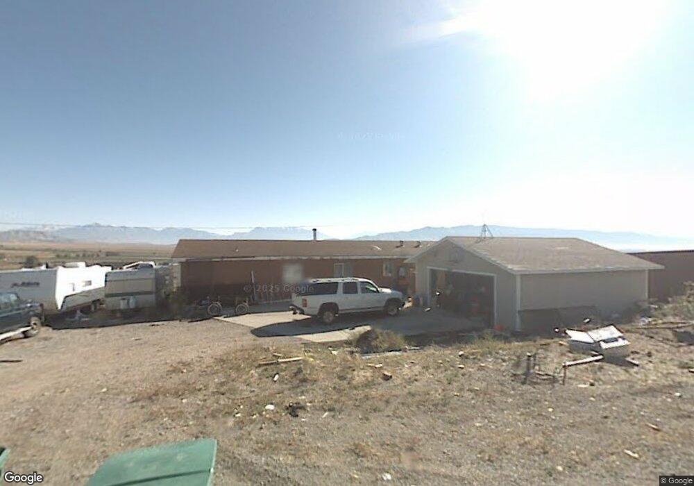
375 S 100 E Cedar Valley, UT 84013
Estimated Value: $678,000 - $1,160,752
4
Beds
3
Baths
2,115
Sq Ft
$443/Sq Ft
Est. Value
About This Home
This home is located at 375 S 100 E, Cedar Valley, UT 84013 and is currently estimated at $936,917, approximately $442 per square foot. 375 S 100 E is a home located in Utah County with nearby schools including Cedar Valley Elementary School, Frontier Middle School, and Cedar Valley High.
Ownership History
Date
Name
Owned For
Owner Type
Purchase Details
Closed on
Jul 7, 2015
Sold by
Jukes Steven and Jukes Pamela K
Bought by
Mcinnes Michael and Mcinnes Janet
Current Estimated Value
Home Financials for this Owner
Home Financials are based on the most recent Mortgage that was taken out on this home.
Original Mortgage
$350,000
Outstanding Balance
$274,332
Interest Rate
4.01%
Mortgage Type
New Conventional
Estimated Equity
$662,585
Purchase Details
Closed on
Aug 19, 2004
Sold by
Hutchings Robert A and Hutchings Mary Lou
Bought by
Hutchings Robert A and Hutchings Mary Lou Milner
Purchase Details
Closed on
Mar 19, 1999
Sold by
Huber Warren R and Huber Lynette C
Bought by
Jarvis Gregory W and Jarvis Heather
Create a Home Valuation Report for This Property
The Home Valuation Report is an in-depth analysis detailing your home's value as well as a comparison with similar homes in the area
Home Values in the Area
Average Home Value in this Area
Purchase History
| Date | Buyer | Sale Price | Title Company |
|---|---|---|---|
| Mcinnes Michael | -- | First American | |
| Hutchings Robert A | -- | -- | |
| Jarvis Gregory W | -- | Guardian Title Insurance |
Source: Public Records
Mortgage History
| Date | Status | Borrower | Loan Amount |
|---|---|---|---|
| Open | Mcinnes Michael | $350,000 |
Source: Public Records
Tax History Compared to Growth
Tax History
| Year | Tax Paid | Tax Assessment Tax Assessment Total Assessment is a certain percentage of the fair market value that is determined by local assessors to be the total taxable value of land and additions on the property. | Land | Improvement |
|---|---|---|---|---|
| 2025 | $2,938 | $443,975 | $304,900 | $723,000 |
| 2024 | $2,938 | $376,151 | $0 | $0 |
| 2023 | $2,932 | $407,548 | $0 | $0 |
| 2022 | $3,220 | $1,007,900 | $300,300 | $707,600 |
| 2021 | $3,310 | $825,400 | $211,200 | $614,200 |
| 2020 | $2,913 | $747,400 | $183,900 | $563,500 |
| 2019 | $2,556 | $689,300 | $171,500 | $517,800 |
| 2018 | $2,579 | $602,600 | $111,000 | $491,600 |
| 2017 | $2,330 | $246,250 | $0 | $0 |
| 2016 | $2,199 | $215,551 | $0 | $0 |
| 2015 | $2,036 | $188,876 | $0 | $0 |
| 2014 | $1,794 | $165,675 | $0 | $0 |
Source: Public Records
Map
Nearby Homes
- 68 W 200 St N
- 74 W 100 S
- 185 S 100 E
- 3731 Adams St
- 15500 W Pole Canyon Blvd
- 3172 N Firefly Blvd Unit 302
- 3148 N Firefly Blvd Unit 305
- 2151 N Stardew St Unit 551
- 2098 N Stardew St Unit 528
- 3051 N Stardew St Unit 315
- 3189 N Stardew St Unit 3189
- 3008 Kingbird Dr Unit 618
- 2970 Kingbird Dr Unit 621
- 3070 N Summer Wood Dr Unit 811
- 3059 N Summer Wood Dr Unit 649
- 2959 Kingbird Dr Unit 613
- 2995 Kingbird Dr Unit 617
- 2987 Kingbird Dr Unit 616
- 2994 Kingbird Dr Unit 619
- 2982 Kingbird Dr Unit 620