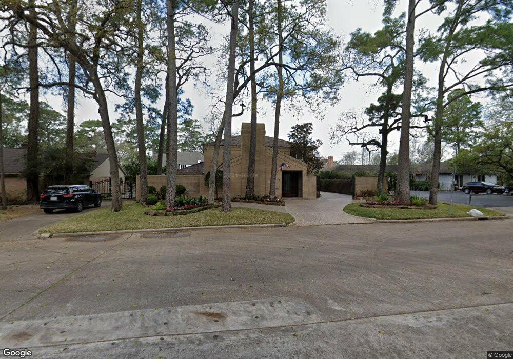
375 Tealwood Dr Houston, TX 77024
Memorial NeighborhoodEstimated Value: $1,218,000 - $1,408,000
5
Beds
5
Baths
4,235
Sq Ft
$316/Sq Ft
Est. Value
About This Home
This home is located at 375 Tealwood Dr, Houston, TX 77024 and is currently estimated at $1,337,013, approximately $315 per square foot. 375 Tealwood Dr is a home located in Harris County with nearby schools including Frostwood Elementary School, Memorial Middle, and Memorial High School.
Ownership History
Date
Name
Owned For
Owner Type
Purchase Details
Closed on
Jun 9, 2016
Sold by
Auchter David J and Green Auchter Margaret Lee
Bought by
Ma Karl Long and Qin Yan
Current Estimated Value
Purchase Details
Closed on
Jan 29, 1998
Sold by
Chase Bank Of Texas Na
Bought by
Wilhelm John and Wilhelm Bessie
Purchase Details
Closed on
May 4, 1995
Sold by
Adams Jennie V
Bought by
Wilhelm John and Wilhelm Bessie F
Create a Home Valuation Report for This Property
The Home Valuation Report is an in-depth analysis detailing your home's value as well as a comparison with similar homes in the area
Home Values in the Area
Average Home Value in this Area
Purchase History
| Date | Buyer | Sale Price | Title Company |
|---|---|---|---|
| Ma Karl Long | -- | Stewart Title Houston Div | |
| Wilhelm John | -- | Houston Title Company 700 | |
| Wilhelm John | -- | -- |
Source: Public Records
Tax History Compared to Growth
Tax History
| Year | Tax Paid | Tax Assessment Tax Assessment Total Assessment is a certain percentage of the fair market value that is determined by local assessors to be the total taxable value of land and additions on the property. | Land | Improvement |
|---|---|---|---|---|
| 2025 | $15,053 | $1,071,200 | $631,800 | $439,400 |
| 2024 | $15,053 | $914,688 | $534,600 | $380,088 |
| 2023 | $15,053 | $855,600 | $534,600 | $321,000 |
| 2022 | $18,119 | $775,000 | $534,600 | $240,400 |
| 2021 | $18,107 | $741,656 | $534,600 | $207,056 |
| 2020 | $18,191 | $726,000 | $534,600 | $191,400 |
| 2019 | $20,549 | $784,900 | $534,600 | $250,300 |
| 2018 | $6,991 | $714,303 | $534,600 | $179,703 |
| 2017 | $20,869 | $797,700 | $534,600 | $263,100 |
| 2016 | $18,531 | $827,599 | $534,600 | $292,999 |
| 2015 | $8,869 | $827,599 | $534,600 | $292,999 |
| 2014 | $8,869 | $720,269 | $340,200 | $380,069 |
Source: Public Records
Map
Nearby Homes
- 358 Tealwood Dr
- 354 Tealwood Dr
- 12334 Beauregard Dr
- 336 Litchfield Ln
- 318 Litchfield Ln
- 206 Sutton Row Place
- 207 Sutton Row Place
- 209 Sutton Row Place
- 211 Sutton Row Place
- 203 Memorial Parkview Dr
- 115 Litchfield Ln
- 271 Litchfield Ln
- 212 Morningside Park St
- 216 Morningside Park St
- 53 Litchfield Ln
- 220 Morningside Park St
- 259 Litchfield Ln Unit 66
- 12564 Memorial Dr
- 161 Litchfield Ln
- 241 Litchfield Ln
- 371 Tealwood Dr
- 12421 Memorial Dr
- 12445 Memorial Dr
- 367 Tealwood Dr
- 310 Paul Revere Dr
- 370 Tealwood Dr
- 12370 Longworth Ln
- 363 Tealwood Dr
- 366 Tealwood Dr
- 12326 Tealwood Dr
- 306 Paul Revere Dr
- 12366 Longworth Ln
- 362 Tealwood Dr
- 359 Tealwood Dr
- 12419 Rip Van Winkle Dr
- 12362 Longworth Ln
- 12423 Rip Van Winkle Dr
- 12359 Longworth Ln
- 12415 Rip Van Winkle Dr
- 12355 Longworth Ln