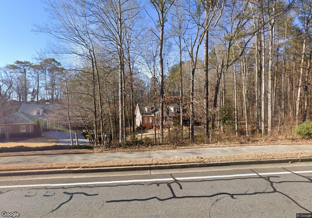
3750 Paul Samuel Rd NW Kennesaw, GA 30152
West Cobb NeighborhoodEstimated Value: $573,551 - $635,000
3
Beds
3
Baths
3,263
Sq Ft
$183/Sq Ft
Est. Value
About This Home
This home is located at 3750 Paul Samuel Rd NW, Kennesaw, GA 30152 and is currently estimated at $595,888, approximately $182 per square foot. 3750 Paul Samuel Rd NW is a home located in Cobb County with nearby schools including Bullard Elementary School, Mcclure Middle School, and Kennesaw Mountain High School.
Ownership History
Date
Name
Owned For
Owner Type
Purchase Details
Closed on
Sep 29, 2022
Sold by
Goss Doris S
Bought by
Morrell Virginia L and Morrell Brad
Current Estimated Value
Home Financials for this Owner
Home Financials are based on the most recent Mortgage that was taken out on this home.
Original Mortgage
$315,000
Outstanding Balance
$301,083
Interest Rate
5.13%
Mortgage Type
New Conventional
Estimated Equity
$294,805
Create a Home Valuation Report for This Property
The Home Valuation Report is an in-depth analysis detailing your home's value as well as a comparison with similar homes in the area
Home Values in the Area
Average Home Value in this Area
Purchase History
| Date | Buyer | Sale Price | Title Company |
|---|---|---|---|
| Morrell Virginia L | $500,000 | -- |
Source: Public Records
Mortgage History
| Date | Status | Borrower | Loan Amount |
|---|---|---|---|
| Open | Morrell Virginia L | $315,000 |
Source: Public Records
Tax History Compared to Growth
Tax History
| Year | Tax Paid | Tax Assessment Tax Assessment Total Assessment is a certain percentage of the fair market value that is determined by local assessors to be the total taxable value of land and additions on the property. | Land | Improvement |
|---|---|---|---|---|
| 2024 | $5,656 | $198,288 | $52,000 | $146,288 |
| 2023 | $5,797 | $192,288 | $46,000 | $146,288 |
| 2022 | $1,071 | $138,980 | $34,000 | $104,980 |
| 2021 | $1,000 | $115,008 | $24,800 | $90,208 |
| 2020 | $980 | $108,464 | $24,000 | $84,464 |
| 2019 | $980 | $108,464 | $24,000 | $84,464 |
| 2018 | $980 | $108,464 | $24,000 | $84,464 |
| 2017 | $847 | $104,464 | $20,000 | $84,464 |
| 2016 | $850 | $104,464 | $20,000 | $84,464 |
| 2015 | $888 | $99,064 | $20,000 | $79,064 |
| 2014 | $903 | $99,064 | $0 | $0 |
Source: Public Records
Map
Nearby Homes
- 1415 Sutters Pond Dr NW
- 791 Lapis Trail
- 5611 Meadowstone Walk
- 5627 Meadowstone Walk
- 5623 Meadowstone Walk
- 5619 Meadowstone Walk
- 1135 Weighhouse Place
- 3621 Sutters Pond Way NW
- 1344 Hamilton Creek Dr NW
- 1395 Crestwind Rd NW
- 1442 Crestwind Rd NW
- 3816 Whithorn Way
- 4100 Chanticleer Dr NW
- 4130 Stilesboro Rd NW
- 1441 Beaumont Dr NW
- 1558 Amberwood Creek Dr NW
- 3780 Paul Samuel Rd NW
- 3792 Paul Samuel Rd NW
- 1654 Stoddard Cir NW
- 1656 Stoddard Cir NW
- 1652 Stoddard Cir NW
- 1650 Stoddard Cir NW
- 1595 Stoddard Ct NW
- 3670 Paul Samuel Rd NW
- 0 Stoddard Cir NW Unit 7148032
- 0 Stoddard Cir NW Unit 8526712
- 0 Stoddard Cir NW Unit 8133982
- 0 Stoddard Cir NW Unit 7045458
- 0 Stoddard Cir NW Unit 7101125
- 1658 Stoddard Cir NW
- 1597 Stoddard Ct NW
- 1653 Stoddard Cir NW
- 1657 Stoddard Cir NW
- 1593 Stoddard Ct NW
- 3675 Davidson Farm Dr NW
- 3665 Davidson Farm Dr NW