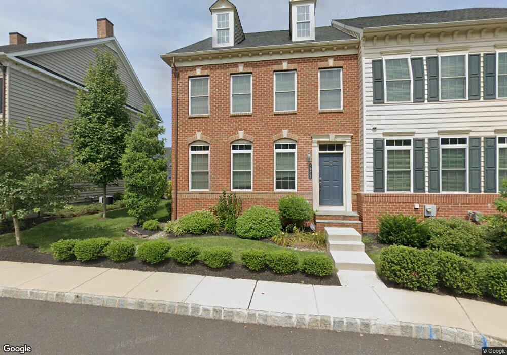
3753 William Daves Rd Doylestown, PA 18902
Plumstead NeighborhoodEstimated Value: $683,856 - $757,000
4
Beds
4
Baths
3,414
Sq Ft
$208/Sq Ft
Est. Value
About This Home
This home is located at 3753 William Daves Rd, Doylestown, PA 18902 and is currently estimated at $710,714, approximately $208 per square foot. 3753 William Daves Rd is a home located in Bucks County with nearby schools including Groveland Elementary School, Tohickon Middle School, and Central Bucks High School-West.
Ownership History
Date
Name
Owned For
Owner Type
Purchase Details
Closed on
Apr 14, 2018
Sold by
Zandman Brian and Oshaunessy Amy
Bought by
Shaugnessy Amy O
Current Estimated Value
Purchase Details
Closed on
Apr 27, 2012
Sold by
Carriage Hill Jv Llc
Bought by
Nvr Inc and Nv Homes
Create a Home Valuation Report for This Property
The Home Valuation Report is an in-depth analysis detailing your home's value as well as a comparison with similar homes in the area
Home Values in the Area
Average Home Value in this Area
Purchase History
| Date | Buyer | Sale Price | Title Company |
|---|---|---|---|
| Shaugnessy Amy O | -- | None Available | |
| Nvr Inc | $810,000 | None Available |
Source: Public Records
Tax History
| Year | Tax Paid | Tax Assessment Tax Assessment Total Assessment is a certain percentage of the fair market value that is determined by local assessors to be the total taxable value of land and additions on the property. | Land | Improvement |
|---|---|---|---|---|
| 2025 | $8,152 | $46,920 | $3,640 | $43,280 |
| 2024 | $8,152 | $46,920 | $3,640 | $43,280 |
| 2023 | $7,893 | $46,920 | $3,640 | $43,280 |
| 2022 | $7,805 | $46,920 | $3,640 | $43,280 |
| 2021 | $7,718 | $46,920 | $3,640 | $43,280 |
| 2020 | $7,718 | $46,920 | $3,640 | $43,280 |
| 2019 | $7,671 | $46,920 | $3,640 | $43,280 |
| 2018 | $7,671 | $46,920 | $3,640 | $43,280 |
| 2017 | $7,565 | $46,920 | $3,640 | $43,280 |
| 2016 | $7,565 | $46,920 | $3,640 | $43,280 |
| 2015 | -- | $46,920 | $3,640 | $43,280 |
| 2014 | -- | $46,920 | $3,640 | $43,280 |
Source: Public Records
Map
Nearby Homes
- 3688 Christopher Day Rd
- 3622 Alley E
- 3910 Cephas Child Rd Unit 6
- 4570 Louise Saint Claire Dr
- 3970 Salome Rd
- 4215 Ferguson Dr
- 30 John Dyer Way
- 117 Cottonwood Ct
- 4317 Kleinot Dr
- 4464 Kleinot Dr
- 4330 Kleinot Dr
- 4246 Kleinot Dr
- 4298 Kleinot Dr
- 4306 Kleinot Dr
- 4625 Old Oak Rd
- 807 N Broad St
- 4 Windey Way Ln
- 333 Lacey Ave Unit B9
- 102 Clear Springs Ct
- 150 Selner Ln
- 3757 William Daves Rd Unit 107
- 3757 William Daves Rd
- 3749 William Daves Rd
- 3761 William Daves Rd
- 3745 William Daves Rd
- 3765 William Daves Rd
- 3741 William Daves Rd
- 3769 William Daves Rd
- 3737 William Daves Rd
- 3752 William Daves Rd Unit 8
- 3752 William Daves Rd
- 3752 William Daves Rd Unit 13
- 3752 William Daves Rd Unit 10
- 3752 William Daves Rd Unit 9
- 3752 William Daves Rd Unit 5
- 3752 William Daves Rd Unit 15
- 3752 William Daves Rd Unit 4
- 3752 William Daves Rd Unit 1
- 3752 William Daves Rd Unit 14
- 3752 William Daves Rd Unit 6
Your Personal Tour Guide
Ask me questions while you tour the home.