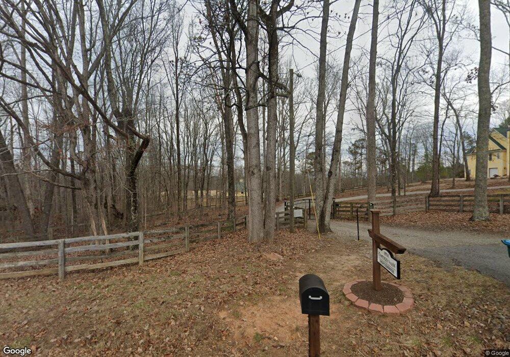
3755 Land Rd Ball Ground, GA 30107
Estimated Value: $818,000 - $1,145,000
2
Beds
3
Baths
2,119
Sq Ft
$443/Sq Ft
Est. Value
About This Home
This home is located at 3755 Land Rd, Ball Ground, GA 30107 and is currently estimated at $938,039, approximately $442 per square foot. 3755 Land Rd is a home located in Cherokee County with nearby schools including Clayton Elementary School, Teasley Middle School, and Cherokee High School.
Ownership History
Date
Name
Owned For
Owner Type
Purchase Details
Closed on
Aug 30, 2002
Sold by
Fry Grgeory and Fry Zeborah A
Bought by
Fry Grgeory and Fry Zeborah
Current Estimated Value
Home Financials for this Owner
Home Financials are based on the most recent Mortgage that was taken out on this home.
Original Mortgage
$300,000
Outstanding Balance
$125,960
Interest Rate
6.31%
Mortgage Type
New Conventional
Estimated Equity
$812,079
Purchase Details
Closed on
Jun 22, 2001
Sold by
Beierla Bruce
Bought by
Fry Gregory
Home Financials for this Owner
Home Financials are based on the most recent Mortgage that was taken out on this home.
Original Mortgage
$265,300
Interest Rate
7.16%
Mortgage Type
New Conventional
Create a Home Valuation Report for This Property
The Home Valuation Report is an in-depth analysis detailing your home's value as well as a comparison with similar homes in the area
Home Values in the Area
Average Home Value in this Area
Purchase History
| Date | Buyer | Sale Price | Title Company |
|---|---|---|---|
| Fry Grgeory | -- | -- | |
| Fry Gregory | $168,000 | -- |
Source: Public Records
Mortgage History
| Date | Status | Borrower | Loan Amount |
|---|---|---|---|
| Open | Fry Grgeory | $300,000 | |
| Previous Owner | Fry Gregory | $265,300 |
Source: Public Records
Tax History Compared to Growth
Tax History
| Year | Tax Paid | Tax Assessment Tax Assessment Total Assessment is a certain percentage of the fair market value that is determined by local assessors to be the total taxable value of land and additions on the property. | Land | Improvement |
|---|---|---|---|---|
| 2024 | $7,732 | $324,760 | $105,080 | $219,680 |
| 2023 | $6,279 | $276,360 | $88,640 | $187,720 |
| 2022 | $5,727 | $226,320 | $75,520 | $150,800 |
| 2021 | $5,513 | $197,040 | $65,680 | $131,360 |
| 2020 | $5,196 | $185,080 | $65,680 | $119,400 |
| 2019 | $4,818 | $171,760 | $65,680 | $106,080 |
| 2018 | $4,743 | $168,160 | $65,680 | $102,480 |
| 2017 | $4,847 | $426,200 | $65,680 | $104,800 |
| 2016 | $4,748 | $413,500 | $65,680 | $99,720 |
| 2015 | $4,860 | $419,000 | $65,680 | $101,920 |
| 2014 | $4,305 | $371,100 | $62,560 | $85,880 |
Source: Public Records
Map
Nearby Homes
- 204 A Donald Rd
- 106 Shalea Ln
- 261 Clayton Trail
- 3869 Lower Burris Rd
- 538 Black Horse Cir
- 535 Black Horse Cir
- 533 Black Horse Cir
- 257 Martin Ln
- 1010 Martin Ln
- 1393 Worley Rd
- 2980 Lower Bethany Rd
- 0 Worley Rd Unit 7634670
- 0 Worley Rd Unit 10540255
- 341 Denali Butte Terrace
- 617 Valdosta Dr
- 365 Denali Butte Terrace
- 423 Murphy Ave
- 1029 Towne Mill Crossing
- 601 Worley Rd
- 148 Bridle Ridge Ln
- 3871 Land Rd
- 4321 Land Rd
- 514 A Donald Rd
- 3754 Land Rd
- 3880 Land Rd
- 0 Land Rd Unit LL 215 3005733
- 0 Land Rd Unit LL 215 7042602
- 0 Land Rd Unit 215 7373855
- 0 Land Rd Unit 215 7586587
- Lot19 Land Rd
- 0 Land Rd Unit 5643779
- 0 Land Rd Unit 7320556
- 0 Land Rd Unit 8967065
- 0 Land Rd Unit 8723805
- 0 Land Rd Unit 8913164
- 0 Land Rd Unit 8931760
- 0 Land Rd Unit 6802690
- 0 Land Rd Unit 8770864
- 0 Land Rd Unit 8489478
- 0 Land Rd Unit 6125695
