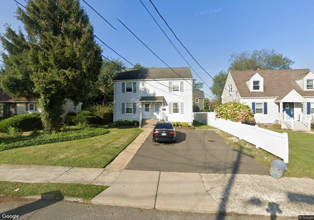
376 Long Branch Ave Long Branch, NJ 07740
Estimated Value: $509,490 - $801,000
2
Beds
1
Bath
896
Sq Ft
$711/Sq Ft
Est. Value
About This Home
This home is located at 376 Long Branch Ave, Long Branch, NJ 07740 and is currently estimated at $636,623, approximately $710 per square foot. 376 Long Branch Ave is a home located in Monmouth County with nearby schools including Long Branch High School and Holy Trinity School.
Ownership History
Date
Name
Owned For
Owner Type
Purchase Details
Closed on
Feb 12, 1997
Sold by
Blake James
Bought by
Devory Kenneth and Devory Jo Ann
Current Estimated Value
Home Financials for this Owner
Home Financials are based on the most recent Mortgage that was taken out on this home.
Original Mortgage
$70,000
Outstanding Balance
$8,085
Interest Rate
7.8%
Estimated Equity
$628,538
Create a Home Valuation Report for This Property
The Home Valuation Report is an in-depth analysis detailing your home's value as well as a comparison with similar homes in the area
Home Values in the Area
Average Home Value in this Area
Purchase History
| Date | Buyer | Sale Price | Title Company |
|---|---|---|---|
| Devory Kenneth | $102,000 | -- |
Source: Public Records
Mortgage History
| Date | Status | Borrower | Loan Amount |
|---|---|---|---|
| Open | Devory Kenneth | $70,000 |
Source: Public Records
Tax History Compared to Growth
Tax History
| Year | Tax Paid | Tax Assessment Tax Assessment Total Assessment is a certain percentage of the fair market value that is determined by local assessors to be the total taxable value of land and additions on the property. | Land | Improvement |
|---|---|---|---|---|
| 2025 | $7,281 | $540,200 | $298,500 | $241,700 |
| 2024 | $6,731 | $473,700 | $253,500 | $220,200 |
| 2023 | $6,731 | $433,400 | $243,500 | $189,900 |
| 2022 | $5,707 | $376,300 | $223,500 | $152,800 |
| 2021 | $5,482 | $285,200 | $142,300 | $142,900 |
| 2020 | $5,482 | $262,300 | $120,300 | $142,000 |
| 2019 | $5,207 | $247,700 | $112,300 | $135,400 |
| 2018 | $4,879 | $230,800 | $100,300 | $130,500 |
| 2017 | $4,540 | $220,300 | $92,300 | $128,000 |
| 2016 | $4,386 | $217,000 | $92,300 | $124,700 |
| 2015 | $5,093 | $228,700 | $56,400 | $172,300 |
| 2014 | $4,733 | $224,000 | $71,100 | $152,900 |
Source: Public Records
Map
Nearby Homes
- 381 Long Branch Ave
- 154 Atlantic Ave
- 172 Chelton Ave
- 323 Florence Ave
- 188 Chelton Ave
- 164 Airsdale Ave
- 392 Florence Ave
- 138 Rosewood Ave
- 9 Manahassett Park Dr
- 165 Kingsley St
- 432 Ocean Blvd N Unit 506
- 432 Ocean Blvd N Unit 315
- 231 Long Branch Ave
- 16 Shore Dr
- 422 Ocean Blvd N Unit 5H
- 28 Patten Ln
- 50 Valentine St Unit 27A
- 50 Valentine St Unit 22A
- 50 Valentine St Unit 12B
- 43 Valentine St
- 380 Long Branch Ave
- 380 Long Branch Ave Unit SUMMER
- 374 Long Branch Ave
- 136 Charles St
- 370 Long Branch Ave
- 410 Long Branch Ave
- 383 Long Branch Ave
- 138 Charles St
- 140 Charles St
- 368 Long Branch Ave
- 133 Charles St
- 412 Long Branch Ave
- 379 Long Branch Ave
- 135 Charles St
- 377 Long Branch Ave
- 144 Charles St
- 137 Charles St
- 366 Long Branch Ave
- 375 Long Branch Ave
- 139 Charles St